Our work schedule initially consisted of half shifts each. Normally, this would give each of us time to explore or chill. But I knew this wasn’t going to happen. Patricia was as nervous as a cat in a room full of rocking chairs in the beginning. My shift became her shift and her’s mine. And that’s totally cool. It’s certainly not her comfort zone. But I also know that she spent twenty years supporting a dozen crotchety engineers. So, in a way, I was curious to see what she would do. We both wanted to “do more” and so this “giving back” is a learning process.
There was some “vibe” from Kirsten that just gave me peace in our first correspondence. I knew we would both do well.
It’s best to see Leo’s whole piece.
And it came to pass. Blessed once again by truly amazing people. Kirsten, Carolyn, Sarah, Samira, and even Gabby and Charles at the restaurant. And so many passers-by. Just accepted and absorbed and mellowed in to something different, something unexpected, something very special.
I saw Patricia standing behind the counter having an engagingly good time with the visitors. Her heart was in it. My soul mate has come to love seeking. She didn’t start there. In fact, when we first met, she hadn’t done anything more than some weekend camping. But there must have been something deeper I think. She’s stuck with me through some incredibly uncomfortable, and sometimes scary journeys. But she just tucks in and trusts me.
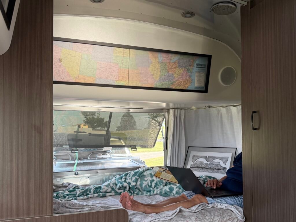
We’ve found a place for our laminated road atlas now. What is she planning?
I’ve had a couple of people ask me why we are doing this. I have tried and tried, but I haven’t been able to pin it down in a way that I can share in words.
Maybe my better half can shed a little light on it.
“A last word from P, the silent partner in this life long journey with Jeff. I cook, I clean, I encourage, I collaborate, I participate, and I love it. Jeff has taken me to great heights, on some awesome experiences, and to deep and meaningful places. Some quite out of my comfort zone but all with the assurance that he is there with me and for me.
“There is no way to capture this ‘Bears Ears’ experience in pictures although Jeff does an excellent job. The majesty, uniqueness, ever changing, spiritual depth, and historical significance cannot be portrayed in a photograph.
“It must be experienced, first hand, morning, noon and night; with a mind set of reverence and appreciation and understanding of the importance of viewing someone’s life, life style, and their generations of family.
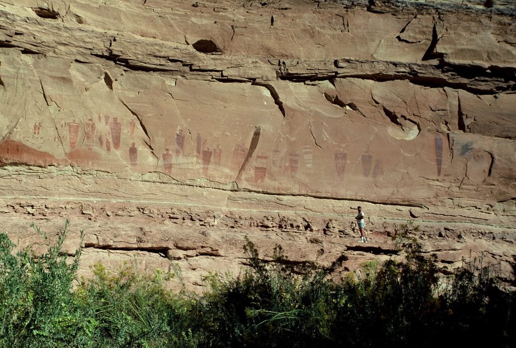
“Oh, if we could only understand the meaning of the art they painted and etched on the rocks! Did they know that thousands of years later we would be studying those sketches and tappings? What about those carved stars? The snake? All the hand prints? The calendar? The list could go on and on.
“We are nearing the end of our ‘giving back’ journey here but, not surprisingly, we have gained much more than we have ‘given back’. We have learned so much, experienced so much, and shared so much.
“We have found a community of like minded people who love nature, love the story of the people who came before us, love the landscape, and love the whole idea of Visit With Respect. We are so thankful to those that have worked to preserve and honor the ancestors and establish the Bears Ears Partnership. Working diligently to teach these principles is necessary for future generations to continue honoring and respecting this land!
“We have fallen in love with Bears Ears. We will be back!💗
Carolyn responded, noting that our plan to visit friends in Denver was already a pretty long drive.
Well, Fry Canyon and the head of Glen Canyon is up that way, how could we not? Besides we’ve been through Moab a few times now and would rather do something a little different. I mean it only adds an hour or two to our 7-hour trip!
We left Bluff around 5:30am and by sun up we were well on our way along the Trail of the Ancients, Utah’s scenic highway 95. We saw only four cars in over 120 miles.
It was worth it too. The descent into Fry Canyon was beautiful…and I just shouldn’t have been driving. Fortunately the road was wide, the hairpins were few and I was able to keep it on the road.
We dropped over a rim onto a 10 percent grade down to Hite Crossing on the Colorado. Near the crossing we came upon a bike packer. He was literally standing in the middle of the road waving an empty water bottle to whoever might pass by! No way were we going to speed by without talking to him!
A European – I’m guessing German – he had flown into L.A. and was just touring around the U.S.A.! He said he had really been careful researching his water stops, but the Hite boat ramp was closed and the road gated. Completely out of water he was becoming desperate enough to try and hike down to the Colorado, no easy feat.
Gauging his sanity, I asked him how much he could carry. He said, “A little over two gallons.” Ok, I thought, he knows what he is doing.
I dug out our emergency 5-gallon jug and we loaded him up with all he could carry, even asking if he wanted one of our collapsible containers. He said he thought he had enough, he was aiming for Natural Bridges National Monument today. Sooo doable. I mean, it’s a mere 58 miles away with only the 10 percent grade to the rim and then the climb out of Fry Canyon to the top of Cedar Mesa! Looking back, he had already come 48 miles since his last reliable water in Hanksville.
Jeez.
As we were buttoning up, I noticed that he had drained the water out of his quart Coke bottle. I yelled, “Do you want us to fill that up again?”
“I don’t want to bother you.”
“What will bother me is not filling your bottle up again.”
And away he went. A nice morning for a ride. I’m actually a bit envious.
The boat ramp at Hite Crossing has been closed for a while due to the dropping water level in Lake Powell. To put a boat in requires 4WD and nearly a one-mile drive to the river. The high water mark for the lake was in 1983 and it has been dropping ever since. The dam was not constructed with river-level outlets and “dead pool” is over two hundred feet above the river bed. If the lake drops to this level, no water will get into the Colorado River downstream. A very big deal with the convoluted water rights and millions depending on it.
Working in the BEEC, I had access to all of the books for sale, as well as their library. So many books, so little time!
Zak Podmore’s “Life after Dead Pool” is a great read and it discusses the water situation and possible outcomes for Lake Powell. One of which is a chance to resurrect Glen Canyon by sending the water down to Lake Mead where it can be better utilized.
The Hite parking area and concrete boat ramp are in the distance. Glen Canyon is reclaiming land.
An older book “Cadillac Desert” by Marc Reisner is a fascinating read on the water wars of the West, but also includes the dam-building era in the East. It made me sad to learn the true history of Tellico Dam. Pure pride alone caused this dam to be built, displacing over 10,000 people and serving nearly no purpose at all. This final dam on the Little Tennessee, what the Cherokee called “the Long Man” helped to erase thousands of years of history and culture for the people of this land.
As we rolled toward Hanksville, Capitol Reef loomed on our left. Some of the ancient culture was so distinctive here along the Fremont River that they have been designated “Fremont People” by archaeologists. No time to explore this trip…
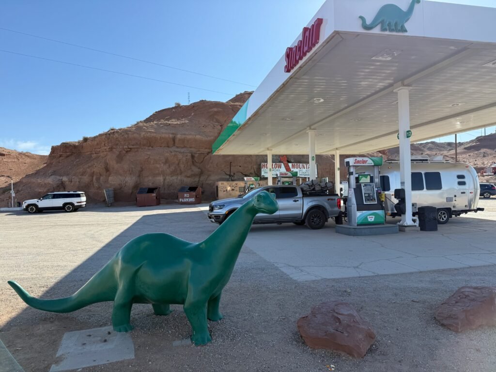
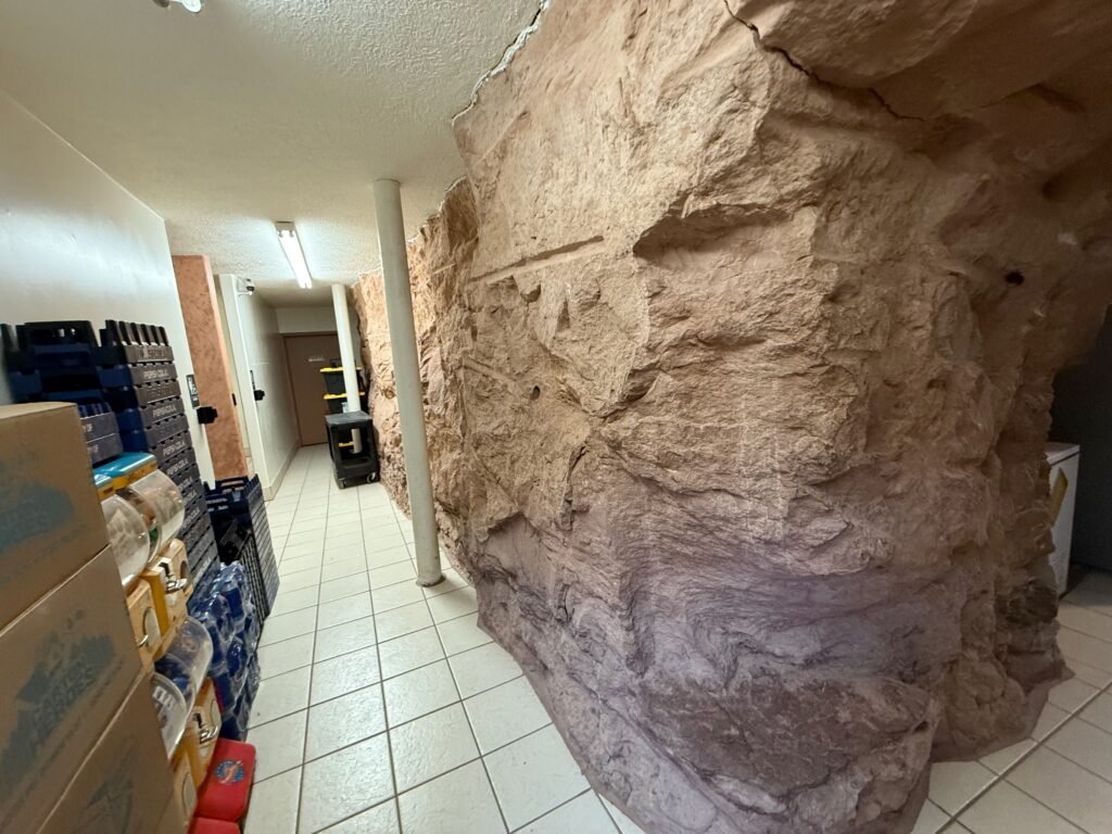
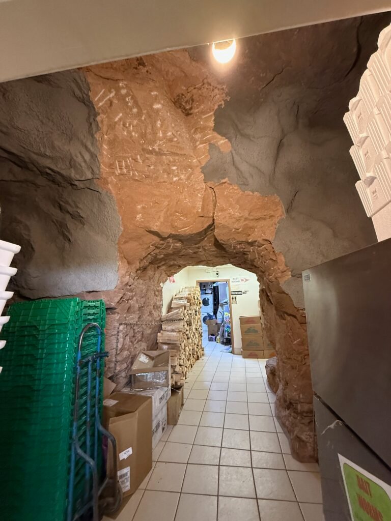
We’ve been running on Sinclair dinosaur fat for most of our stay out here. The Hollow Mountain Market has a big green one out front. The market itself was carved into the mountain over forty years ago, pretty cool.
The market is in the rock face, without the giant red arrow you may just pass it by.
Heading due north toward I-70, we pass the turn-off for Horseshoe Canyon and the Grand Gallery on our right. An hour-and-a-half washboard/sand drive to the trailhead. My good friend James and I made the trip there back in 1988 with my then-new Cherokee, dodging sand dunes in the dark. I’ll be back someday.
The Grand Gallery is fascinating. Still miss you James!
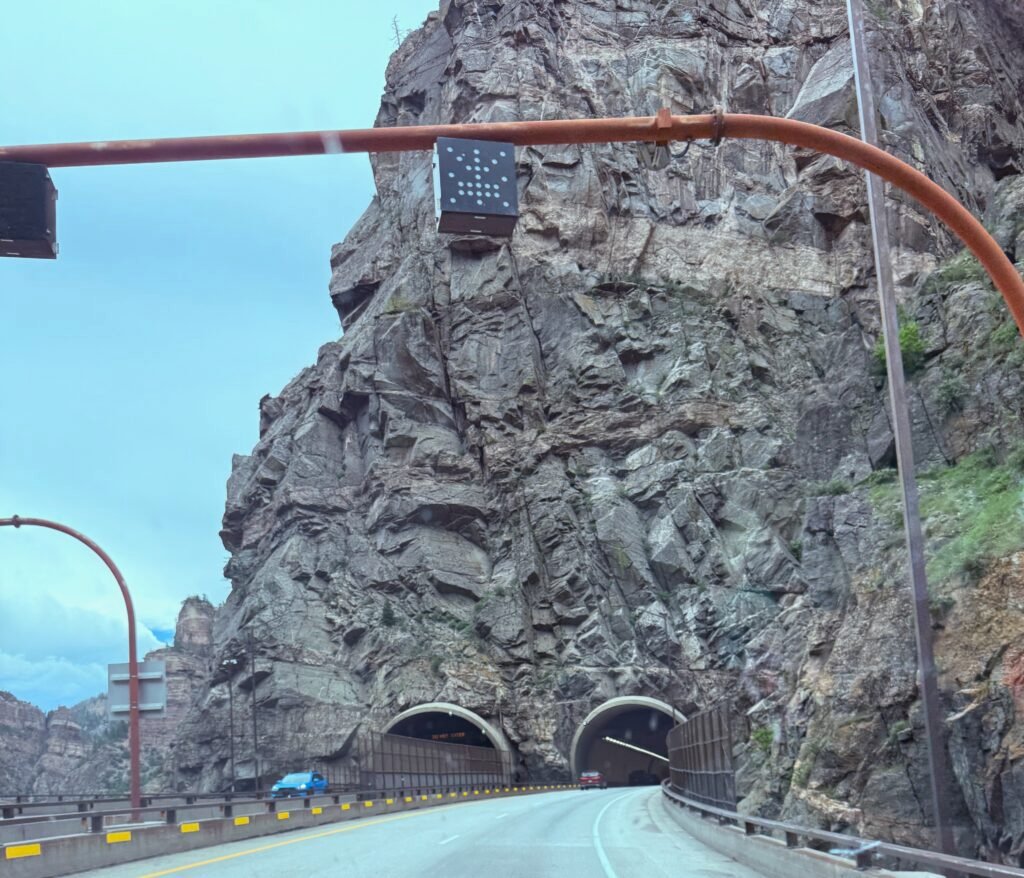
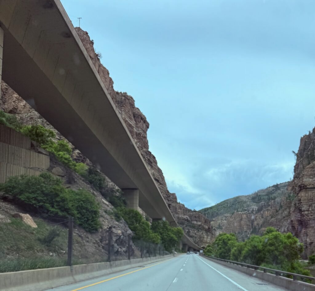
I-70 in Colorado was interesting, but also rough with lots of construction and abrupt lane changes. Elevated highways and tunnels through the Rockies kept us on our toes.
As difficult as it must have been to carve an interstate through this country, in some sections there was an express lane! Priced $9 to $15 – depending on the traffic – it was essentially empty of cars. What a waste! How much better to provide some three-lane relief to the citizens! Let alone the increased safety.
We passed several rest areas that seemed more like local gathering points. They were crowded and not easy to access. So we just kept moving. A LOT of paved bike path through here, we’ll need to investigate…
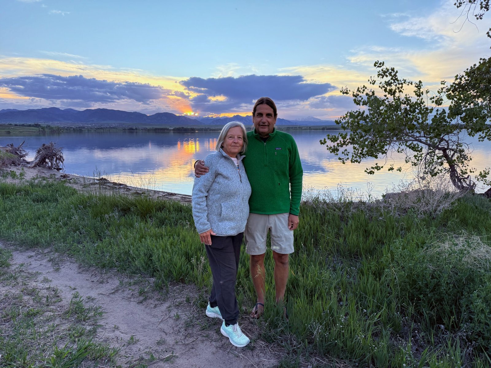
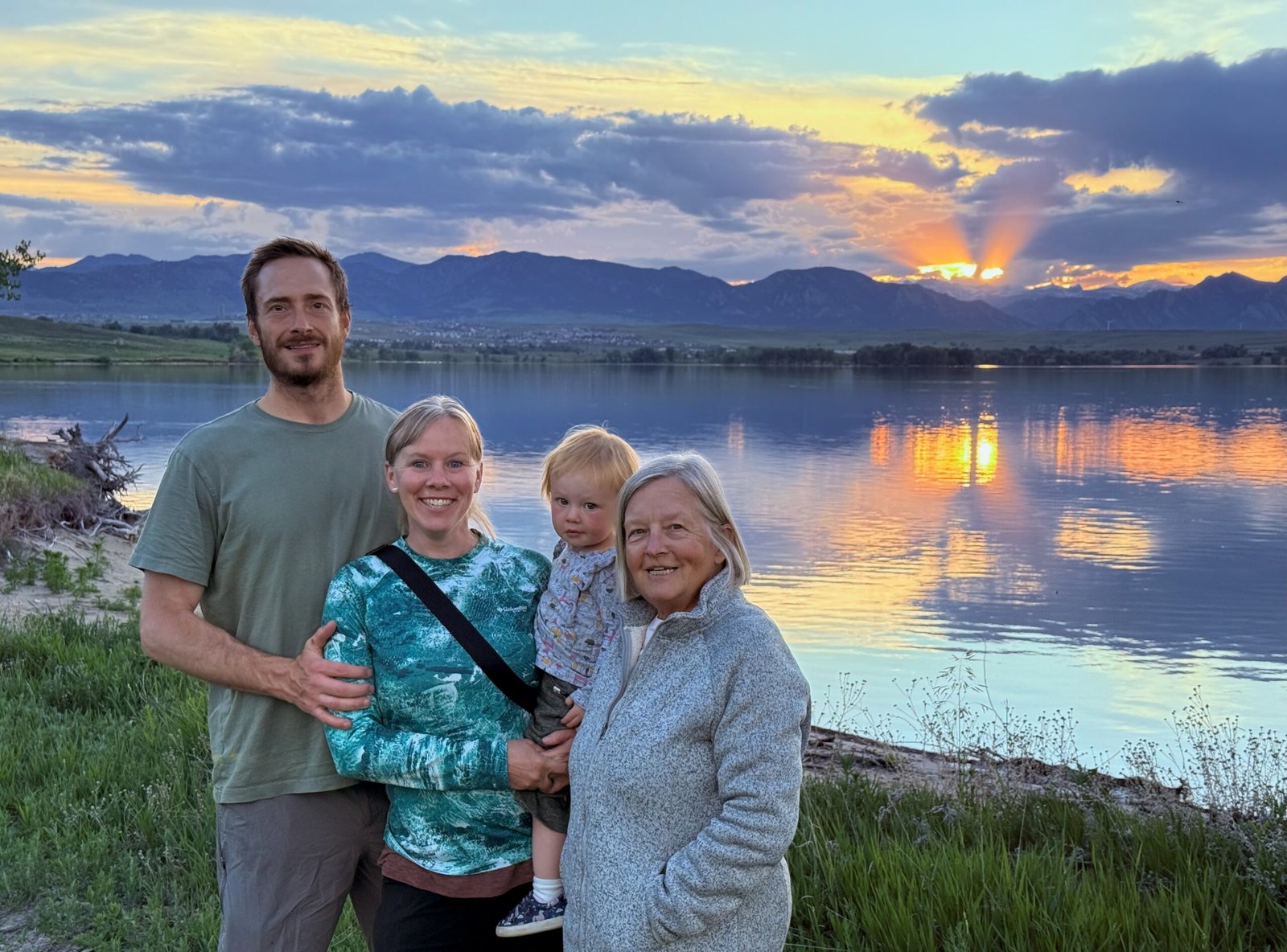
It was great to see Laura and her family. It has been years since we’ve seen her. It was a treat to see how she, Nate, and little Eden are carving out their own lifestyle in the big city. Raising chickens in the back yard, growing strawberries in the front, being thoughtful with what they buy, repurposing and minimizing their impact. We appreciated their down-to-earth ethic. And don’t forget their dog Millie, who required my full attention for an extended ear massage.
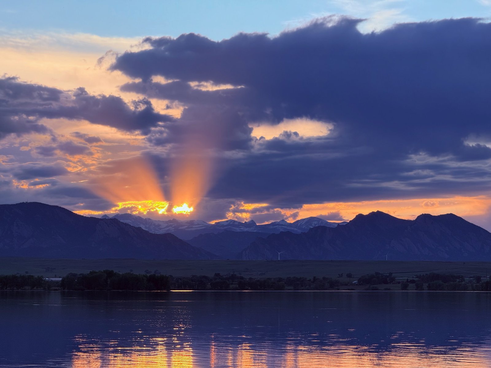
A short hike to a lake revealed a gorgeous sunset with Long’s Peak in the distance. Laura recommended we get on the road by 6am to miss the traffic. But even leaving at 5:30am, it was getting pretty intense on our way out. Big cities have aggressive drivers.
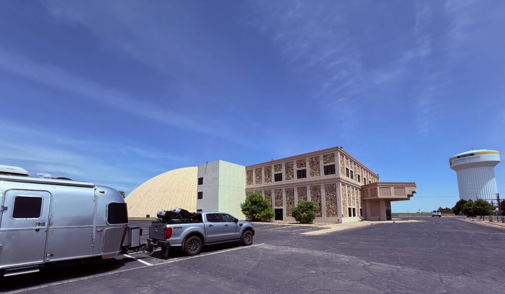
Just into Kansas, a faded billboard proclaimed “Sternberg Natural History Museum” but we didn’t catch the location. My navigator found it was in Hays and about 80 miles ahead on our route, we decided to stop for lunch. I-70 through Kansas was quite pleasant, rolling grassland and little traffic.
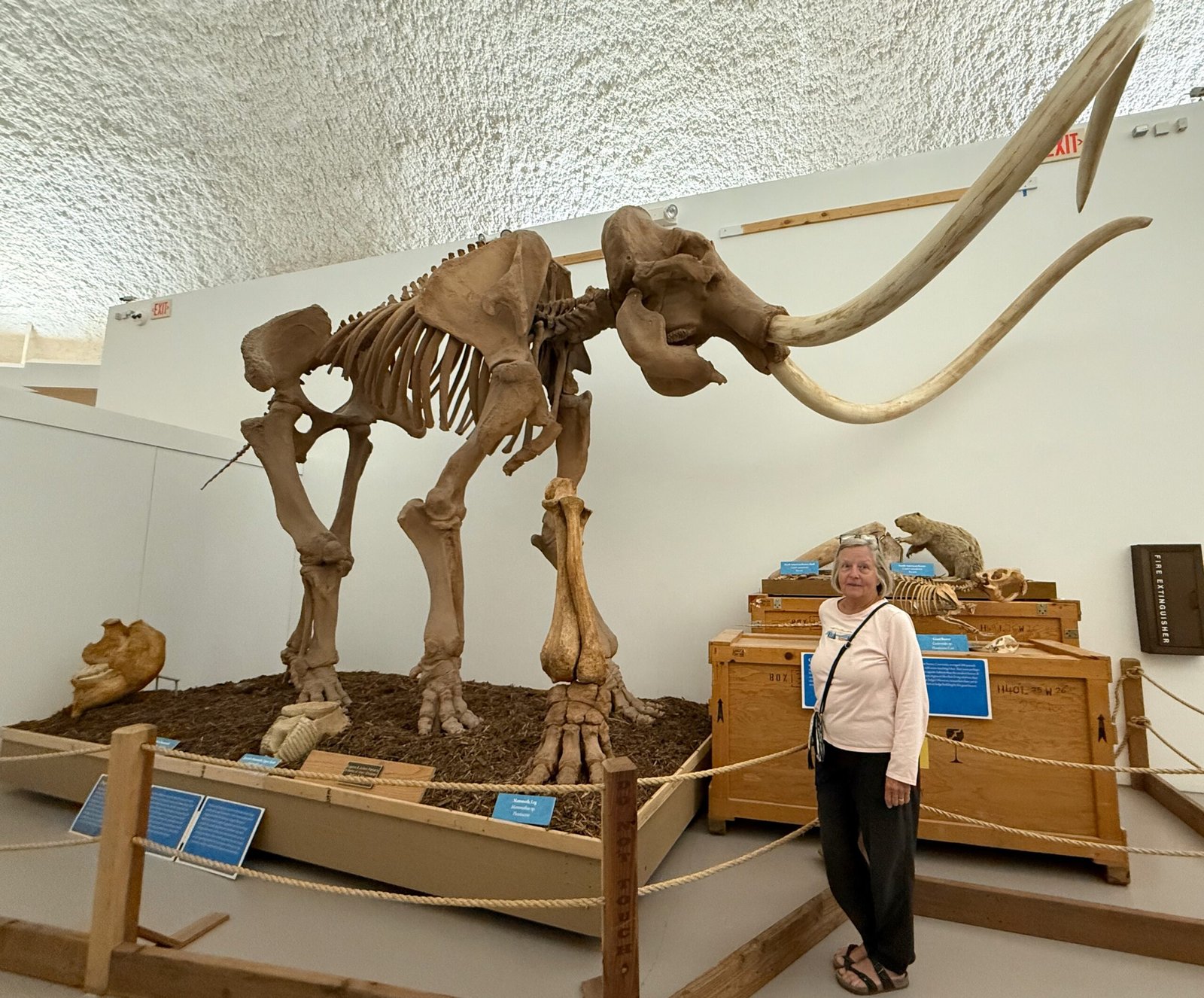
Pushing the fuel tank limit, we rolled into Hays and navigated across town to the museum. Wow. It was spectacular.
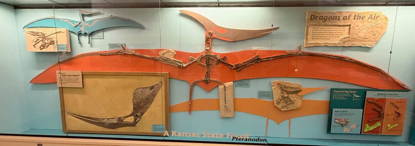
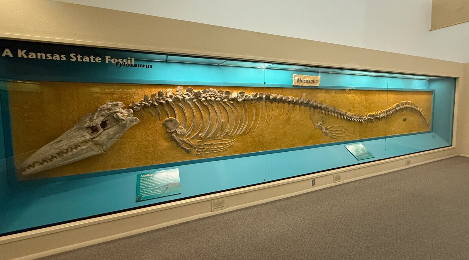
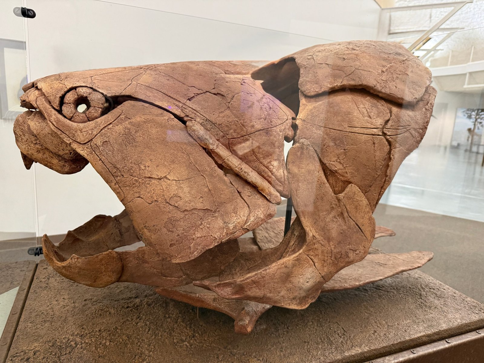
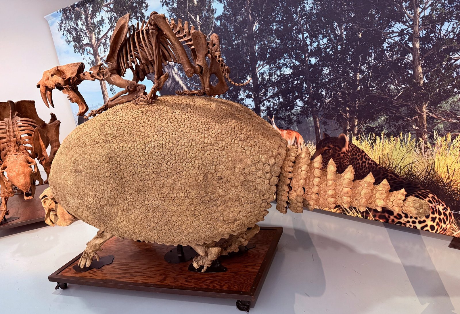
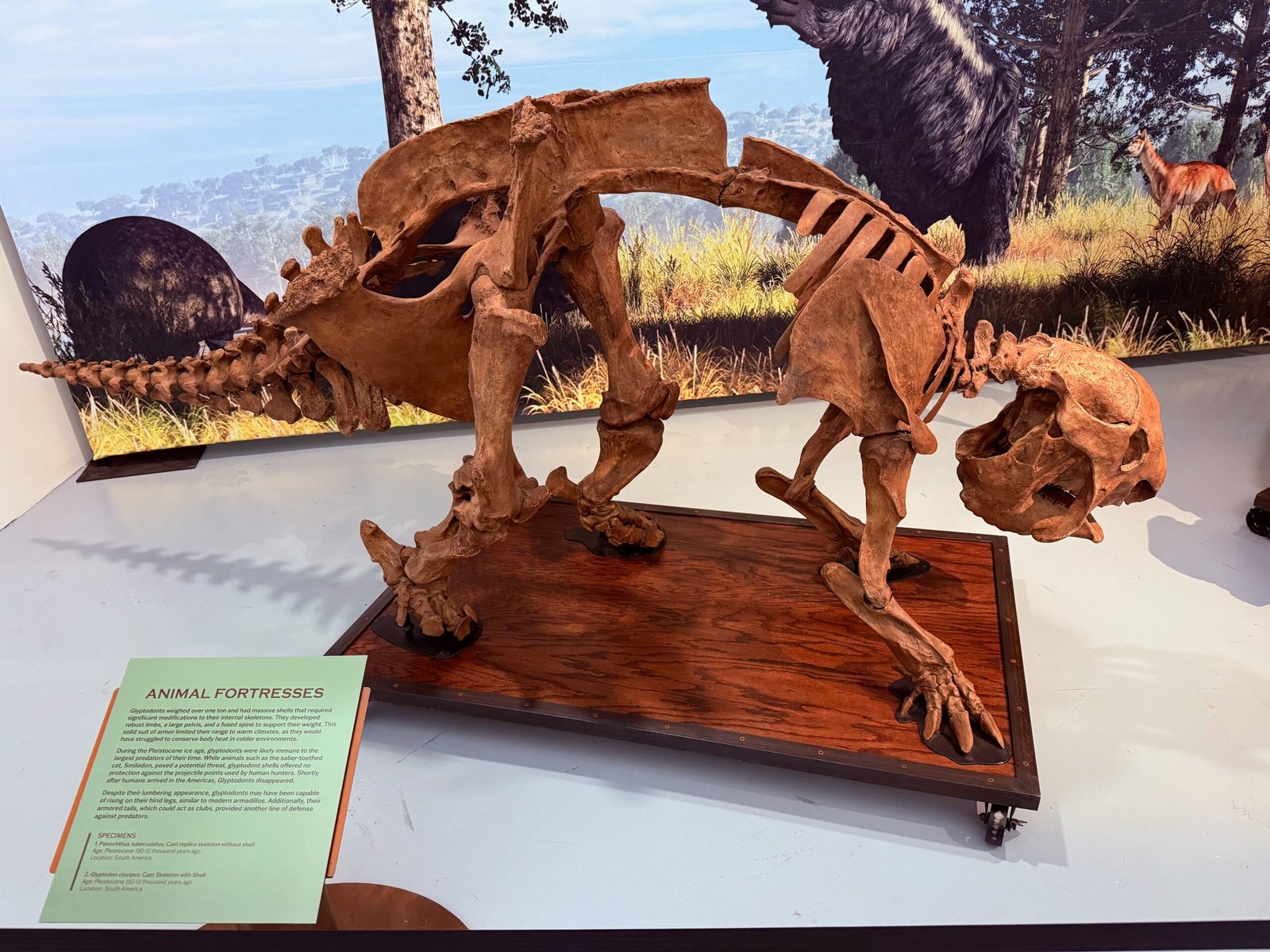
A pterodon with a 20 foot wingspan!A 30 foot Mosasaur!Dunkleosteus, thought to have the most powerful bite known.A glyptodont with a smilodon on its back.Glypdodonts were massively built.A mammoth! She’s so excited!
Dr. George M. Sternberg was a surgeon in the Civil War (and later Surgeon General for the army) and was stationed in Kansas. He began identifying fossils collected by soldiers. He purchased a ranch after the war and his brother Charles helped him manage it. They both became interested in the fossils around Kansas. Many of the specimens collected are on display in museums around the world. Charles’s three sons became fossil hunters too, one finding a plesiosaur at age nine.
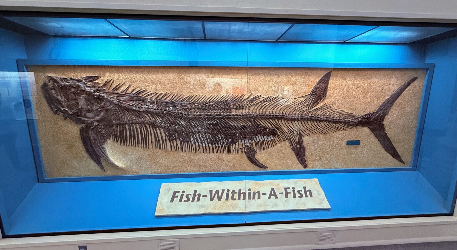
He, George F., became curator of the now-named Sternberg Museum in 1928, and in 1952 discovered the world famous “fish-within-a-fish,” a nearly complete pair of specimens, one swallowing the other and then dying.
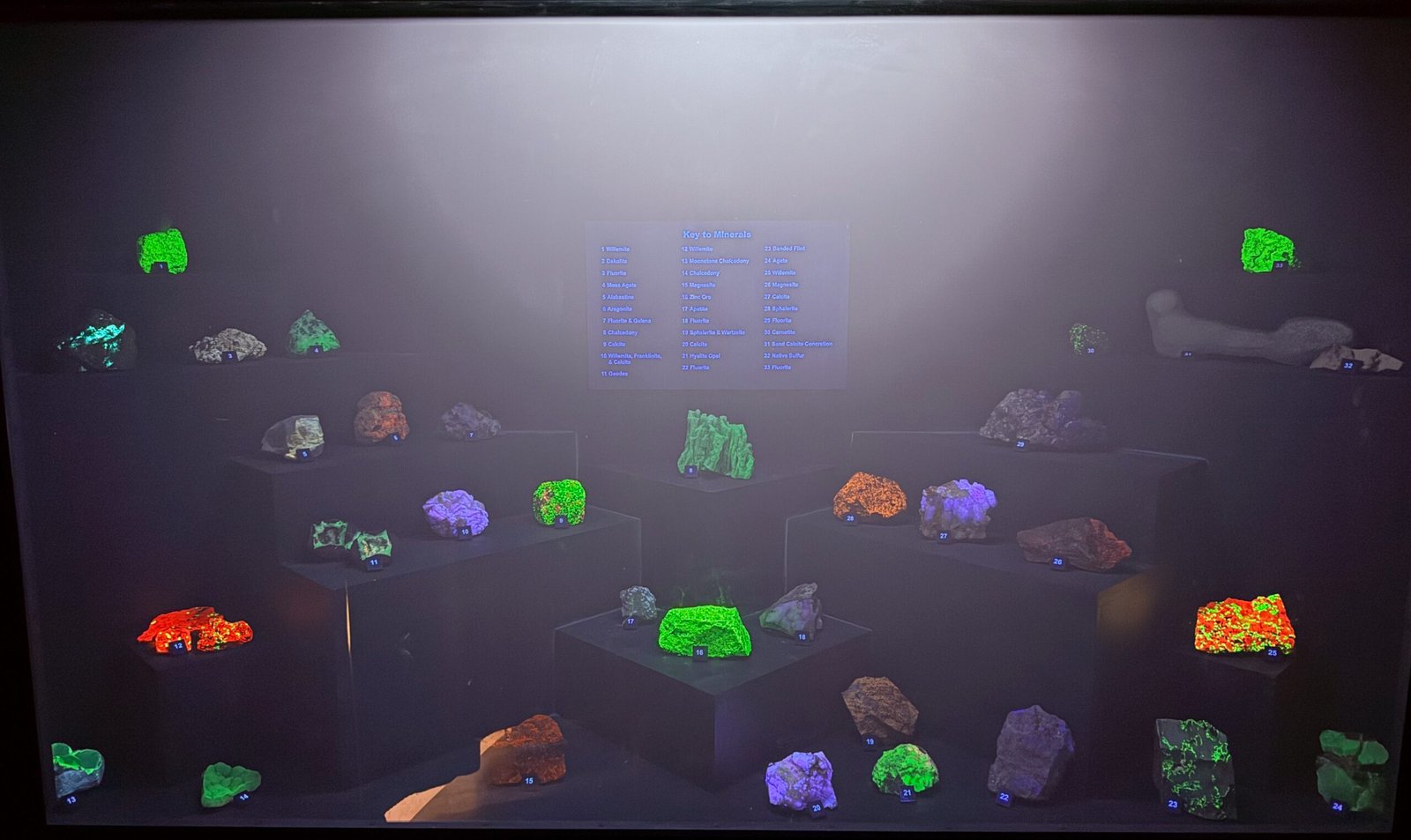
A great display and explanation of how mineral fluoresce under different wavelengths of light.
There was a section on fluorescing minerals. You could view the rocks in natural light, then flip on ultraviolet bands of UV-A or UV-C. Boy, UV-C really lit them up!
While we fight sunburn and cataracts from UV-A and UV-B exposure, nearly all of the Sun’s UV-C is filtered out by a vanishingly thin layer of ozone high in the atmosphere. UV-C is incredibly energetic and harmful. In fact, it would kill most plant life on earth if it reached the ground, they have no defense against it.
I’ve heard people say that there is just not enough carbon dioxide in the atmosphere to cause climate change. It’s “only” 0.04% of the air!
Guess what, ozone makes up 0.00006% of the atmosphere. Almost 700 times less than carbon dioxide. And yet it determines our fate. Without this protection, we wouldn’t last long after our crops died.
Whatever you may believe, using “there’s not enough to make a difference” is not really a valid argument.
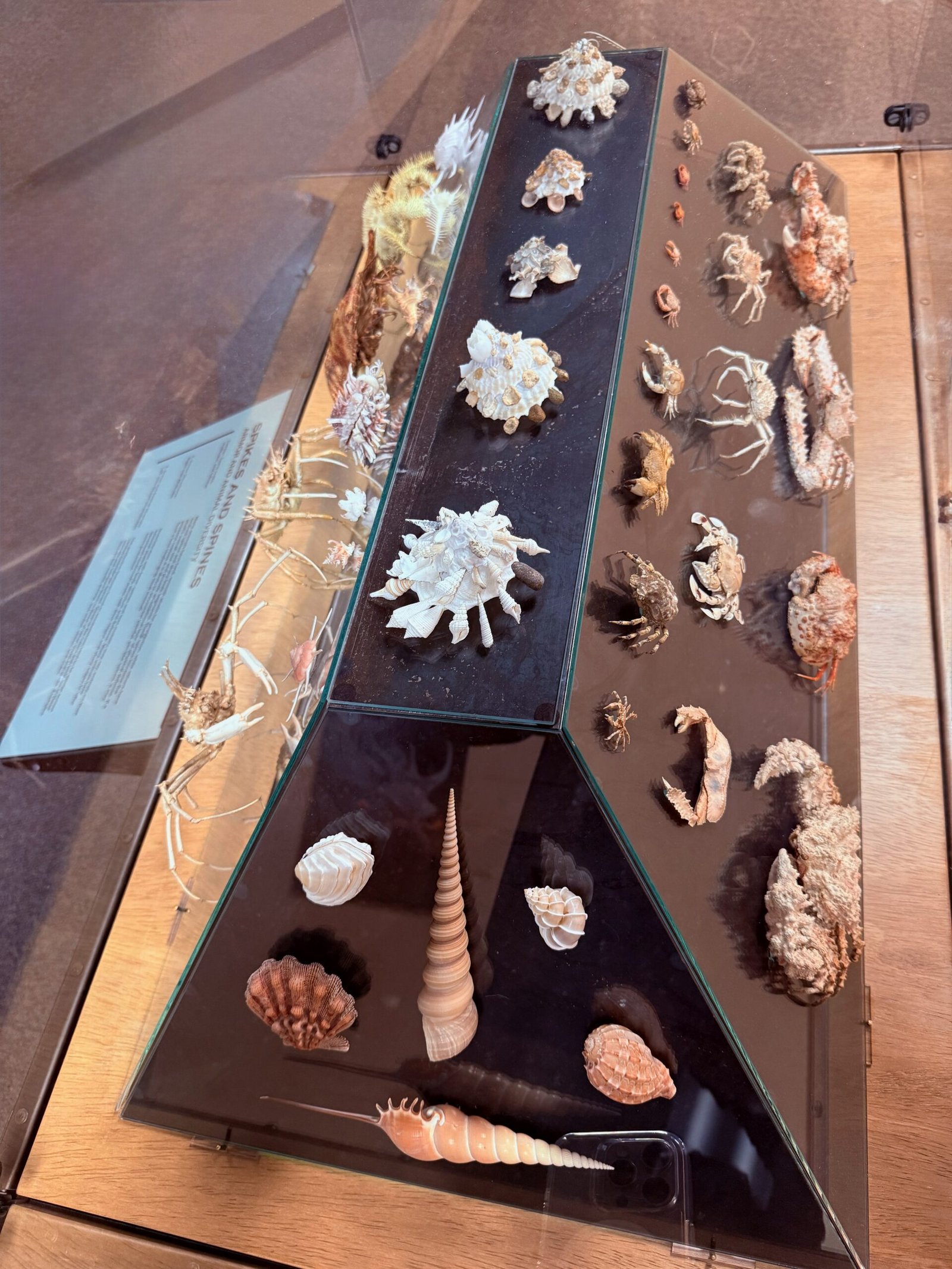
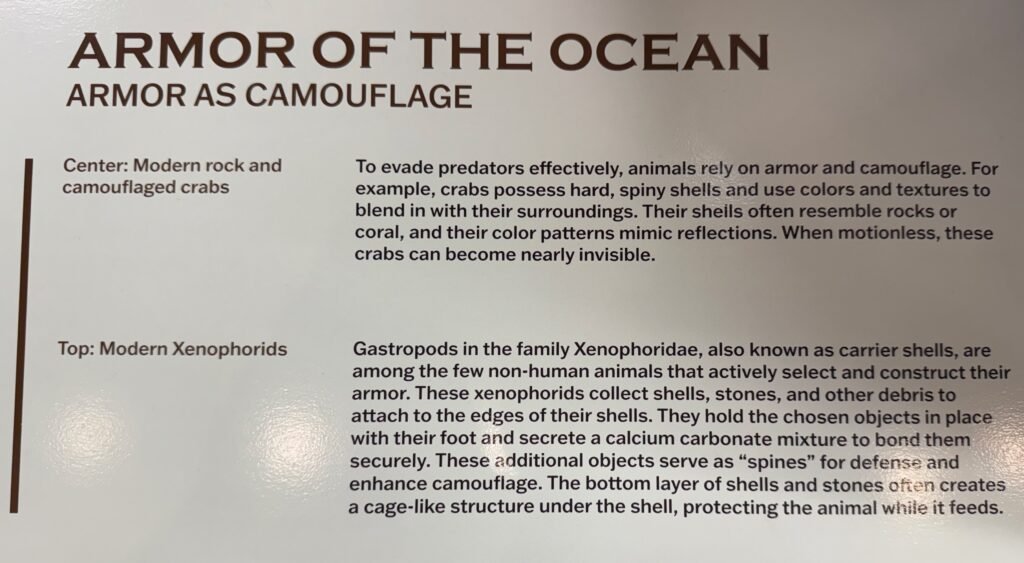
This display kind of bent my brain.
The little guys across the top are known as “xenophorids.” They fasten other shells and rocks to their shells as they grow. So wild looking. Read about them below. Beautiful display.
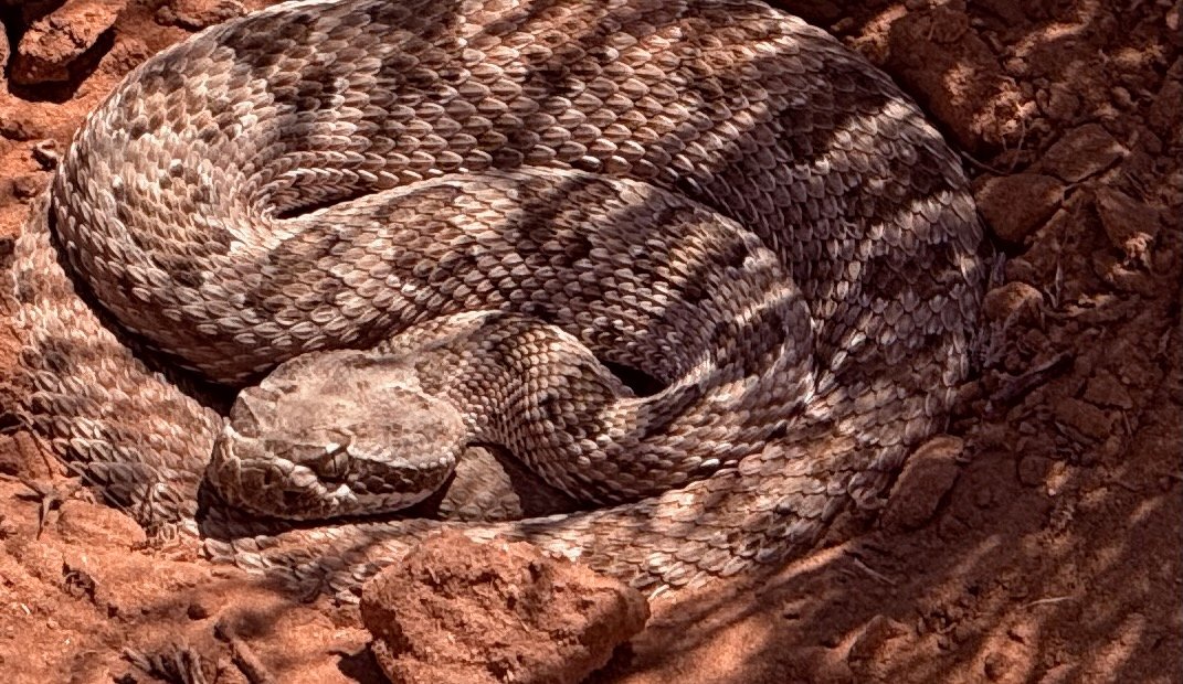
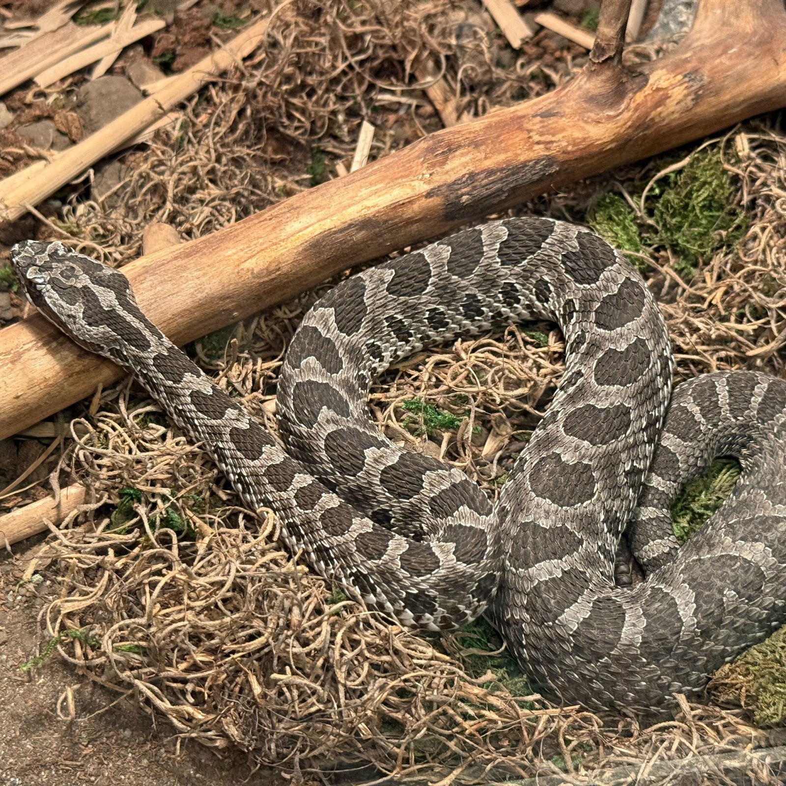
Just before we walked out of the museum we found an entire section dedicated to rattlesnakes. All the rattlers in the U.S., alive in display cases showing how and where they lived. The display even had a toxicity scale!
Hmmm, I wonder if a cousin to my little friend is in here? And then just around the corner, I think I found him.
To slide, touch or mouseclick/hold on circle.
It’s hard to tell. I didn’t get a good shot of the large head scales, the defining feature. But everything else seems to line up. A Massasauga.
Isn’t it a little weird? Nearly stepping on one a few days ago and then wandering into probably the one museum with this extensive a display.
The museum was wonderful and should be a stop for anyone rolling down I-70 through Kansas!
The gas pump read 19.65 gallons. Pretty good for an 18-gallon tank! I think this beats the Buc-ee’s fiasco of 2022. Well, I did have a 5-gallon jerry can in the back just in case…
A fine lunch at Gella’s Diner downtown and a quiet evening at Minooka Park on Wilson Lake set us up for a long drive to Jefferson City, MO.
We had planned to stay at Binder Park in Jefferson City for a couple of nights. But we were itchy to get home and with rain in the forecast, we decided to send it, driving all the way home.
Avoiding St. Louis, Paducah, and Nashville, we added some time, but interstate travel through large cities can be tricky. The roads are rough, there’s always construction, and sometimes the cars and trucks don’t play well with each other.
So we worked our way southeast. Unexpectedly, we crossed two very long, very narrow iron bridges going into Wickliffe, KY. The first across the Mississippi, the second across the Ohio. Watch the oncoming trucks and hold your breath!
Our only “real” driving incident on the whole trip was – you guessed it – on I-40. After fueling, I was accelerating down a short on-ramp. There wasn’t much of a merge lane so I needed to get up to speed quickly. Watching for the oncoming traffic in my mirror, I glanced up. The flashing lights on the back of a tractor-trailer were sweeping across the nose of my truck. In trouble, it’s heading for the emergency lane to the right of the on-ramp lane!
Standing on the brakes I’m now out of momentum. And I couldn’t use the emergency lane to buy a little merge time because the truck was now in it! Fortunately, the trucker coming up I-40 was paying attention and slowed enough for me to merge with my foot on the floor. Go Ranger go.
Complete chaos avoided. All is well.
Other than some insanely mismatched bridge/road interfaces on I-840, the rest of the trip was uneventful. After a good night’s sleep, I find a nearly flat tire on the camper. We had picked up a screw somewhere. Probably in the last 50 of the nearly 4,000 miles we traveled.
One more post to wrap the adventure up, stay tuned…
This has been such an amazing experience. And a lot of it is due to the fact that we’ve been able to spend significant time here. But also, just about everyone we’ve met has been friendly and engaging.
“Are you a long hair?” Leo asked me matter-of-factly when he came through the door of the BEEC. Leo is quite an artist and he creates designs for the partnership.
“Well,” I said, “I do have a little Cherokee heritage.”
“How do you say ‘hello’ in your language? I’m Diné, We say ‘yá’át’ééh’.”
“I don’t have a clue,” I replied, a little embarrassed.
He sat down across from me at the low side counter and we had a nice chat.
This is interesting. I’ve kept a running list of how I’ve been “profiled” over the years and maybe the circle is now finally complete. Let me explain with a somewhat nonlinear story.
Not too long after 9/11, I attended a security conference at Fort Huachuca, near Sierra Vista. The base is very close to the Mexico border. The dinner and evening entertainment one night was at the Officers’ Club. Walking into the club I stopped by the restroom. In typical government style, there was a row of sinks along one wall. A man in a long black Duster had his toiletry/shaving kit out, and was apparently finishing up a shave. His hair was still wet from a rinse and he was completing the wash up by drying and twisting up his mustache.
I’m thinking, “Wow, how did this guy get in the Officers’ Club? How did he get on base?”
Lo and behold, he was a Cowboy Poet, part of a cadre of cowboys that included Baxter Black, the most famous. If you ever get a chance to read (or hear) Black’s “Range Fire,” give it a go, it’s quite captivating. But I digress…
This guy was the entertainment. And apparently he just rode in off the range? Fascinating. So after dinner he took the stage with a deep, booming voice and regaled us with cowboy poetry, steeped in wisdom and mystery. But let’s get back on track…
Driving back to Tucson from Fort Huachuca, I decided to take a more scenic route along state highways. As I topped a hill I saw a state trooper. Now, I wasn’t speeding. But I tan easily and it was summer and I had my shirt off with the windows down. Oh, and I had this massively bushy beard. As I expected, he pulled me over. Obviously an Arab terrorist sneaking across the border.
He asked for my license and looked me over. Then…he asked me my name. As the Appalachia rolled off of my tongue, he just handed me my license back. Yeah, no foreigner can fake an accent like that, you can go.
The second time it happened, I was with my family at Tybee Island. No beard this time. Joe and I were trying to get all the beach gear across the deep dry sand and had everything balanced on a wheeled cooler. The stack was high and unwieldy but we were almost over the rough part. A lady about 30 feet away shouted over to us, “If you put a strap across all of that it would stay together!” My son-in-law Joe and I were a bit dumbfounded that she felt the need to “help” us with our task and I had this quizzical look on my face. She asked, “¿No habla inglés?”
We both just fell out laughing. And we have laughed over it many times since.
So it became a thing for me over the years:
A man with a clipboard approached me in front of a quick mart and asked me if I was the owner, thinking India.
An office worker in Huntsville thought I was Sicilian.
A veteran at a campground in PA, who was Brazilian, thought I was Columbian.
In Belize, a local thought I owned the ice cream store up the street. Another, on hearing about my red meat allergy, just wanted to know, “How do you live here?!”
In Peru, one of our drivers eyed me over and thought that maybe I was Bolivian.
Something is just not quite right about me. They can’t put their finger on it. Maybe it’s the green eyes.
So – and maybe sadly – my frame and skin tone have never been recognized as Native American, let alone Cherokee.
Do you remember Iron Eyes Cody? He was popular in some of the old westerns, but he became most famous as the “Crying Indian” for anti-litter campaigns in the 1970’s. He wasn’t Native American at all! He was in fact a Sicilian through and through, one Espera de Corti. Interestingly, he became a strong advocate of Native Americans, and near the end of his life actually believed he was Native American. Truth is stranger than fiction.
Anyway, I think Leo brought it on home. He came in a couple of days later and I was ready. He announced, “Yá’át’ééh!” I replied in Cherokee, “O si yo!”
Ya know, I’m kinda glad to get that off my chest. I’ve always wondered if my ancestry would ever be recognized. It seems that Native Americans are just an afterthought these days. You don’t hear much about them, other than some “pain” they want to cause. And back east it’s only street and place names that seem to carry their legacy. Just like our beautiful springs, the reason most towns got their start. But that’s another discussion.
We’ve gotten comfortable here in Bluff. And there’s so much more to explore. But it feels like it’s time to head back home.
I briefly met another Joe, this one being a local artist. A fascinating man whom I learned not only discovered the mammoth petroglyph at Sand Island but also the oldest named dinosaur species in all of Utah. He walks to the beat of his own drum, you can feel it and see it in his demeanor. As we talked, he asked why we were here. I mentioned that we were volunteering for a month and that we like to spend time in a place in order to get a feel for it.
He said, “We call that eddying out.”
That hit me like a bolt of lightning. I’ve spent a lifetime of “swimming upstream.” Sometimes because I’ve had to, sometimes because I like questioning things to sift out their true meaning, sometimes, because I just enjoy it. It can be hard, and every once in a while I just give up and float aimlessly back down the river like an electro-shocked fish until I snap out of it. I have learned that taking the stream head-on in the channel will tire me quickly. Steadily working upstream along the streambanks is a better way to go.
But this idea of drifting along downstream while looking for the calm eddies is something I will have to consider. Or maybe it is something I’ve been doing all along.
The comment reminded me of late last summer when Patricia and I were floating the 16-mile remnant of Glen Canyon to Lee’s Ferry from the dam. The Colorado twists and turns and there are huge, deep pools just before the riffles where the river narrows and the flow regains speed. Patricia and I had been gently pulled into an eddy that split from the riffle and literally carried us several hundred feet back upstream along the inside of the bend along the magnificent bluff wall. It took minutes to circle around…and we just let the eddy circle us around a second time.
And then with a single paddle stroke at the appropriate time, we slipped out of the eddy to move on downstream. Delicious.
So yeah, eddying out. Some circle a while, some never leave. I love the chill.
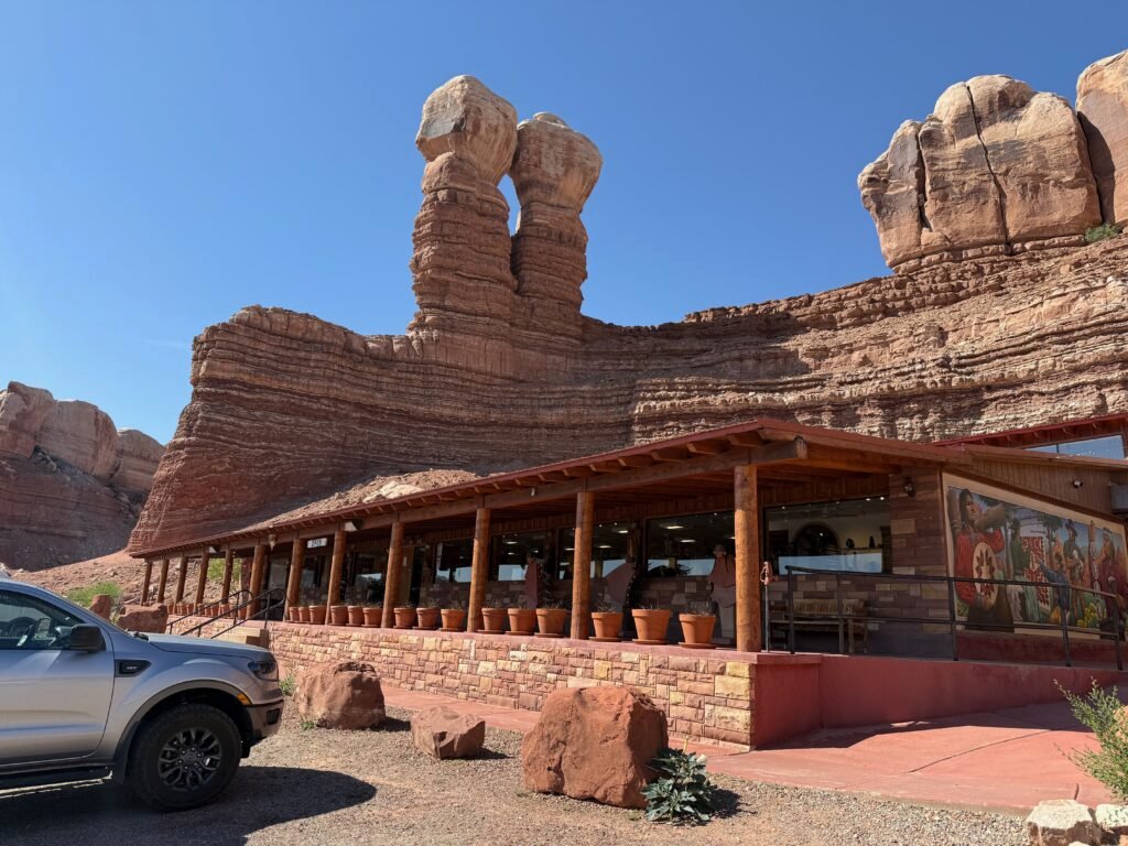
It’s a unique place. Steve at Twin Rocks Trading Post is first class, as is his beautiful store. His “watch dogs” are not to be confused with “guard dogs” and have their own special purpose, tripping up any ne’er-do-well attempting to flee the front door.
I guess those rocks have been there a long time, but man they are huge.
Across the street, Cow Canyon Trading Post has its own vibe. Liza has a beautiful space with a little music from time to time.
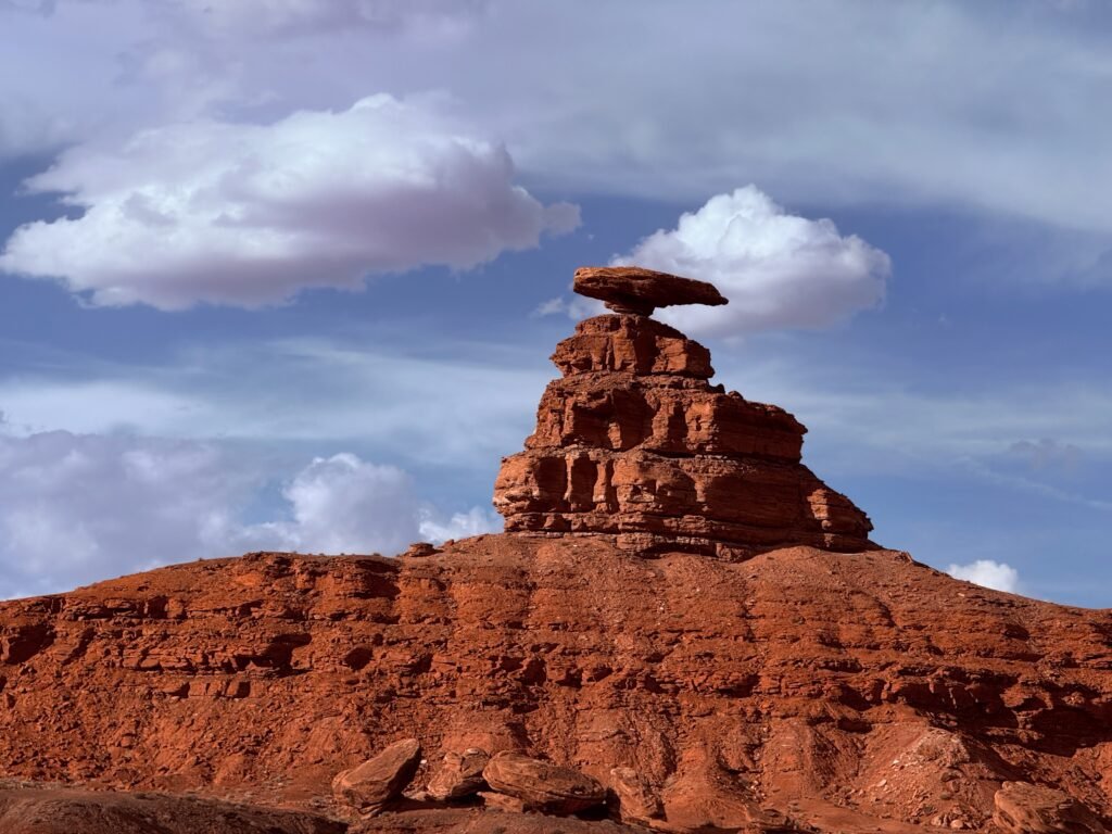
And there are even crazier rocks down the road. Mexican Hat gets its name because it looks like an upside down sombrero.
It kinda defies belief. Especially when you think about how long it has balanced there.
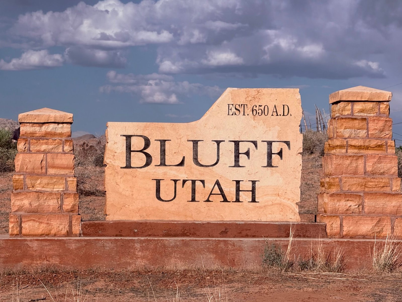
But I love the city limit signs in Bluff. Stating that it was “established” in 650AD, it acknowledges that cultures come and go. Centuries and centuries of indigenous tribes, and more recently the Mormons made a go of it before mostly moving on to Blanding and Monticello.
Maybe that’s the story of the Colorado Plateau and its people. A dynamic landscape and a living history. Maybe that’s the way life is supposed to be lived. Settle where you might, move when you need, return if you can.
The buttes at Bears Ears were recognized by five different and distinct tribes as “Bears Ears.” A centerpoint of ancestral lands. The Bears Ears Partnership, in kind, is at the center of a cultural renaissance. One where we begin to more fully understand the history of our great nation and earnestly begin to teach it to our children. Our country has a history and culture like no other, it seems we should awaken to it and respect it in a manner it deserves.
We’re in our last week. We’ve covered a lot of territory, seen so many things, and talked to so many people. The temperature has climbed considerably in the past few days. Early morning hikes are best, there’s just too much sunshine to do much in the afternoon. The humidity has been running 13 to 18 percent and it’s hard to stay hydrated.
The camper water heater sounded an alarm the other day. It turns out the incoming water was hotter than the set temperature!
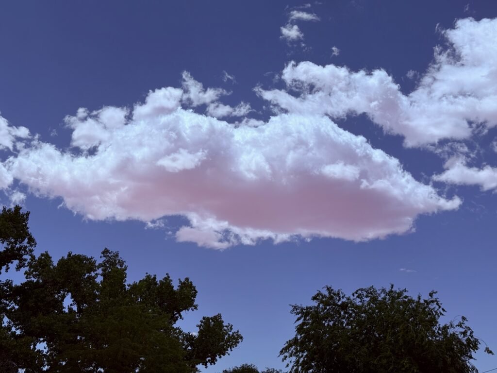
Canyon dust (or spice melange) is ubiquitous and permeates everything. Even the clouds were pink yesterday, their undersides tinted by reflection from the sandy desert.
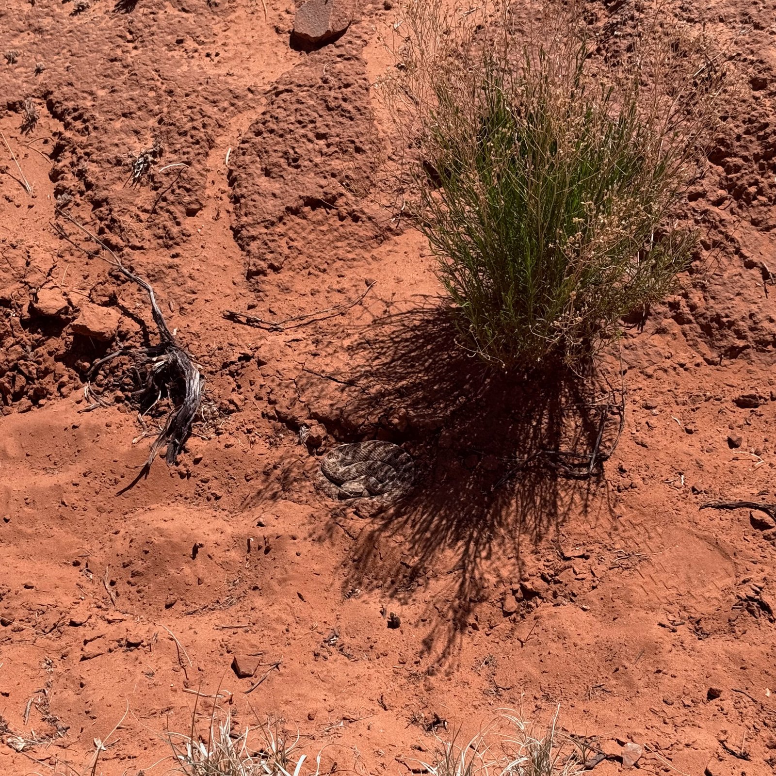
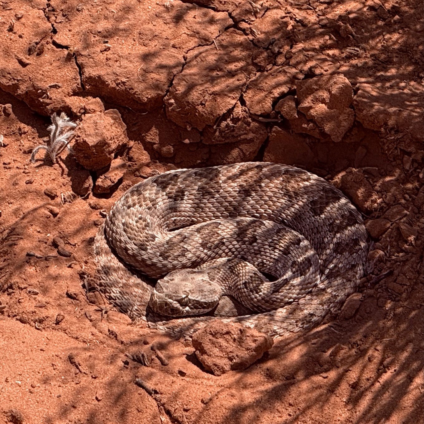
One early morning, we were hiking along a sandy two-track. The area was open for grazing, with cow dung scattered among the bushes and grasses. I became lost in thought and I heard Patrica say, “Snake.” She was a few steps behind me and as I turned back toward her, the little rattlesnake scooted back into the den it had apparently commandeered from a lizard. A cozy little spot with a shady bush nearby. It had created a little depression in the sand and was enjoying the morning – and I had nearly stepped on it.
Knowing how my mind works and the fact we were coming back this way, I marked the location on my GPS app. We hiked on up to the gap in the Comb. There was a good-sized ruin and the gap was nice and flat, probably even suitable for agriculture a thousand years ago. Oddly, we didn’t find any rock art, who knows why.
On the return I watched for my GPS waypoint and, you guessed it, our friend was back in his spot. I am not sure which species, maybe a “western” rattlesnake. As we investigated, he scooted back in his lizard hole and he never rattled.
To slide, touch or mouseclick/hold on circle.
Notice my sandal print. Mind how you go.
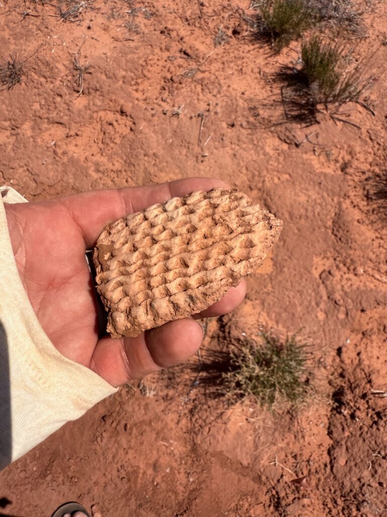
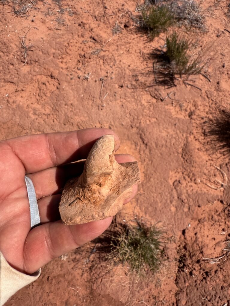
The day was rewarded with some fantastic pottery sherds, maybe the biggest we’ve seen. Patricia has the eye and spied them both, just lying on the ground.
It’s important to put them back where you found them, for a number of reasons:
An archaeological survey relies on placement to piece together how people lived. Putting them on display or in a pile destroys that information.
Pulling them out and placing them on rocks ruins the experience of discovery for the next visitor.
It’s flat out illegal to take them, according to President Theodore Roosevelt’s awesome Antiquities Act of 1906.
These are sacred things to many tribes.
Again, mind how you go.
A pot where a woven object has been pressed into the clay before firing.A pot handle! Pretty cool.
So far, the only souvenirs we’re bringing backer the stickers and spines in my feet! Ah, the memories…
Today we finished up our last day. In general, we’ve had 30 to 60 visitors a day, today was 54. It’s a bittersweet thing for sure. We hope to be back next year, and we wish the best for the BEEC and VWR. And especially for Kirsten and Carolyn, as they continue their mission of education and respect.
The Comb is sublime. And it is not a museum, something that I am finding that travel bloggers convey as they show you how to find and check off the ruins. In reality it’s an expansive and living land that many tribes still return to as their ancestral home. Like Grandma’s house, the old homeplace, or maybe your old family cemetery.
Many of us explorers treat adventures this way. Find the thing, get a selfie with it, tell everyone else about it. Talk about how careful we should be, even though our selfie shows us near the ruin with our unleashed (and uncollared) dog. Unfortunately, the number one threat to all of the ancestral sites is not extraction, prospecting, or cattle, it’s visitation.
When you visit, if you ever should, we hope you would achieve a certain personal “stillness.” A reflectiveness that incorporates the surrounding awe into your place in this world. We’ve found this doesn’t come right away. Passing through with just enough time to squeeze in a couple of hikes or run the roads, you won’t understand it. For ourselves, even after working through our Visit With Respect training, we didn’t have it at first either. It needs to seep into you at its own pace.
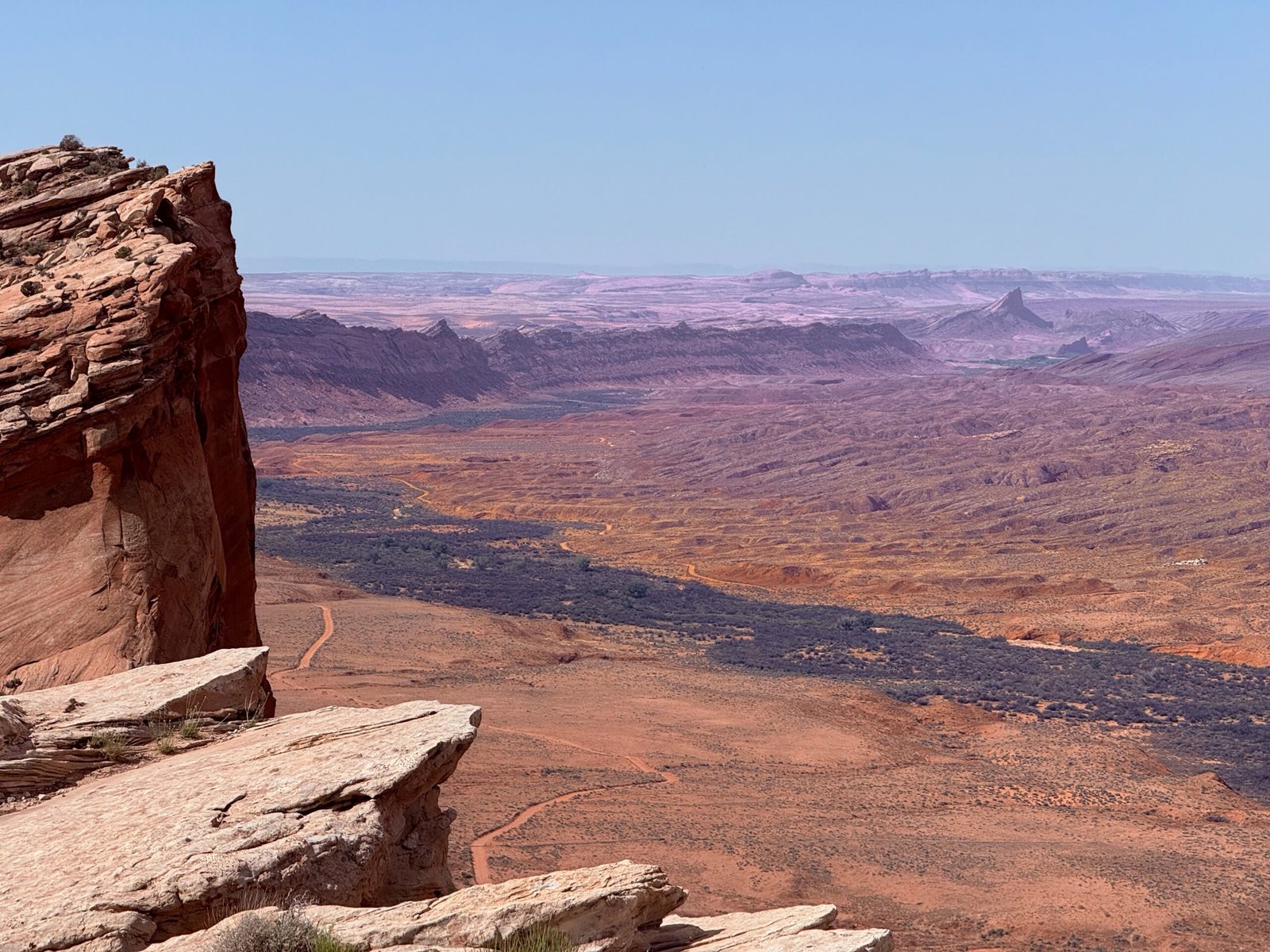
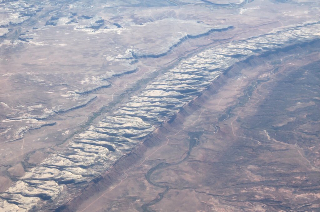
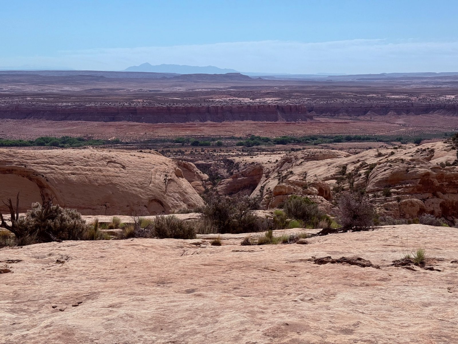
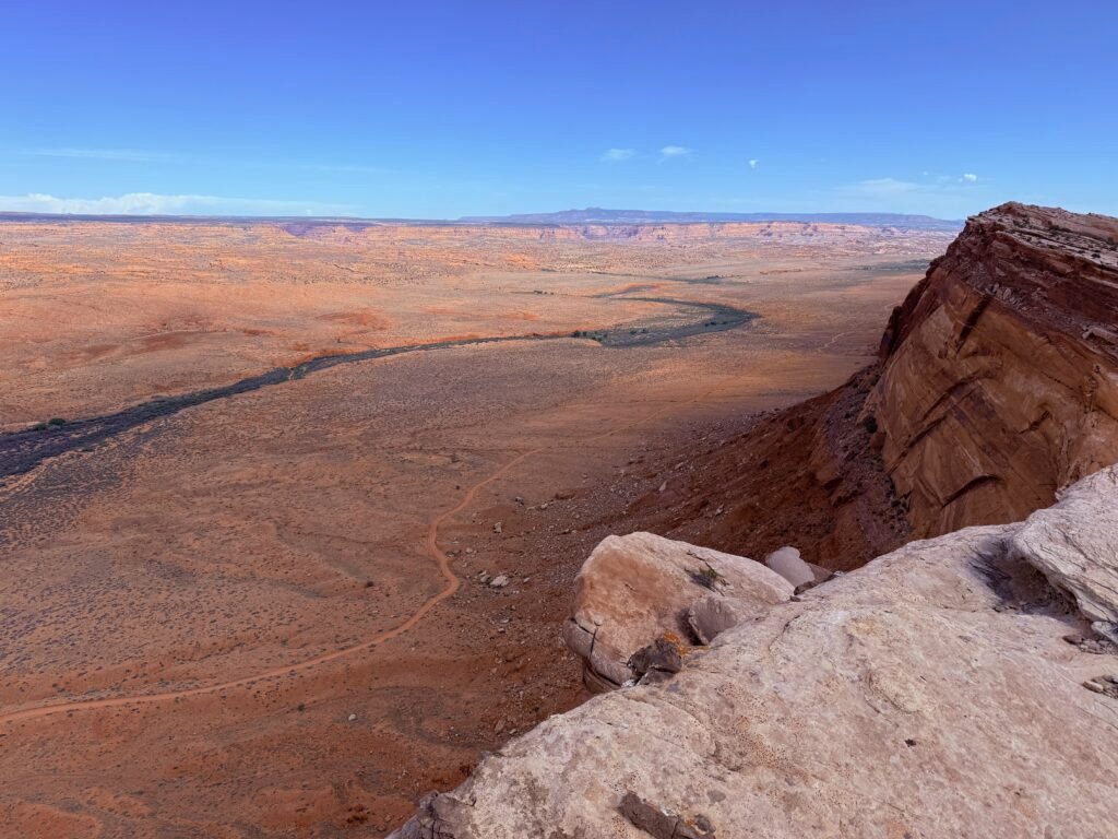
Comb Ridge is a natural wonder, an eroded 80-mile-long monocline that presents itself as a giant 1,000 foot high wave, breaking to the west, frozen in time. The western slope is near-vertical, and there are only a couple of roads that cross the ridge. The eastern side, however, is much more sloped and has eroded into hundreds of canyons and alcoves. The Comb gets its name from this erosion that extends to the ridge and, forming many peaks, is reminiscent of a rooster’s coxcomb.
Borrowed from WikiMedia, this photo gives you an idea. Looking south, the crest is breaking right.
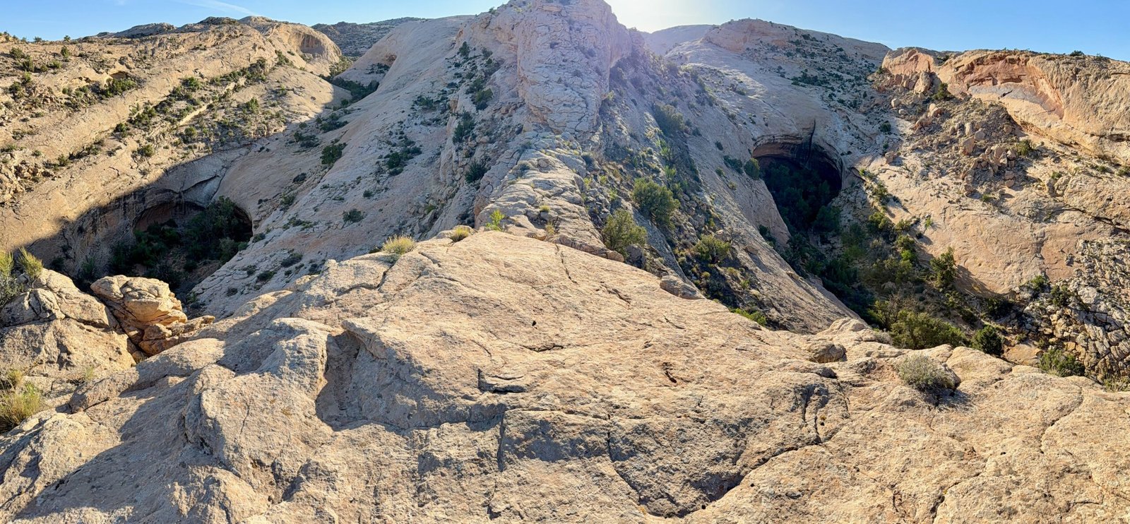
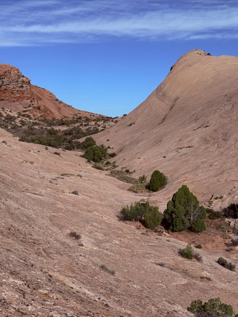
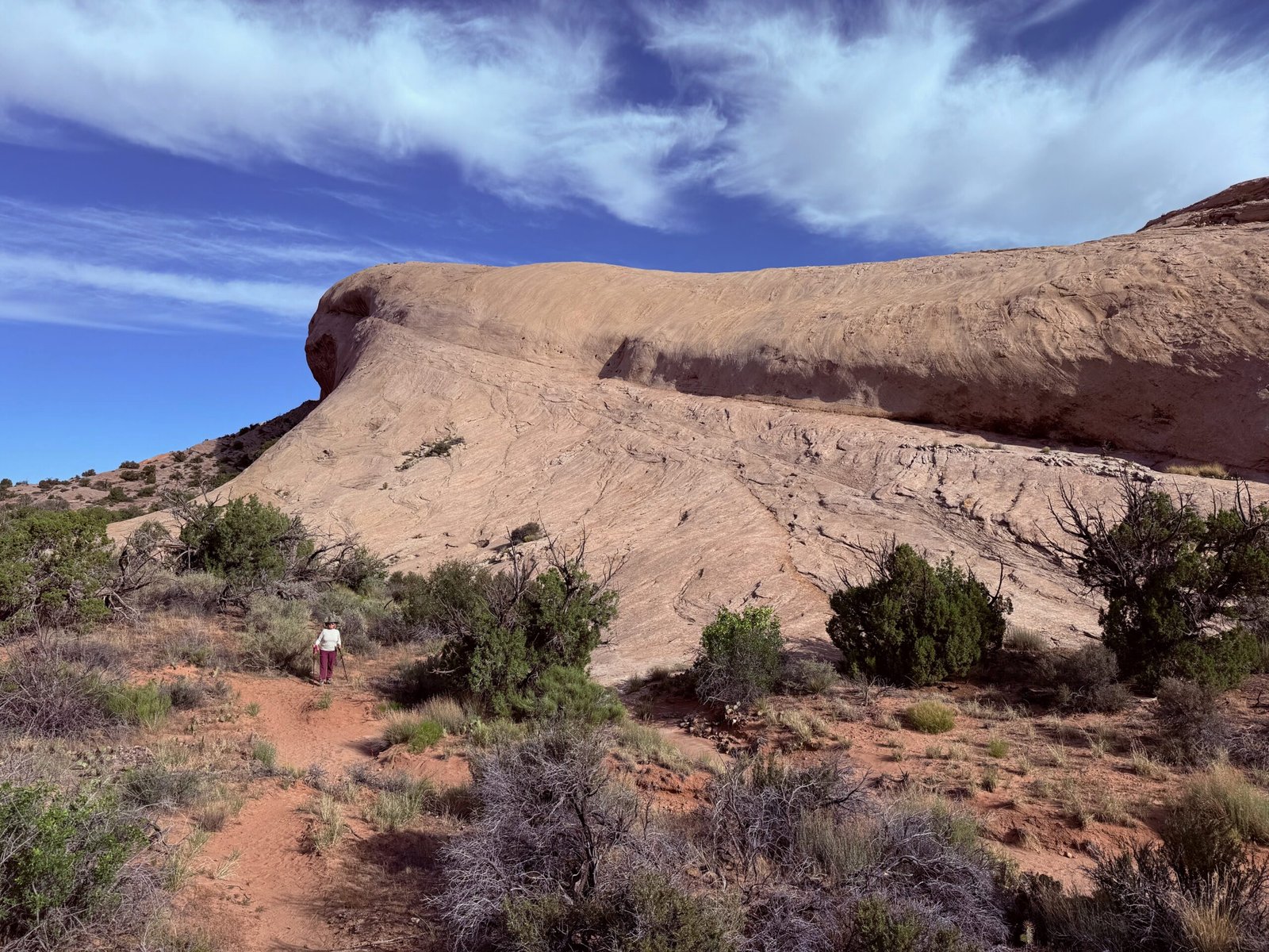
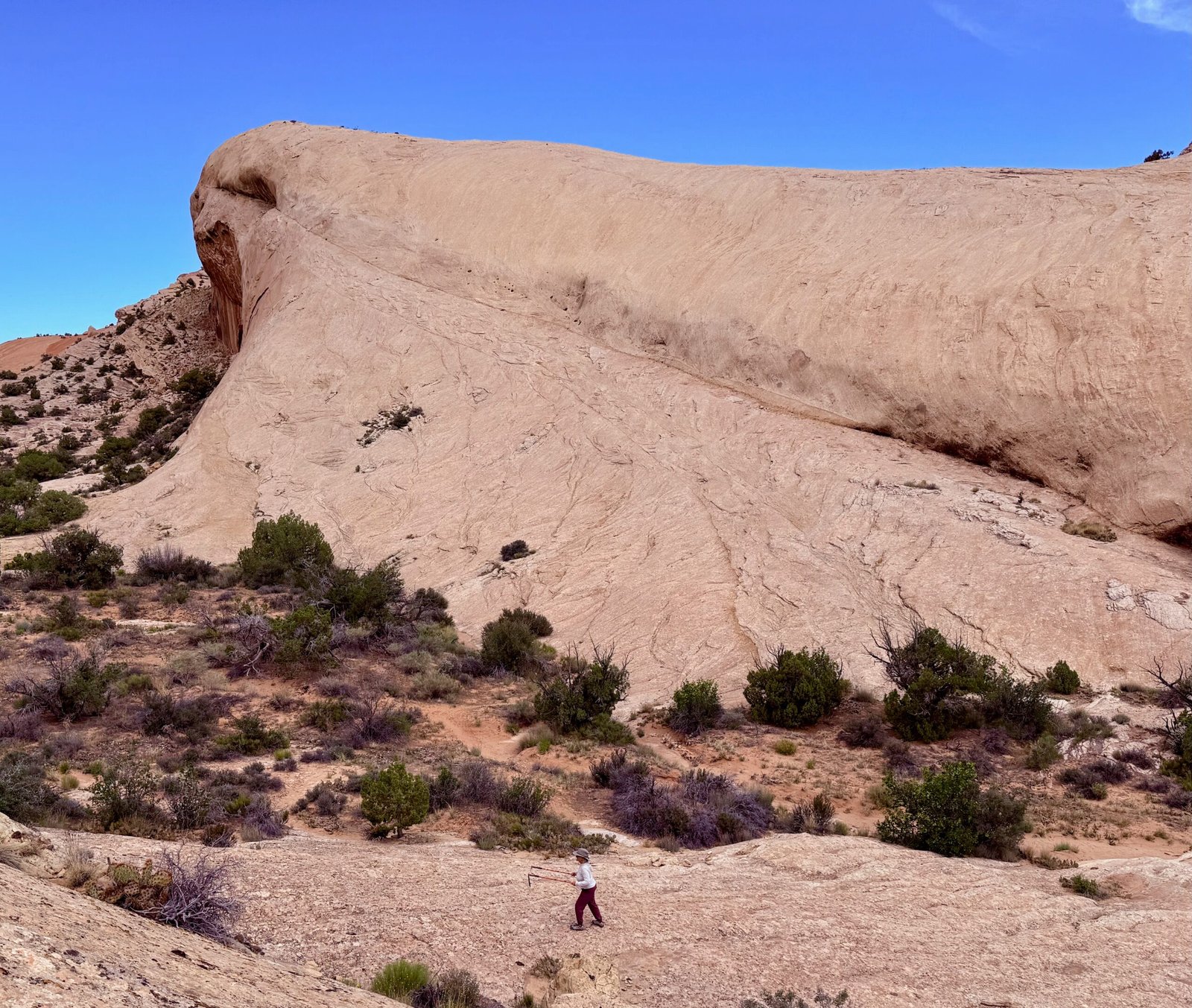
Trying to climb from Comb Wash in the west, one faces a loose talus of boulders followed by sandy scree up to a multi-hundred foot rock face. From Butler Wash in the east however, the Navajo Sandstone is much more agreeable; mystically and massively eroded into slickrock: canyons and alcoves, pour-overs and potholes, hoodoos and rocks near their tipping points.
Click on any of the images for the full-size view. Use the “back” button on your browser to return!
Side-by-side canyons coming from the rim pour over into huge pools. The areas around the pools are lush but the dry wash below returns to solid slickrock with nothing to indicate these little oases upstream exist.
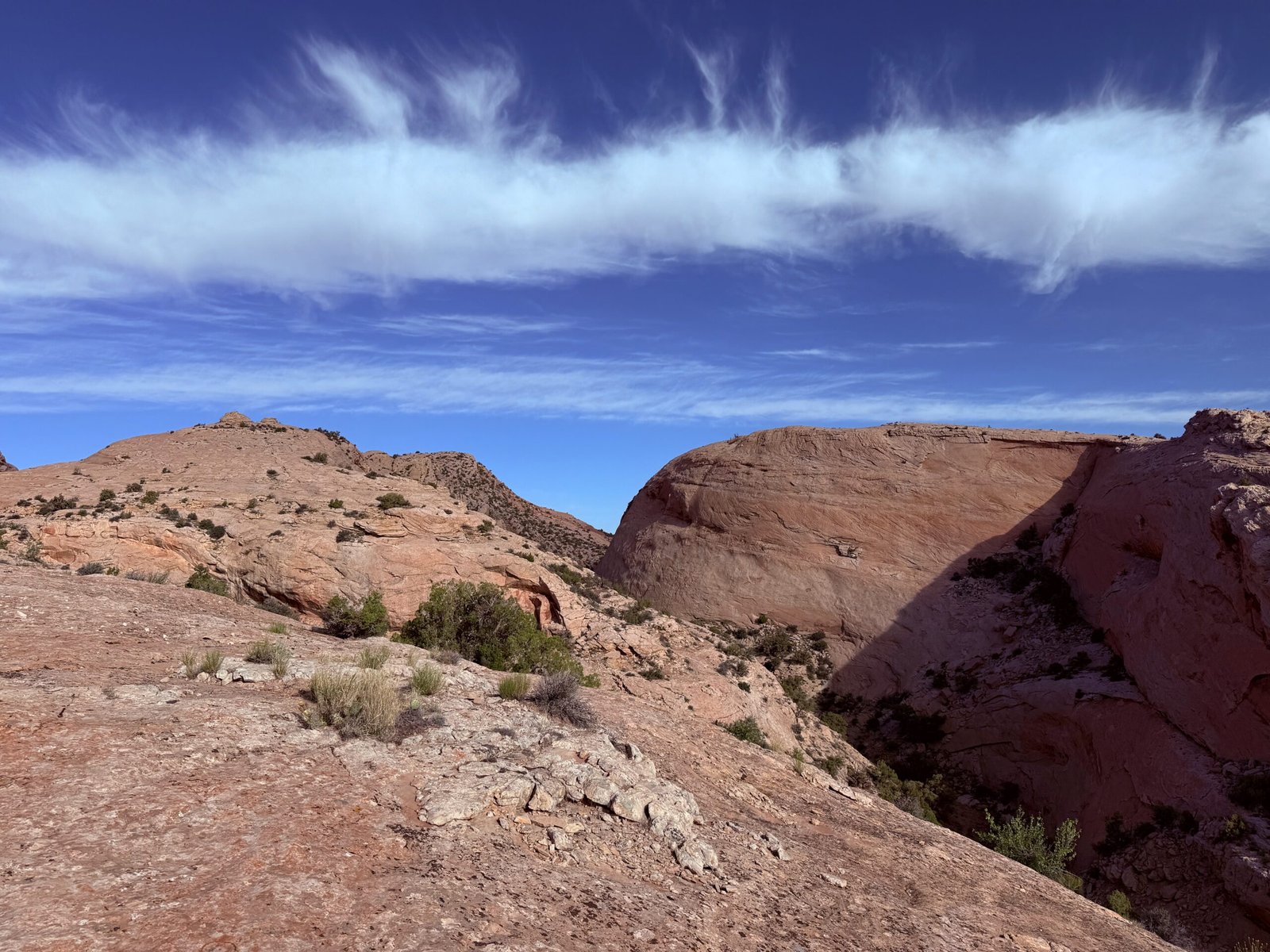
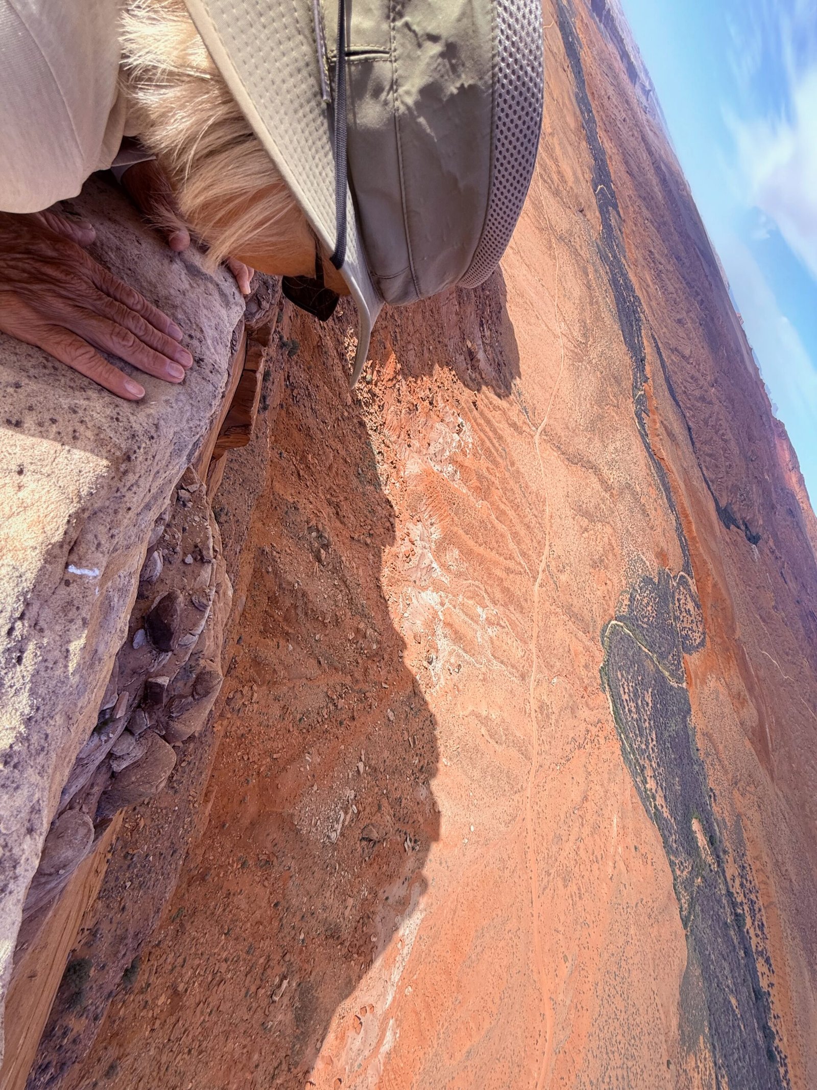
On our early morning hike today, we were dumbfounded at the beauty of this place. The slickrock is so amazing and so inviting. It is also unnerving.
While the grip is incredible, the petrified sand dunes roll off in all directions and are heavily weathered into deep slots and overhangs. We found ourselves lying on our bellies and inch-worming our way to the lip of the rim for a look-see to the west. And going up is quite different than going down. Climbing a rounded slope facing the stone makes you brave. But turning around, trying to come down on your heels with miles of sky in front of you just rubs against your brain’s better judgement. But today…today was a barefoot paradise for me, the trail was well-marked, and the grade was steady. And after our extended visit to an expansive petroglyph, we followed the wave to its crest. I was floating, Heaven on Earth.
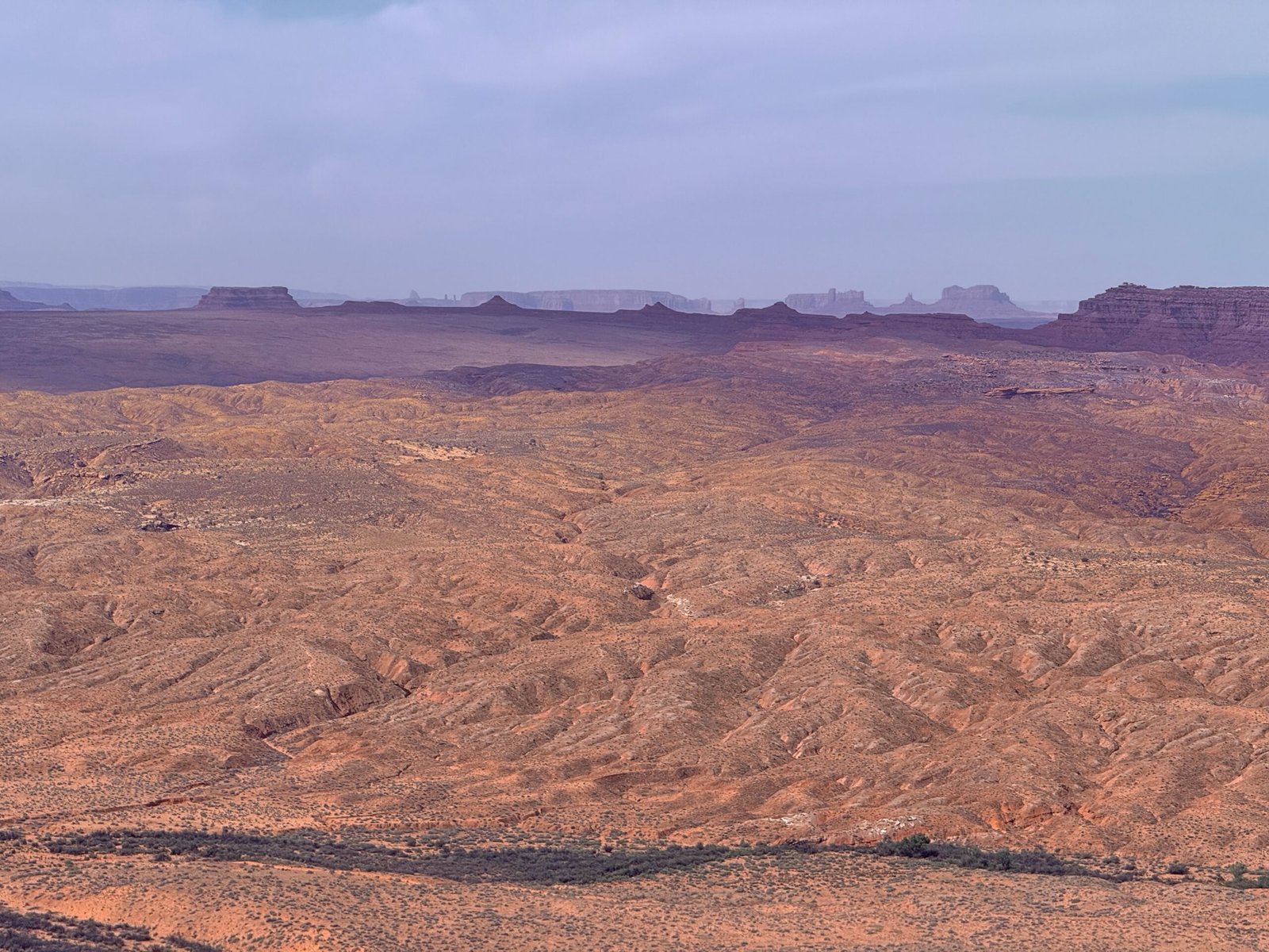
Monument Valley far away, Valley of the Gods a bit closer, Cedar Mesa near and on the right, and Comb Wash in the foreground.
Surveying Monument Valley in the distance, we were surprised to feel a little shade. The Comb had pushed the westerly morning breeze up forming a line of light clouds.
They were now drifting and spreading off to the east as a long line above the rim, a natural contrail.
Comb Wash Road below, is over 800 feet down.
Working our way back down from the rim, we met a lone hiker who was on his way up. I mentioned that Patricia had found the fossilized remains of a sand worm from Dune (see for yourself).
Patricia found a fossilized sand worm!Trail Ninja has her Maker hooks and is ready to ride Shai-Hulud…
Seeing it, he grinned and responded, “Ah, a new mythology.”
I mentioned Ed Abbey and he said he had just finished “Desert Solitaire” a few months ago.
To slide, touch or mouseclick/hold on circle.
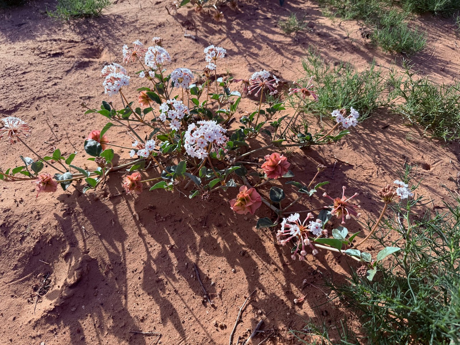
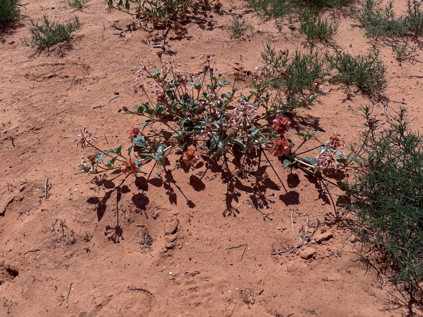
Early morning has its own surprises. This Winged Sandpuff was in full flower at 8am. By 11am it was completely closed up. Only breakfast hours for the bees…
We talked about how Abbey’s predictions from the 1960’s were coming to pass. Abbey was the first modern “resident” of Arches National Park back when it had just been declared a National Monument. Barely a rough dirt road and with zero amenities. His job was caretaker of the 30,000+ acres, with basic chores that included cleaning the camp areas – and if he had to – interacting and conversing with the few visitors. He did this for months while living in a run down government trailer. It had electricity when the diesel generator was working, but he hated the noise and only ran it when absolutely necessary. The trailer had been empty of humans for some time, and it was heavily infested with mice. That is until he co-opted and co-habitated with a large bull snake for a few weeks. Problem solved.
Abbey predicted that when the road into Arches became paved, its soul would be obscured. The unparalleled beauty that forms its own mythology would be lost in the traffic. When the first survey crew came through in a jeep and placed marker pins for the new road, Abbey pulled them up. He knew it was futile, but he felt better just the same.
And now today, nearby Moab is overwhelmed and the Arches National Park requires a staggered entrance regime. It’s an effort to limit the long line of tourists who want to drive through, somehow get a glimpse of the sublime, and make it to dinner by 7.
In the visitor’s center, we’ve had complaints from some visitors – and initially from we ourselves – that the BLM just doesn’t do enough. There just isn’t enough signage, and the roads are rough, sometimes impassable.
As the sublime sinks in, we pray to God that it never changes.