Category: Bears Ears

  • Why would you not?

    Why would you not?

    #5 in the series.

    There’s a thing that seems to happen on adventures of this type. To be sure, I don’t really know what “type” of adventure this is. All I know is that I have certain expectations or ideas about what it will be…and it never is. My logical mind sorts out the logistics, formulates an itinerary, and assumes an adventure of sights to see and things to do. But all it takes is a passionate local to alter the course toward more spiritual things of place and purpose. It happened in Belize with the Actun Tunichil Muknal (ATM) cave tour a few years ago and then again in Peru, on our 17-day odyssey. Is it happening here? Maybe too early to tell.

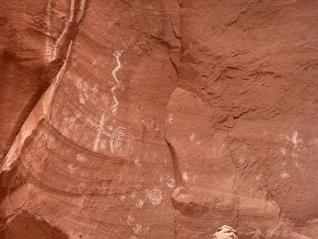
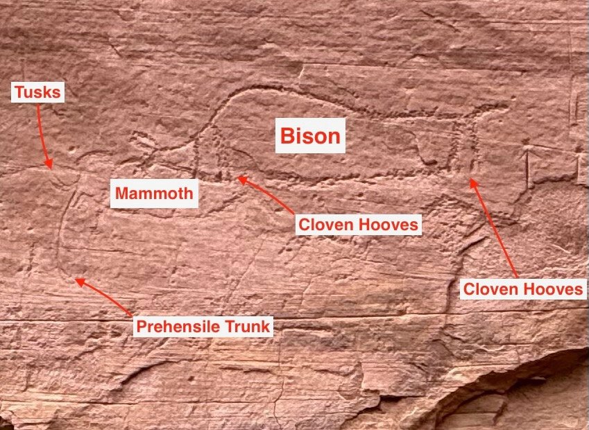
    While I think we all understand that visiting unprotected, ancient sites requires due diligence on our part to not damage, deface, or loot anything there. Even though that seems like a no-brainer, there are people with brains that can’t get a grip on that, and we all lose because of it.

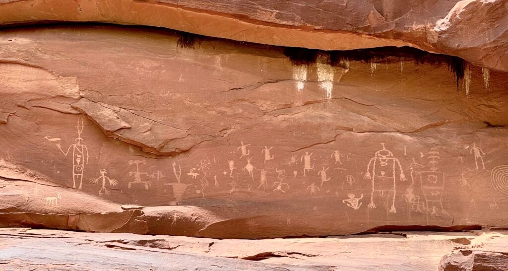
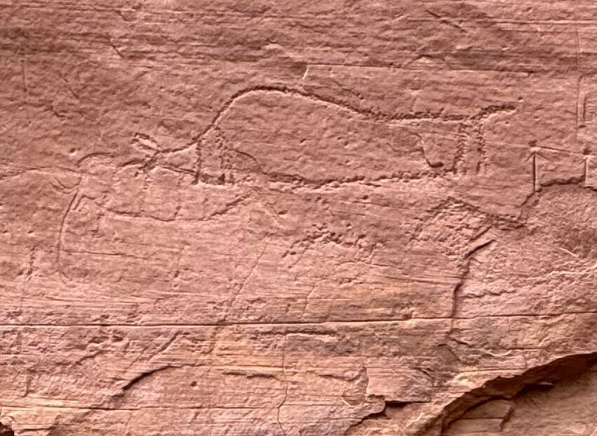
    But as we walked through some of the Visit With Respect guidance, I began to realize it’s more, and it requires a different way of thinking. These sites are from an ancient people, going back an estimated 14,000 years. And many of the descendants that are spread around the southwest consider this area their homeland. Their home place. It’s almost as if you were to have tourists come to your grandma’s house poking around to see how she made her quilts or washed her clothes. And many of the places are sacred, akin to a cemetery or a church. This throws a little extra depth on it. My brother-in-law Tom always says “Why would you not?” The phrase has become a “decider” of sorts in our household. It adds just a little bit of push to something we might be wavering on. Why would you not, out of respect, approach these places as a home?

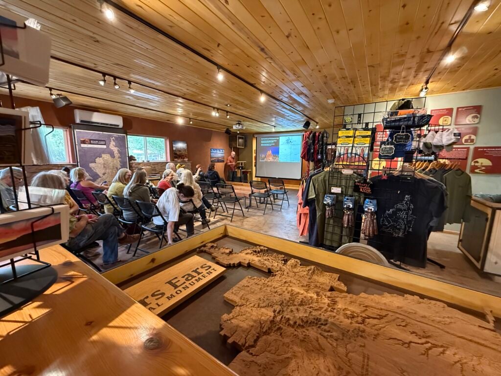
    The talk and music last night was performed by Edward Kabotie, a Hopi Tewa. His presentation was excellent, and he discussed the resilience of the Hopi and the concept of “mythical archaeology,” where you allow the old stories to help inform the logical science of archaeology. Maybe not unlike Christianity.

    I was struck that one of his favorite quotes was from J.R.R. Tolkien:

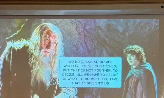
    There’s no doubt that the Pueblo and Tribes have endured a lot. But they have decided what to do with the time that they have been given. And it’s the reason Bears Ears exists. They approached the government for help for their homelands. It remains to be seen if the government reneges yet again.

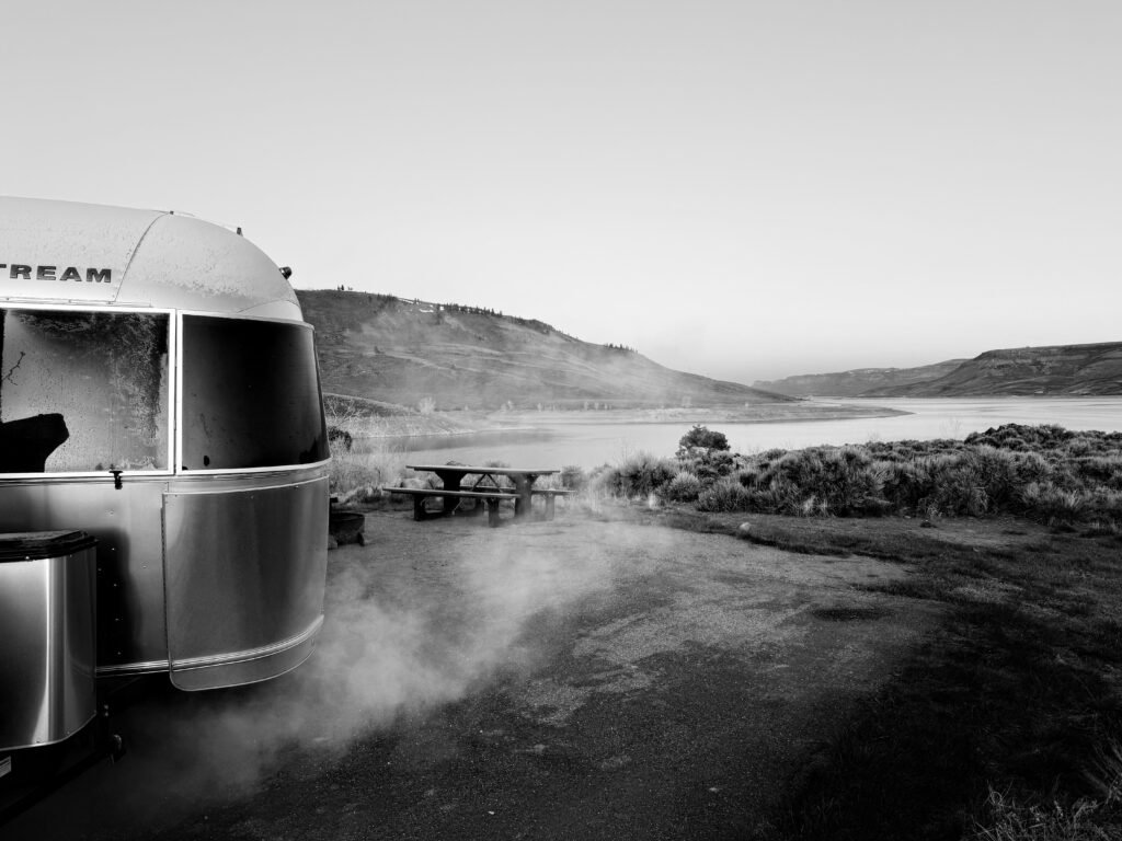
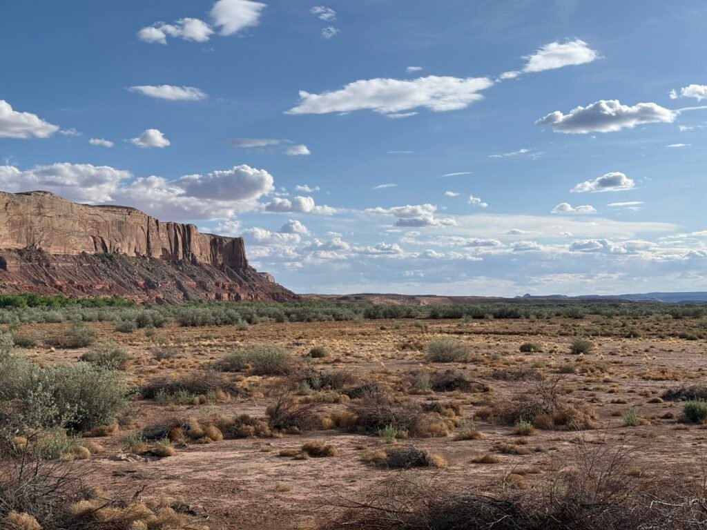
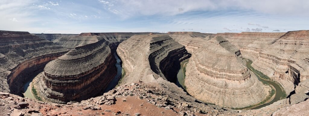
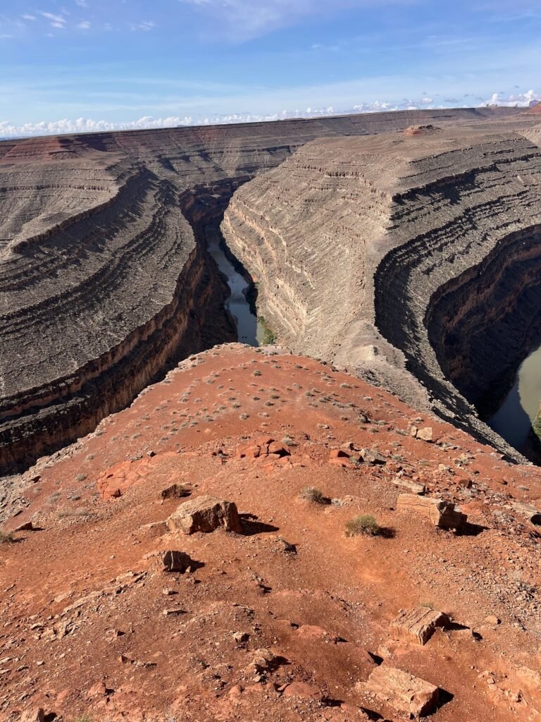
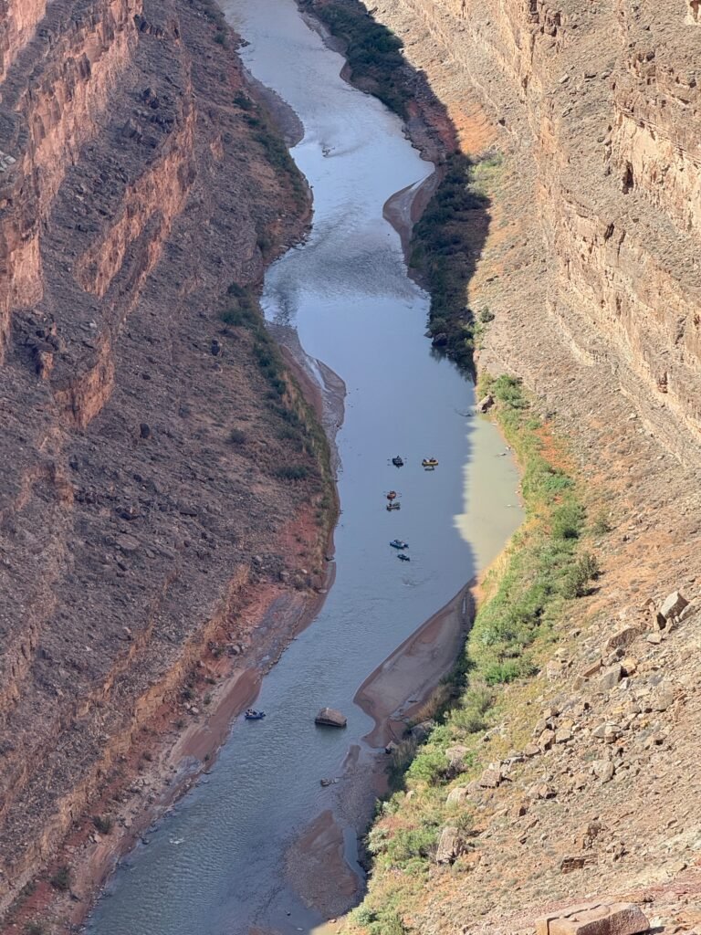
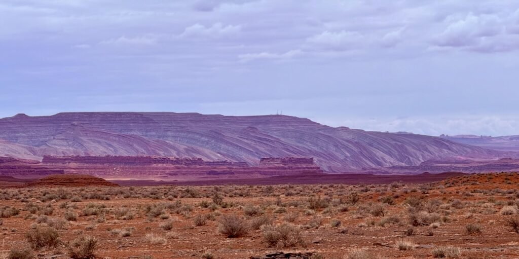
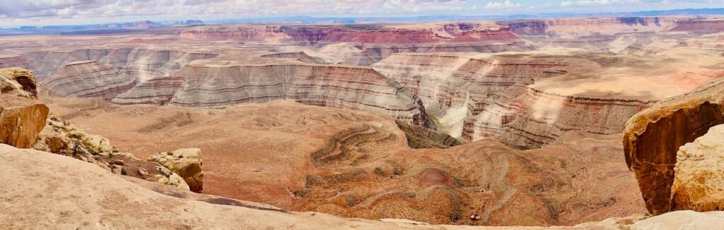
    For the past couple of days, we’ve explored the western edge of the monument. A trip to Goosenecks State Park revealed some stunning scenery and a wonderful place to dry camp under the stars. The Goosenecks are considered by geologists to be the best example of “entrenched meanders” in the world.

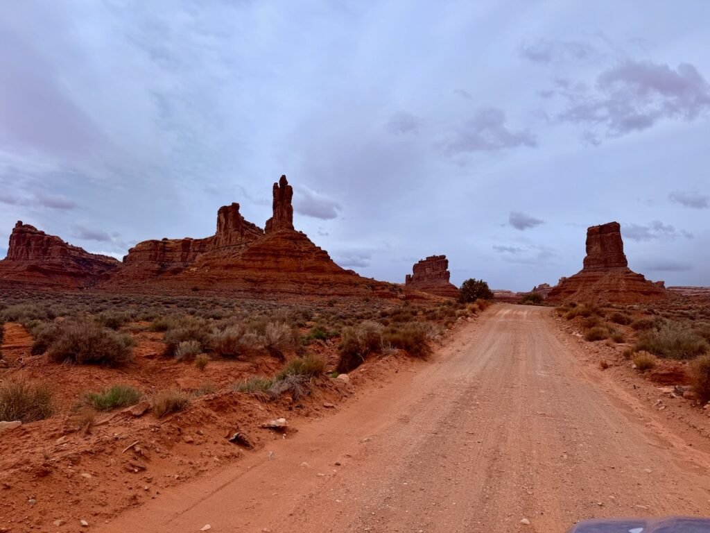
    We looped through Valley of the Gods on 17 miles of rough dirt/rock road. And we were amazed to see so many big camp rigs in there. Three Airstreams! I mean, I could, but why would I? I’d run out of rivets!

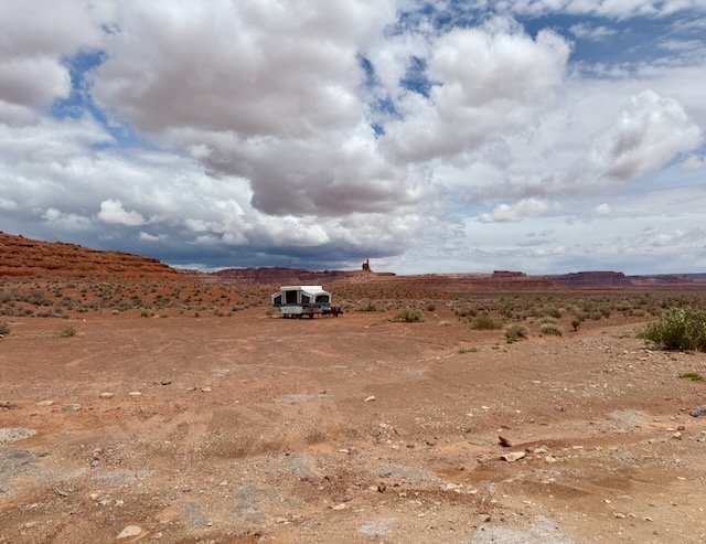
    And a shout out to Larry and Charlotte, this pop up had all the view and privacy you could ever dream of!

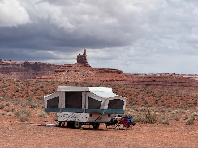
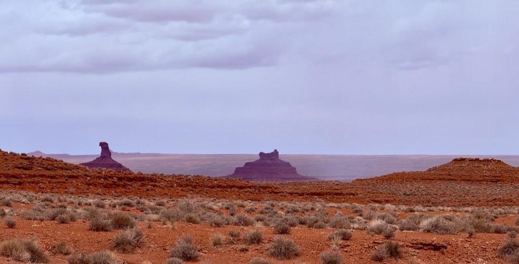
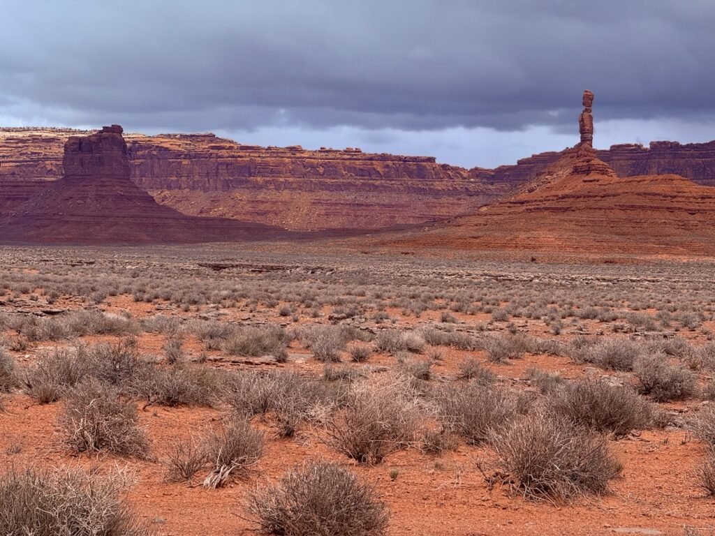
    Valley of the Gods is like a smaller version of Monument Valley…without the crowds. It’s a wonderful place and well worth the visit.

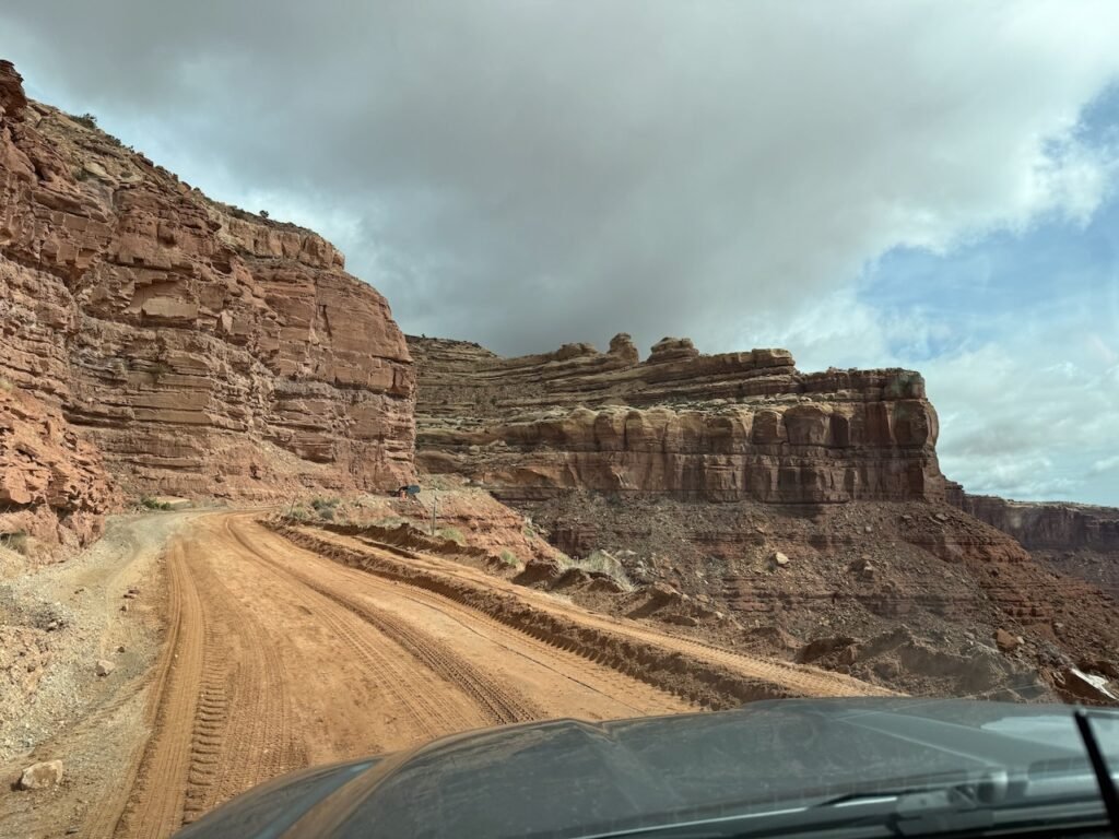
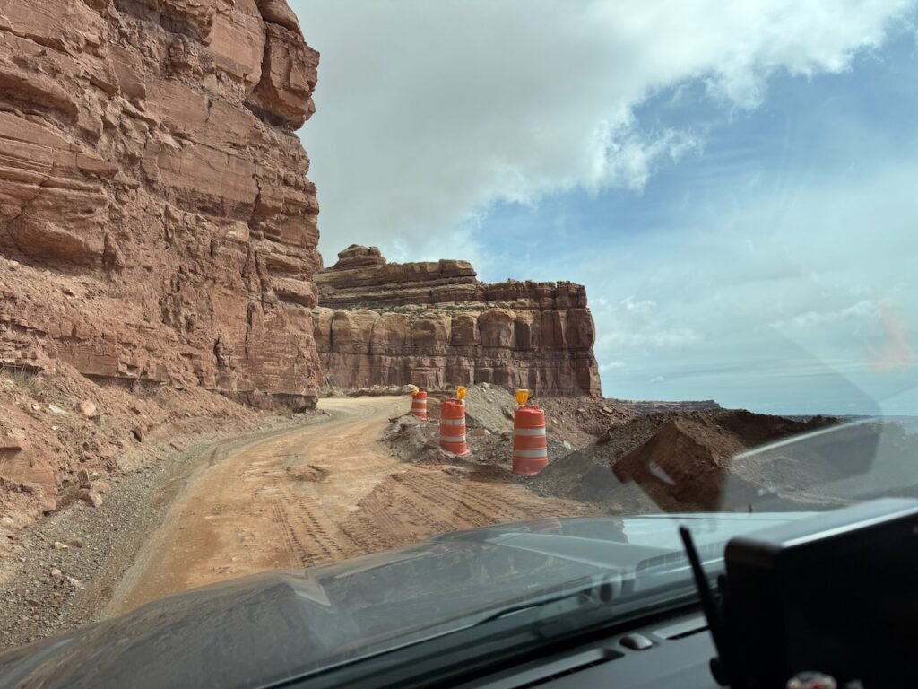
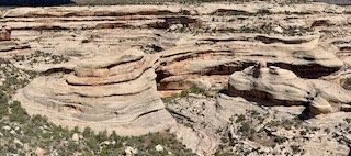
    On our way to Natural Bridges, all of Utah 261 is nicely paved except for the little section known as the Moki Dugway. In the 1950s, the Texas Zinc mining company constructed it to transport uranium ore from the Fry Canyon mines to a processing mill near Mexican Hat. “Moki” is Spanish and refers to something being dug into the rock. And the dugway is literally carved into the bluff, ascending 1200 feet to the top of Cedar Mesa.

    With the recent rains, there was a bit of repair in progress. I imagine this happens on a regular basis.

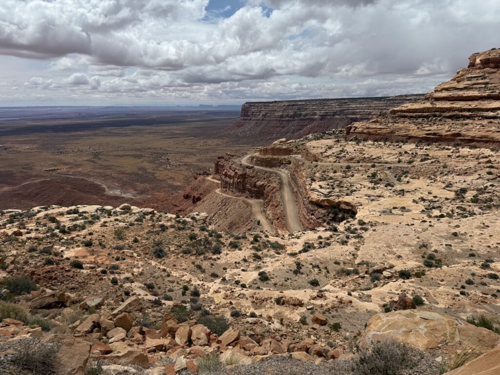
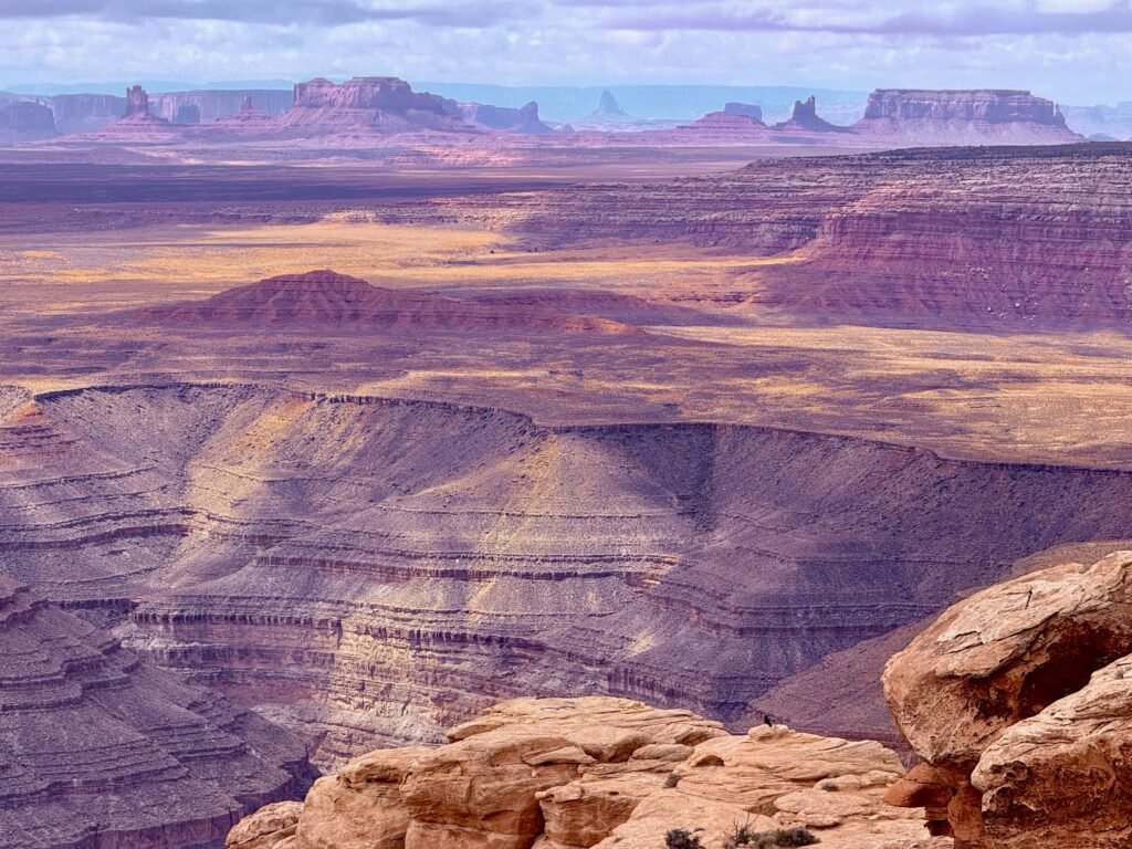
    We stopped at Muley Point and it was a surprise! I guess I didn’t realize the view was into the Glen Canyon area and that the canyons were going to be so deep. Another fine place to hang out or camp under the stars.

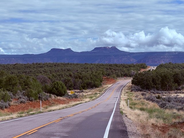
    We rolled on along the top of Cedar Mesa. It averages over 6,000 feet in elevation and has a lot of open range grazing. It’s a land of pinyon, juniper, cactus, cattle, and cowboys. Mind how you go…

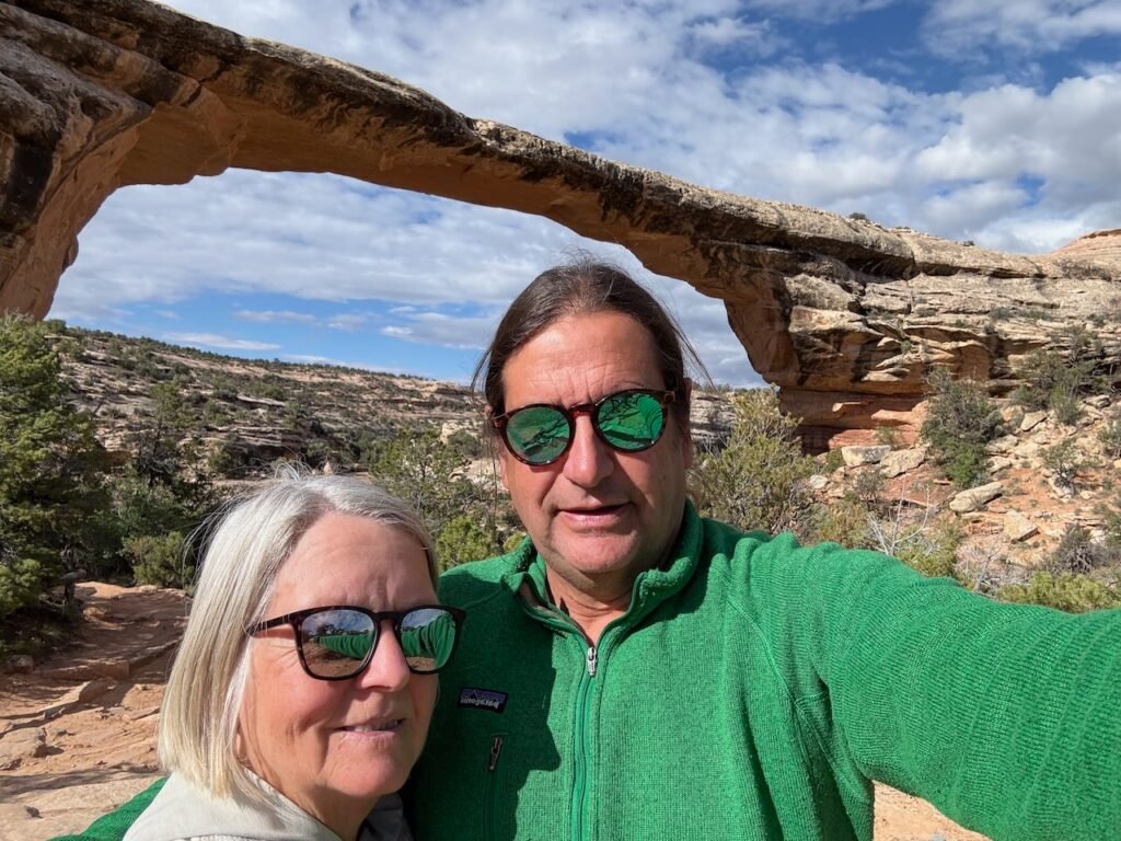
    Natural Bridges National Monument is a monument within a monument. For now it’s surrounded by the newer Bears Ears and was originally protected by President Theodore Roosevelt in 1908. There’s a first-class visitors center and a nice little campground if you have a rig with a combined length of 26 feet. Perfect for camper vans and tent camping setups but too short for us.

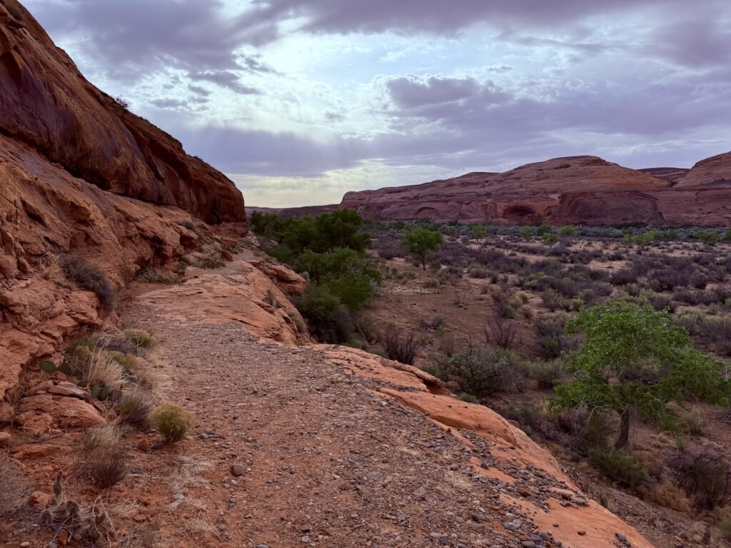
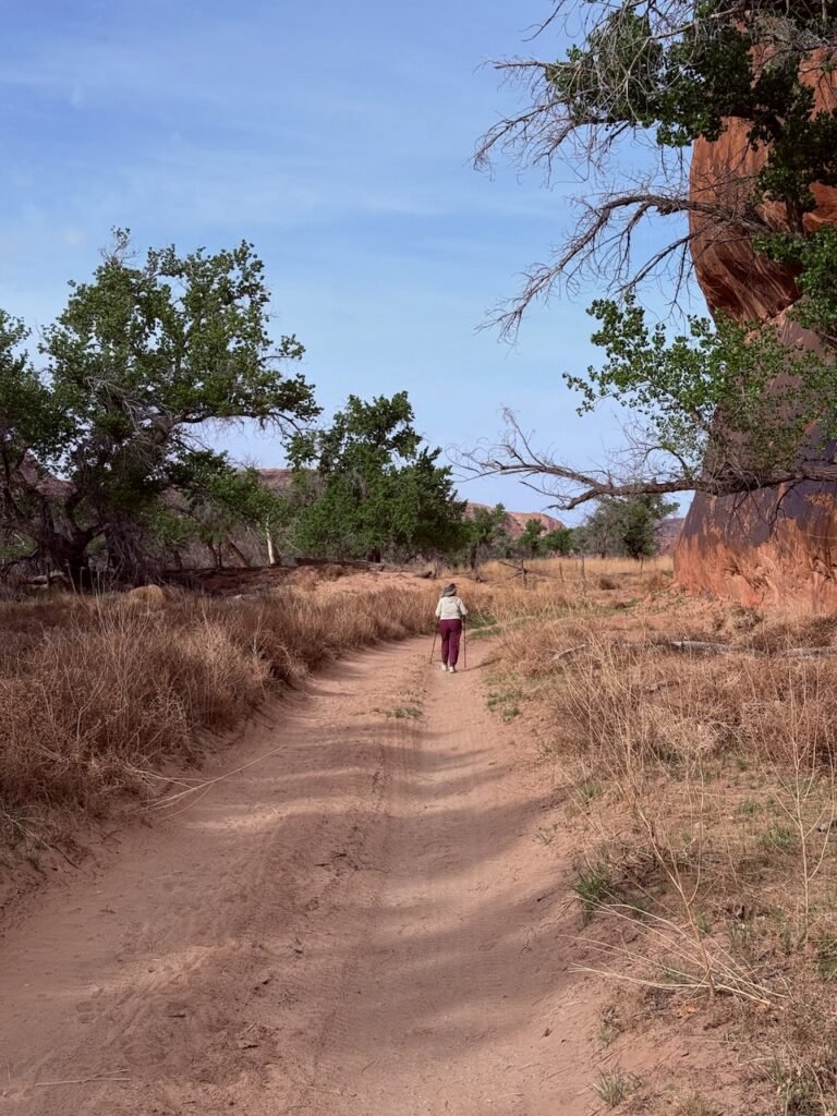
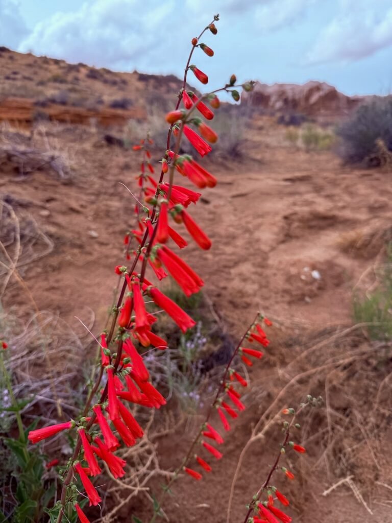
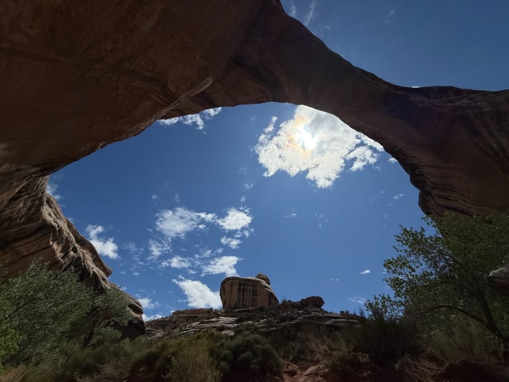
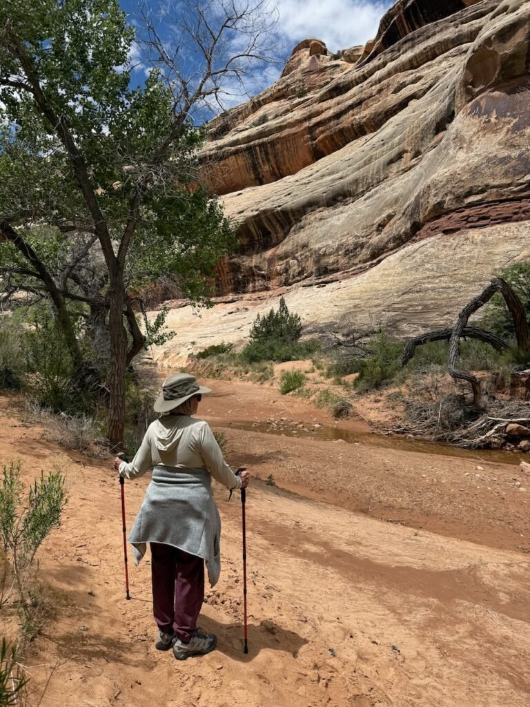
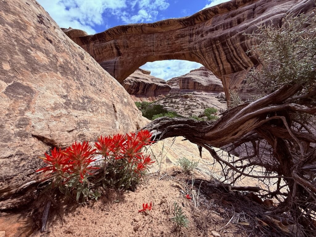
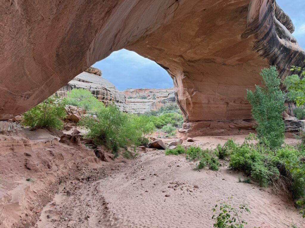
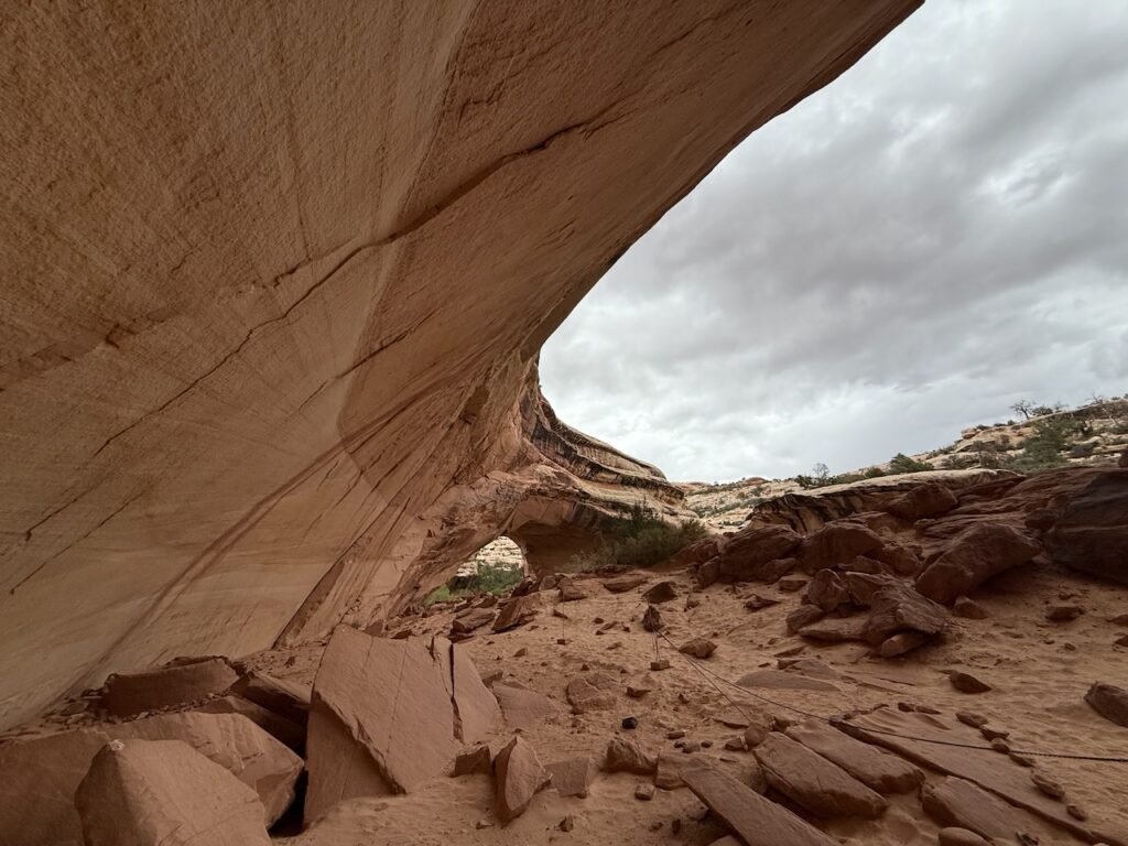
    The loop road provides access to three massive arches and a trail system. We chose a 6.5 mile loop starting at the Sipapu Bridge parking lot area. The trail dropped 500 feet down into White Canyon and wandered along the creek to Kachina Bridge. A beautiful hike, and the spring rains were bringing the flowers out.

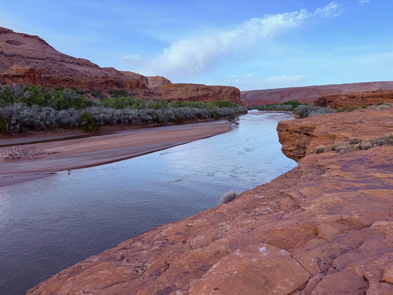
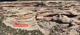
    The bridges are first formed as entrenched meanders like Goosenecks that I described earlier. The stream first cuts down into the petrified sand and becomes trapped in its own banks. Over time, big flows grind away the rock “middle” on both sides until it is breached. This becomes the new stream course and the original bow is abandoned. One day the San Juan may cut through the Goosenecks in just the same way and form an awesome bridge.

    To slide, touch or mouseclick/hold on circle.

    You can use the slider to see what I mean.

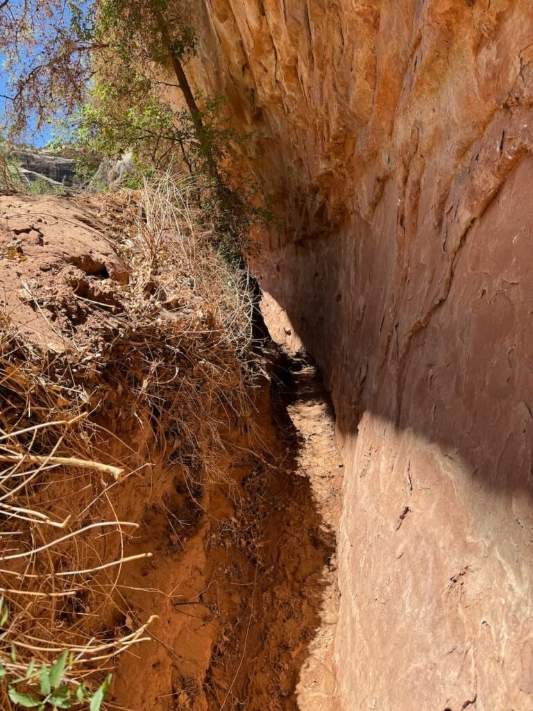
    The hike down White Canyon was so peaceful. Water was burbling in the creek bed from recent rains, and wildflowers were popping out everywhere. So much different than the exposed slickrock on top.

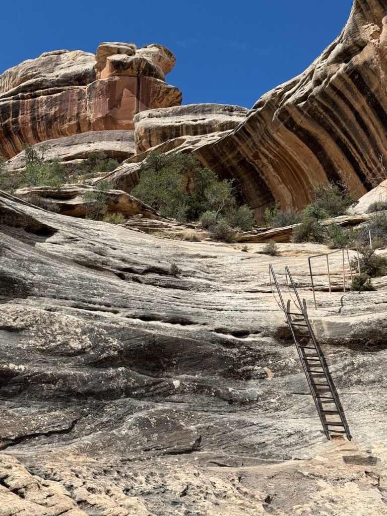
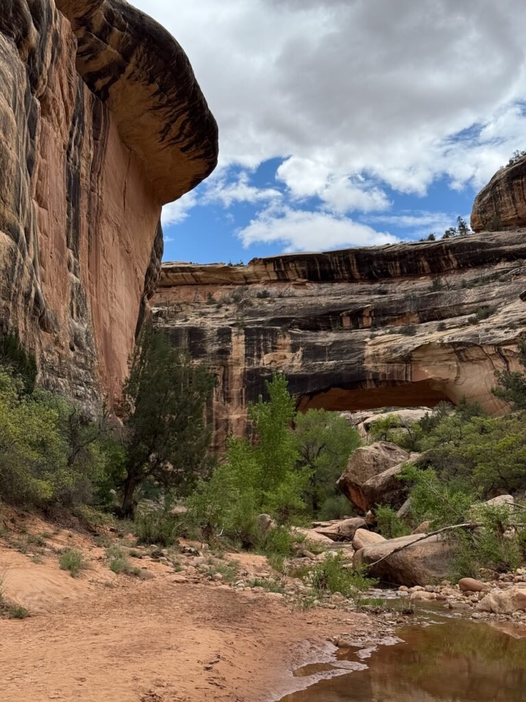
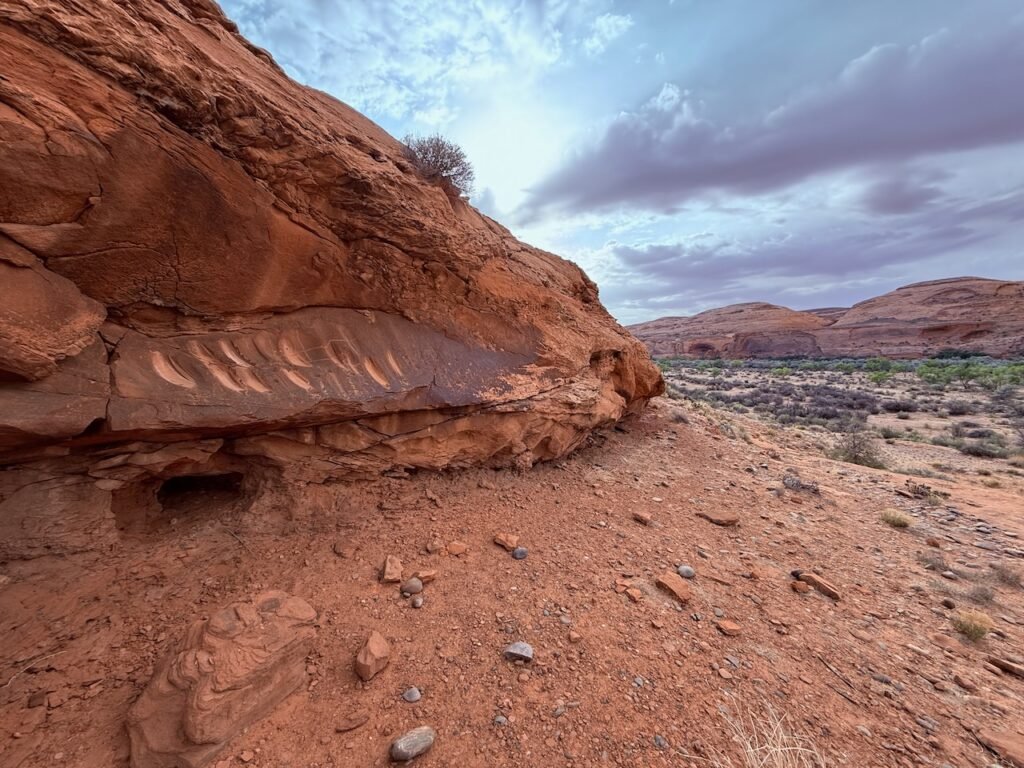
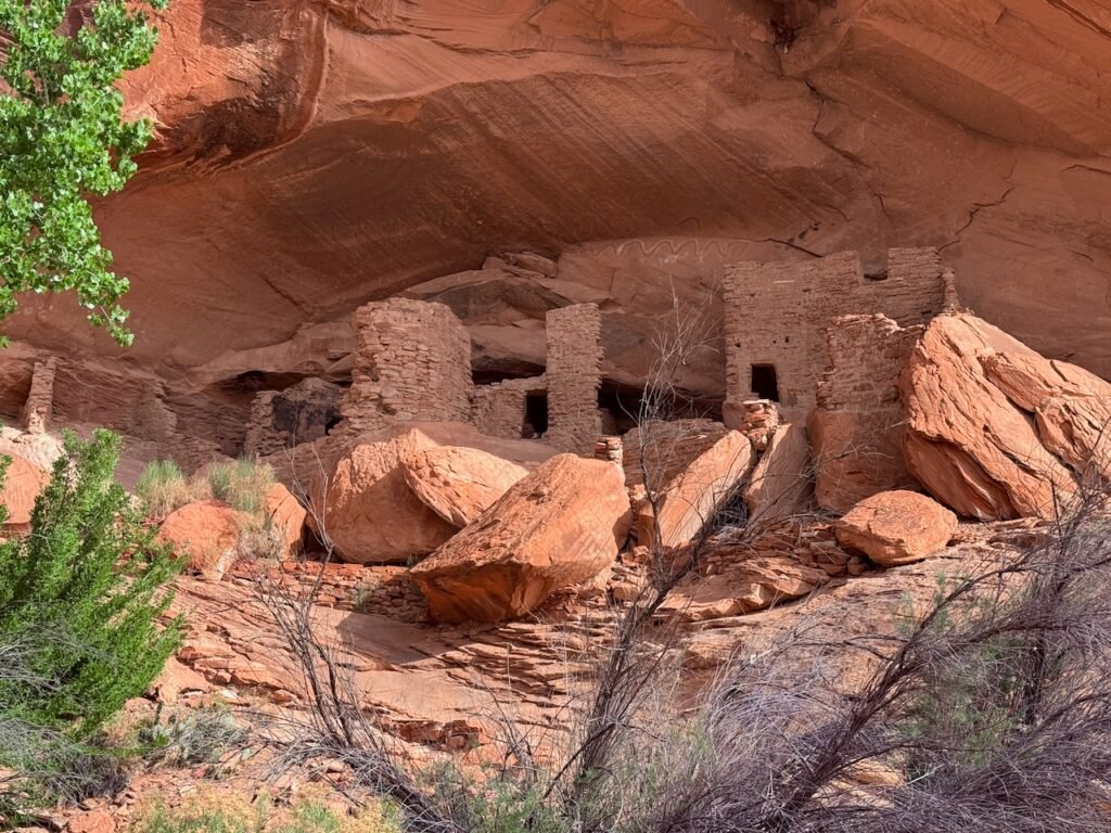
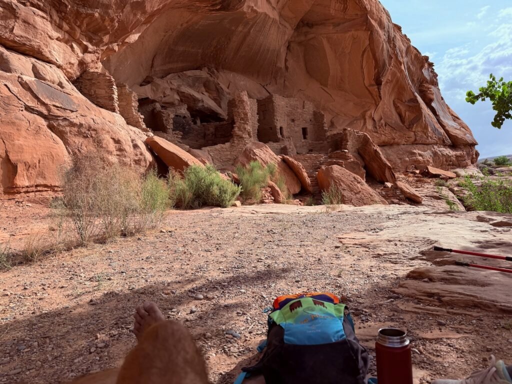
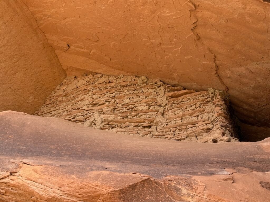
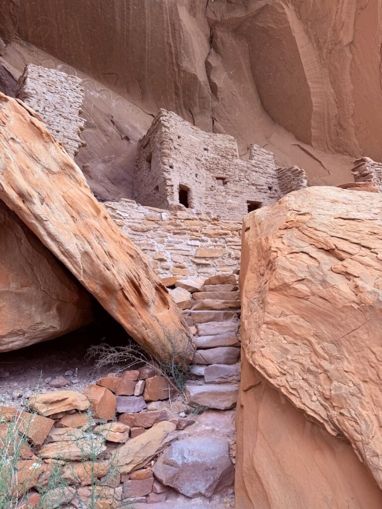
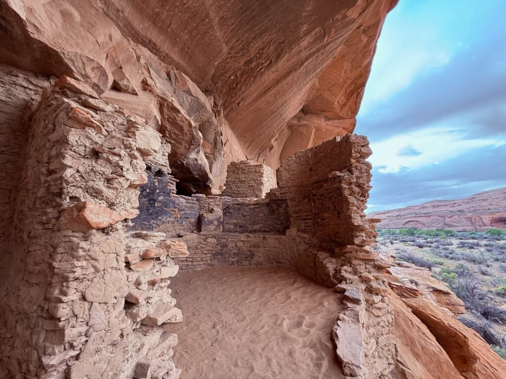
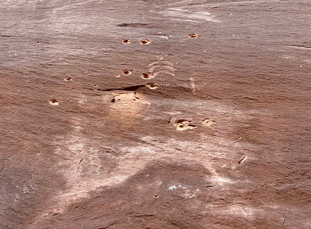
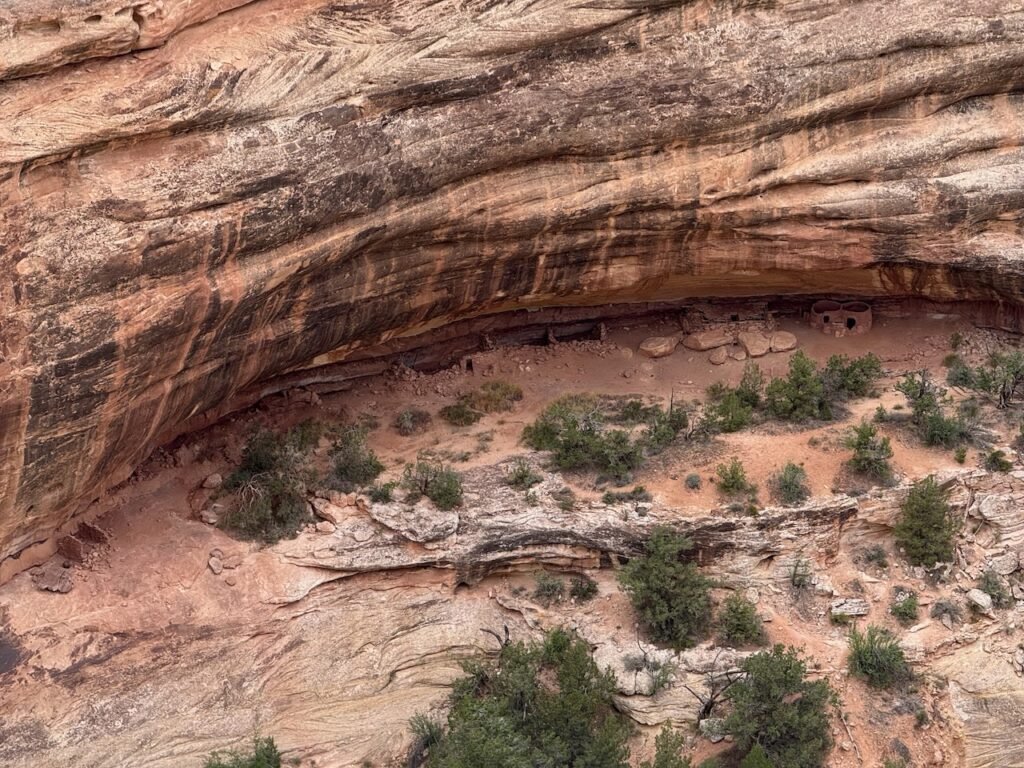
    We made Kachina Bridge and found the ruins, what a treat! And we rounded out the walk by hiking the loop back to the truck.

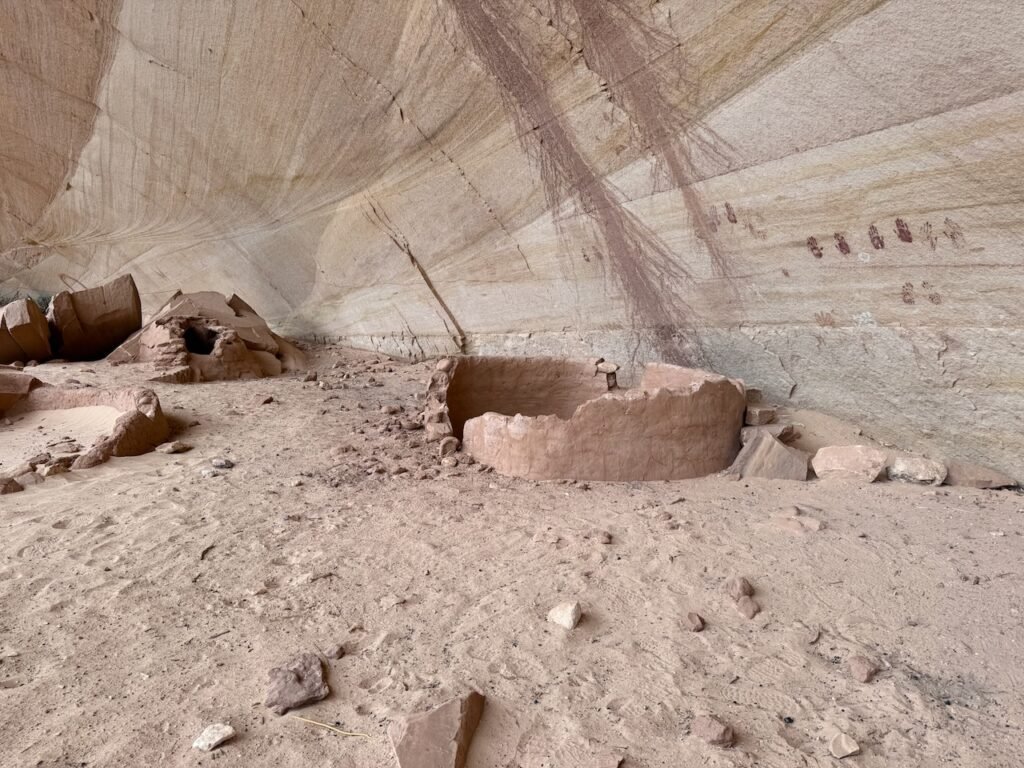
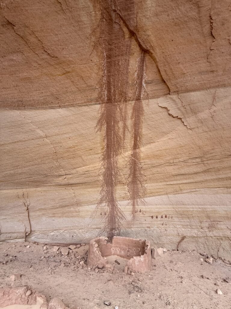
    Before we did our last, short hike to Owachomo Bridge we stopped at Horsecollar Ruin overlook. We had walked right under it in the canyon without seeing it! I love these places.

    A long day but a fine day.

    Owachomo Bridge.

    Tomorrow we start our first full work week. We plan to shift to some of the many shorter, afternoon hikes around Comb Ridge.

  • You’re not listening to me…

    You’re not listening to me…

    #4 in the series.

    On our job shadow day, the first couple in the door came in with a list of questions. Or I should say, the husband did. They had rented an AWD car and he was trying to find out which places he could reach. Kirsten did a great job of explaining in general terms the road conditions, but that these can change quickly and that he must use his own judgement. While he was peppering her with questions, his wife was quietly listening to every word. He changed subjects to rattlesnakes, and wanted to know the situation at a particular site. Kirsten explained that in twelve years she’s only seen one. And of course they are out there, but that has been her experience. A few more round-robin questions and he says, “So you don’t think snakes will be a problem then.” She politely answered, “You’re not listening to me. I said that I’ve only seen one in twelve years, but they are certainly out there. It’s the only information I have to give you.”

    Yeah, I’m thinkin’, another know-it-all. I hope not all the visitors are like this.

    River House

    Sunday morning, our goal was to see three things; San Juan Hill, River House ruins, and the Kachina panel. All of these are more typically seen during a river float down the San Juan. Permits are hard to get, so we chose to take a BLM access road four miles off the main highway. In my zeal that early morning, I neglected to pack any paper maps or guides. In fact, I left quite a few things behind. How many years have I been doing this? Ffej is always ready to go!

    Comb Wash Road is more wash than road. The route goes along the wash, in the wash, and across the wash several times for four miles. One needs to pay attention to deep sand, a few rocks, and false trails. Since the wash changes course over time, the route does too. It’s a pretty fun route and a 4WD with decent clearance is necessary, mainly for the sand.

    The Ranger handled it all quite well, and “Sand Mode” made a big difference. It’s amazing how the technology has improved over the years.

    The photo links to a 3 minute timewarp video of the drive in. You might get a chuckle out of some of the “decision points.”

    We reached a wide area where we could park. There is very little signage, and two routes before us had vertical, post-like signs that declared no vehicles were allowed. So we parked and decided to hike the 2 or so miles in.

    Our first stop was San Juan Hill. If you read the big sign located there, you will find that after a group of Mormon pilgrims blasted out Hole-in-the-Rock in order to drag their wagons across the Colorado River, eventually beating their way up San Juan Hill to eventually establish the town of Bluff.

    It was a horrendous trip and the horses were just brutalized being forced up the terrain. What were they thinking?

    It was a horrendous trip and the horses were just brutalized being forced up the terrain. What were they thinking?

    Next we came to the Rincone, is Spanish for “corner.” This was a popular river crossing and trading post in the 1800’s and some remnants remain.

    There we met a couple camping and they mentioned that we could take a trail along the bench above the river and avoid the sandy road route. They also mentioned that rain was in the forecast for around noon, a serious consideration for returning up four miles of wash! We had seen a similar forecast and had set a “turn around time” that should get us out by 11am.

    We found a pretty good dirt road upon the sandstone bench. It crossed a cattle guard and then on past another vertical signpost that said “NO VEHICLES.” A little confusing, at least to me.

    Patricia pointed to a faint trail by the signpost and mentioned that the couple had said to take a right on the trail once we got to the top. “That’s not a legit trail, and there aren’t any tracks,” I shot back. We moved on along the road. In the distance behind us, we heard a faint shout. Turning, one of the campers was waving. He had climbed to the top of the bench to make sure we had found the trail…right where Patricia said it was. The wind the night before had blown the tracks away on the first part of it.

    You are not listening to me” is ringing in my head. Yeah, another know-it-all. Me.

    I thanked the guy profusely and we followed the sandstone bench right to the River House. Whoa.

    It was amazing! And what an idyllic place to live! The house was in great shape and not much sign of vandalism or damage. Also along the path was a granary, with the walls tightly chinked up against the sandstone bluff to keep animals out.

    We decided to go for the Kachina rock art panel a couple of miles further. The route was loose sand and slow going. We got pretty close but we realized that by the time we arrived, we wouldn’t have any time to survey it if we were going to stick to our exit schedule.

    Looking up, the clouds were building. So we chose to head back to the River House and enjoy a little coffee and snacks while we contemplated the stonework and rock art.

    We made it out a little before 11am and the desert rain set in a little after noon. Sometimes you just gotta call it. But I think we’ll be back. It’s a beautiful place!

    On Monday, we woke to a cold and rainy morning. We did a little maintenance around camp and then met with our Visit With Respect director to review and discuss what being an ambassador entails. There was a lot of material covered, so we’ll share the details a little later.

    Between rainstorms, we took an afternoon hike up the canyon across the highway from us. Flowers were waking up and some were just brilliant, like this firecracker penstemon!

    We’re supporting a talk and music tomorrow evening, so the plan is to check out a couple of easy drives, Goosenecks State Park, Muley Point, and Valley of the Gods. Should be fun…

  • The BEEC and VWR

    The BEEC and VWR

    #3 in the series.

    Today was our first day at work! Yesterday we “shadowed” and learned the ropes for the Bears Ears Education Center (BEEC). But today our fearless leader Kirsten worked in the back office, always within reach for fielding questions that we couldn’t answer for visitors.

    We supported (and listened to) an excellent presentation by archaeologist Kenny Winch. He discussed the archaeological significance of the region around Four Corners and the need for “durable protection.” About 30 people attended the event.

    The BEEC sits on US191 near the middle of Bluff, UT. There’s a good bit of traffic from folks sight-seeing the nearby areas such as Monument Valley, Canyonlands, Arches, and other well-known places. But Bears Ears is not well-known, and the BEEC is in a good location to help out. It’s a fantastic facility with a nice selection of books and merchandise.

    There is an outdoor native plant garden and a couple of camping spots for volunteers like us. They don’t mind helping the wayward traveler and are always ready to provide a place to rest or water-up, as well as point out local restaurants and attractions.

    You can find out more here: https://bearsearspartnership.org/education-center

    Now, while many of the visitors stop by to find out where to explore, the primary goal of the BEEC is to explain how to explore. Bears Ears is public land, but it is also chock-full of ancestral structures and rockart that date back thousands of years! So helping visitors understand the significance of the many sacred sites and how to respect them properly is a major theme. Most of these concepts are straightforward and include things like staying off the structures, or not touching the rockart. Some are maybe not so obvious, such as keeping pets away from sensitive ruins (they dig and pee) or packing out your poo (the desert is too dry to break it down).

    Visitation is up, and as we have begun to visit some of the sites that are more easily accessed, we understand the need. Defaced rockart with names, initials or even bullet holes are easily seen.

    We should do better. Plainly out of respect, but also for future discoveries, and so that our children can experience these amazing things too. Education is the key.

    And this leads us to the other main part of our involvement as volunteers, becoming ambassadors for Visit With Respect (VWR), which I will come back to after a little more explanation.

    Bears Ears is the first time a coalition of federally recognized Tribes has asked the government for area protection. In July of 2015, leaders from the Hopi TribeNavajo NationUte Mountain Ute Tribe Pueblo of Zuni, and Ute Indian Tribe founded the Bears Ears Inter-Tribal Coalition, there are 30 tribes supporting the effort now. The tribes began developing a land management plan for 1.9 million acres that contains literally thousands of ancient sites and communities. President Obama formed the national monument in 2016 consisting of 1.3 million acres. The Trump administration reduced it to 300,000 acres in 2017, but President Biden restored it in 2021. Now the area is threatened again.

    What’s the big deal?

    The General Mining Act of 1872 was signed into law by President Ulysses S. Grant over 150 years ago in an effort to motivate people to move west and develop its resources. For a price ranging from $2.50 to $5.00 an acre, anyone over the age of 18 that locates valuable minerals on public lands can stake a claim.

    And I say can because this ancient law is still on the books in its original form! Any public land that is not being “used” for other purposes can be claimed if minerals are found. So an area much greater than the original 1.9 million acres between Capitol Reef on the west and Mesa Verde to the east is vulnerable.

    In 1990 a company based out of Canada used this law to buy land along Yellowstone National Park for gold mining. They estimated over $600 million worth of minerals could be extracted. It was a serious threat, with obvious environmental concerns, and the impact to the famous geysers being a prominent issue. In 1996, President Clinton worked out a settlement to buy the land back for nearly $63 million dollars. And in 2010, the deal was finally completed, protecting the area.

    So anyone can make a claim and get the land practically free, and then walk away when it doesn’t “pan out,” leaving taxpayers with the environmental mess and loss of resources and beauty.

    For the unprotected public lands to the east of Bears Ears, a potash company is already staking it out.

    Does this seem smart to you? To allow large corporations to take our public land for next-to-nothing in the hope they can make a go of it? Seems we should do this differently a century and a half later. The craving for resources will never end, and if we want anything at all left for our descendants, we need to change how we think and change the laws.

    The Visit With Respect approach doesn’t address the issues with the law, it tries to instill a sense of respect for you and me. In this way we can always enjoy these amazing places and continue to learn from the people that lived here long ago. But especially, respecting the indigenous tribes that live here today. You can find out more here:

    https://bearsearspartnership.org/visit-with-respect

    Hopefully this provides a good idea of what the Bears Ears Partnership is about. They are involved in much more, so I encourage you to check them out: https://bearsearspartnership.org.

    We will start our ambassador training tomorrow. One of the exciting prospects is the encouragement to go and visit many of the places within Bears Ears so that we can share effectively with visitors.

    And we are just getting started…

    Sand Island

    Sand Island is a popular access point on the San Juan River. A primitive campground and a relatively new river trail are there too, but it’s also home to possibly the oldest rockart in North America! Rockart appears in two general forms: Pictographs, where pigments and dyes color the rock like a painting; and Petroglyphs, where images are pecked or cut into the rock itself.

    Sand Island has two sections, or “panels” on either side of the boat ramp. It’s easy access and well worth a stop if you are driving through. The downriver panel is amazingly dense! There are so many figures on the wall. In the before/after slide that follows, I’ve used some filtering to try and expose that in just one little area. Super cool.

    To slide, touch or mouseclick/hold on circle.

    Because of all of the cultures that have lived in Bears Ears over time, archaeologists have their work cut out for them in determining the age in which artwork was created. Styles and the sophistication of the images are one way. Another is seeing which animals are being represented. For example, images of horses indicate images created after the Spaniards arrived. Yet another is the “patina.” The sandstone surface will stain over time from rain, sun and minerals. In more recent carvings (and bullet marks) the patina has not re-covered the stone. So the oldest carvings have become faint under the later patina and are harder to see.

    At the BEEC, I was intrigued with a display showing a bison and a…mammoth! It’s estimated to be more than 10,000 years old. That’s just crazy! Kirsten mentioned it was on the upriver section so we went looking. It took us a couple of times, but we finally located it. In the before/after slider to follow, I’ve identified characteristics that make it easier to see.

    To slide, touch or mouseclick/hold on circle.

    Can you see them? A mammoth and a bison.

    Just too cool.

    Tomorrow, we are going to try and find San Juan Hill and the River House. Hopefully the deep sand won’t be too much for the Ranger…

  • End Avalanche Zone

    End Avalanche Zone

    #2 in the series.

    Huh? That’s what the road sign said. I mean, where did it begin?! I need to know these things!

    But more on that later. We finished up the past post at Birch Lake, OK. Possibly the fastest cell coverage I’ve ever experienced in a campground! The Corps of Engineers (CoE) facility had recently renovated the bath houses and they were first rate. There were only a handful of campers and we had a nice lake view.

    The next day we aimed northwest toward Dodge City, KS. When we picked up our camper back in 2022, our first free camping spot was at Ford County Park nearby. So we thought we’d try it a second time.

    We rolled through Clearwater, KS and came up to the intersection with highway US400. A brown sign to the east proclaimed “Big Well” with “Meteorite” underneath. We had to check it out.

    As it turns out, the town of Greensburg was literally leveled by an EF5 tornado in 2007. Only three buildings remained standing. George W. even paid them a visit.

    During the rebuilding, the town turned this lemon into lemonade. An impressive downtown rose from the destruction.

    A museum was constructed to tell the story of the tornado, the history of the “largest hand-dug well in the world,” and to house a 1,000 pound meteorite found in 1949.

    I will leave you, Dear Reader, to do your research. Particularly about the impressive well and the Ogallala aquifer it finally reached.

    The Ford County park where we stayed the night was quiet. There are a couple of fishing lakes and it is popular with the locals. This was the last place where we knew ahead where we were going to stay. So now the question became, “where to next?” And how much longer to Bears Ears? Mulling it over, we decided for an early start and a long day to get within a day’s drive of Bears Ears, saving a day. So we booked a night at Blue Mesa reservoir near Gunnison, CO and crashed a little early.

    Leaving at 4:30am, we made good time on US50 all the way to…wait, what? Pueblo?! I was aiming for Walsenburg! I was a bit apprehensive about getting across Colorado, especially the mountains. I’ve not pulled Ooo Shiny over any of the big stuff and with the potential of snow, I was planning on swinging through Alamosa and Durango. But Apple Maps has this (very) annoying issue of not sticking to your route if it is not the “fastest” route. Any small deviation, like pulling off at a gas station or missing a turn, will cause Maps to reset to the fastest route. And apparently I didn’t catch it. Googling “RV Monarch Pass” found a few posts describing the new route as perfectly doable, but with a comment that the gas engines struggle with the altitude, and watch the brakes!

    The entire southwest Kansas and southeast Colorado is heavy industrial farming and feedlots. It’s not the most scenic and one reason we decided to stretch the day. US50 is a good road though, and we breezed on through Pueblo, Canon City, and on toward Salida.

    And here is where we add another almost visited to our list. Royal Gorge Bridge! America’s Bridge! Ziplines! Gondola Rides! The Sky Coaster! Indian Food! And only $30 a ticket per person to cross the bridge. Nah.

    And then….we dropped into Bighorn Canyon. Wow! This was a nice drive. Plenty of people fly fishing on the…Arkansas River! Here we were in the middle of Colorado near the headwaters of the Arkansas, when just a couple days before we were in Conway, AR and near where it reaches the mighty Mississippi. I had no idea the Arkansas was that long.

    The Bighorn Canyon area definitely deserves future investigation.

    Out of Poncha Springs we began climbing in earnest with a little snow in the air. The little Ranger had no trouble at all. The turbo-4 and 10-spd transmission are a great combination. And “Trailer Mode” does a great job of keeping the truck in lower gears on the descent, only light work on the brakes was needed for most of it.

    We passed several of the “avalanche zones” before making Monarch Pass at 11,312 feet. No snow on the road, but plenty piled up by the plows. It was noticeably harder to breathe and it instantly reminded me of another place we’ve been to recently. Cusco, the Navel of the World, sits at 11,000 feet in Peru. A city of nearly 500,000 and nearly a mile higher than Denver. But I digress…

    On the way down from the pass, Patricia spied a few bighorn sheep on the mountainside, what a treat! We made camp in the early afternoon and were all set to enjoy the blue sky and lake view.

    Some serious frost on Ooo Shiny this morning.

    But the sky grew dark and the wind began to howl. By morning it was 21 degrees and a heavy frost. Mountain weather.

    Rolling into Grand Junction, we stopped at Eagle Rim park for a couple of hours for stretch yoga and some brunch. The park was beautiful, with a cool skate park and a zipline all the way across the Colorado River. I think Grand Junction is yet another place to go on our list.

    Traffic on I-70 was light and we made good time to our new home for the month of May. It’s been a gorgeous day.

    Speaking of almosts. The West is full of ’em. It’s so big you have to put the blinders on sometimes just to get to your destination. We almost stopped at Black Canyon of the Gunnison, almost saw the Ute Council Tree in Delta, whizzed by Arches and Canyonlands, never stopped in Moab, and completely ignored the signs to Capitol Reef.

    Whew, and that’s just today.

    But we have finally arrived at our destination, the Bears Ears Education Center (BEEC), pulling-in in fine fashion. A little decompression hike down along the San Juan river is just what we needed.

    Tomorrow we start our orientation and training here at the education center. I hope we pass…

  • We Start West (again!)

    We Start West (again!)

    #1 in the series.

    We’ve started working our way west and plan to arrive at the Bears Ears Education Center in Utah on the first of May, about 1,800 miles away. We typically try to avoid interstates, especially I-40, and like to wander the backroads as much as we can. For this first leg, we chose to swing by Paris (Tennessee, not France!) to see my sister and then to Conway, Arkansas to drop by Patricia’s cousin. Stretching beyond that, we made a reservation at Birch Cove recreation area on Birch Lake north of Tulsa, Oklahoma.

    Arriving at Pat’s, we were surprised to learn my niece Sheri and her husband Brian were coming in too. We considered going to the World’s Biggest Fish Fry (Saturday’s attendance was almost 100,000 people!), opting instead for a home-cooked meal and time to visit.

    We watched a spectacular sunset between twin thunderheads in the distance. Those anvil clouds were over Sikeston, MO, a hundred miles to the west!

    Quite a pleasant evening, and tall tales were exchanged until Brian and I began discussing geosynchronous satellites, how they stay “up,” and their ability to remain in space fixed relative to the ground. As we delved deeper, everyone’s eyes started to glaze over and it was time for bed.

    The trip to Charlotte and Larry’s was also pretty nice. We crossed the Mississippi at Dyersburg, cutting the corner of Missouri before entering the northeast corner of Arkansas. The area was still cleaning up from a tornado a couple of weeks back. Arriving in Conway, Larry directed us to their back yard, quite the pleasant and shady camp spot. We took a couple of hours for a little historical trip to Cadron and watched the barges move down the Arkansas river.

    There were about 700-800 Cherokee that moved through here during the Trail of Tears forced removal. Sequoyah, also known as George Guess, had relocated near here from Tennessee before being forced to move again to Oklahoma.

    More tall tales were told during that evening and we learned that we were missing the start of Conway’s Toad Suck Daze, an annual gathering of nearly 200,000 people!

    Heading to Birch Cove, we spent the middle of the day at the Cherokee Nation’s capital city Tahlequah. We had visited here for the day last fall and toured their fantastic (and free!) museums. So we thought it would be nice to hang out for a few hours and explore the downtown and the city park. Low and behold, we just missed the Red Fern Festival, attended by over 30,000!

    And in the Vintage Market, I found a thing I didn’t expect.

    Priced at $40, it was worth every penny.

    It feels to me like it may even capture the meaning of life.

    All the things, in the one thing.

    The one disadvantage of the “avoid tolls” and “avoid highways” switches on Apple Maps is that some of the roads were pretty rough. But we saw a lot of nice countryside and arrived to a nearly deserted campground on Birch Lake. A fine view and a nice evening to rest up.

    So, we were successful in:

    • Almost having fish and hushpuppies at the World’s Biggest Fish Fry in Paris, TN.
    • Almost visiting Toad Suck Daze near Conway, AR.
    • Nearly enjoying the Red Fern Festival in Tahlequah, OK!

    Stats to date: 820 miles covered, 12mpg, 3 nights toward the goal.

    To this point in the journey it all still feels like middle Tennessee countryside. Tomorrow we set the controls for Dodge City, we should begin to see a big change…