#8 of the series.
“Clear and copious!” bellowed the colonel to his troops. Well, they weren’t actually his troops. But he was accompanying his son on Boy Scout Troop 142’s assault of Standing Indian Mountain in North Carolina.
My good friend Bob, also accompanying his son Jon, had invited me and Cinder the Wonder Dog along for the multi-day trip. Cinder was always about the outdoors and to leave her behind would be heartbreaking, so I made sure I cleared it with Scout Master Ralph first.
This section of the Appalachian Trail is unique in that it circumnavigates the headwaters of the Nantahala River, the high ridge creating a nearly complete wagon wheel around the watershed with Standing Indian campground at the hub. About 35 miles in length, it provides several opportunities to loop out of the hub up one of the ‘spokes’ and come back to the vehicle.
Our trip had started at Deep Gap and we were a couple of miles in, climbing our way to the Standing Indian peak. It was summertime, and the temperature and the humidity were pretty much the same value, 90.
The colonel had taken the Boy Scout motto to heart, resulting in a crushingly heavy backpack. By the end of the second mile (it’s called “Deep Gap” for a reason), he was red-faced, sweating bullets, and having some knee trouble. A decision was made and the adults divvied up a few of his items to lighten the load. This must have been a humbling experience for an Air Force colonel, but he was a pretty good joe and he took it well.
Humility is the virtue of the world. And possibly its salvation.
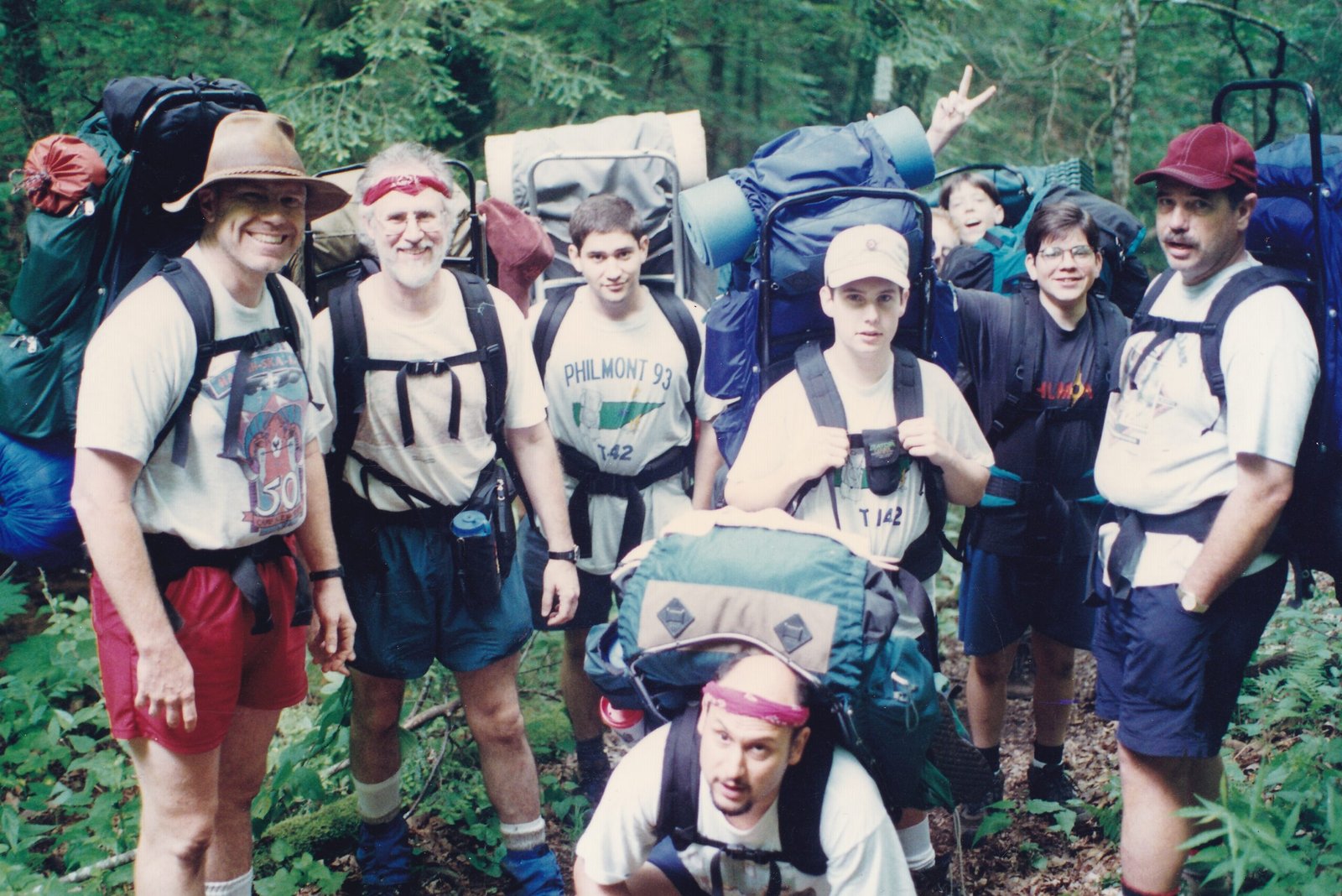
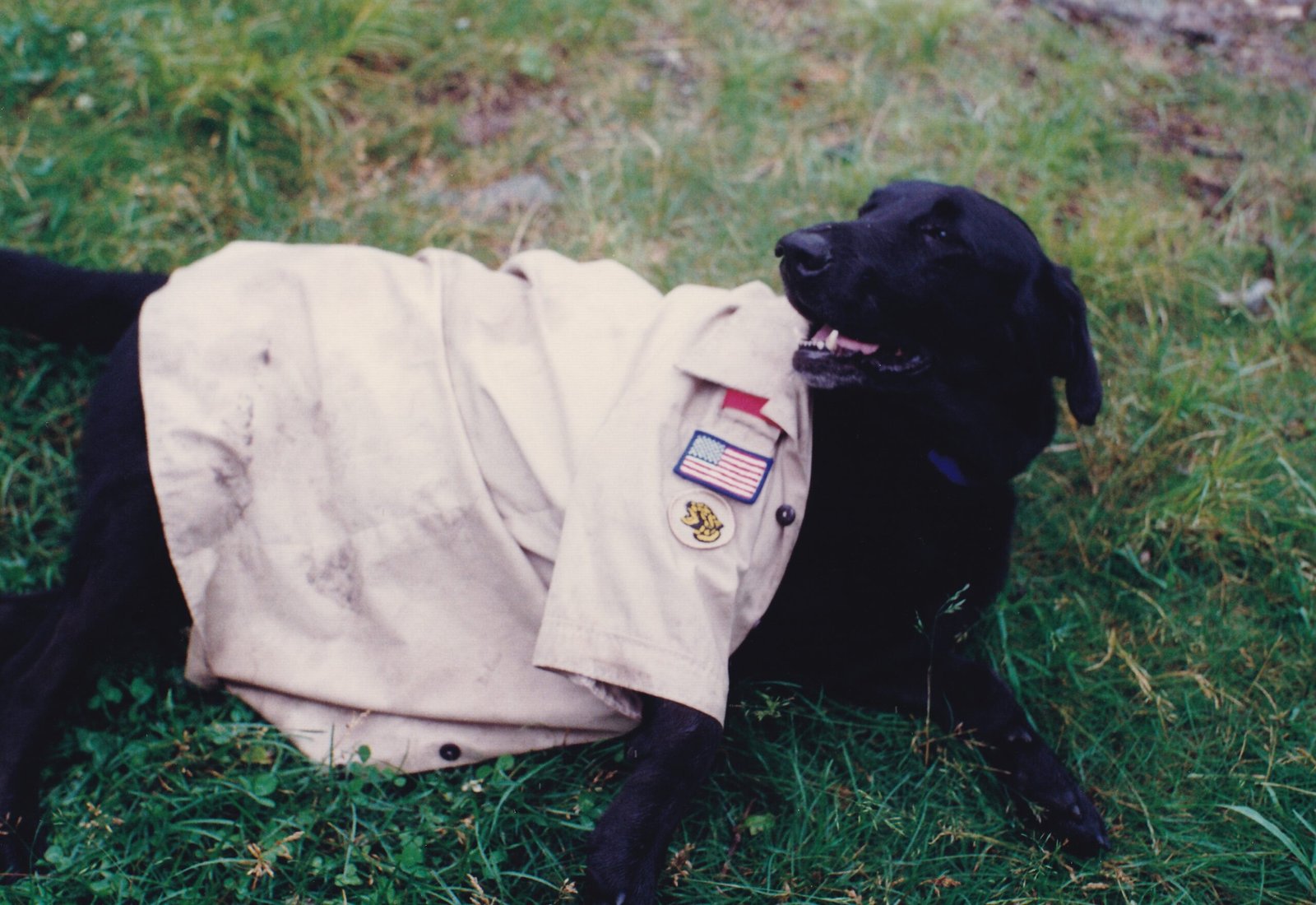
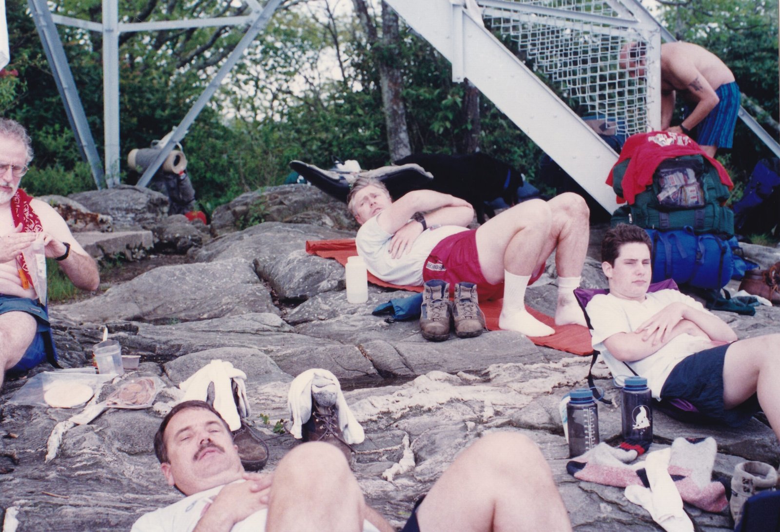
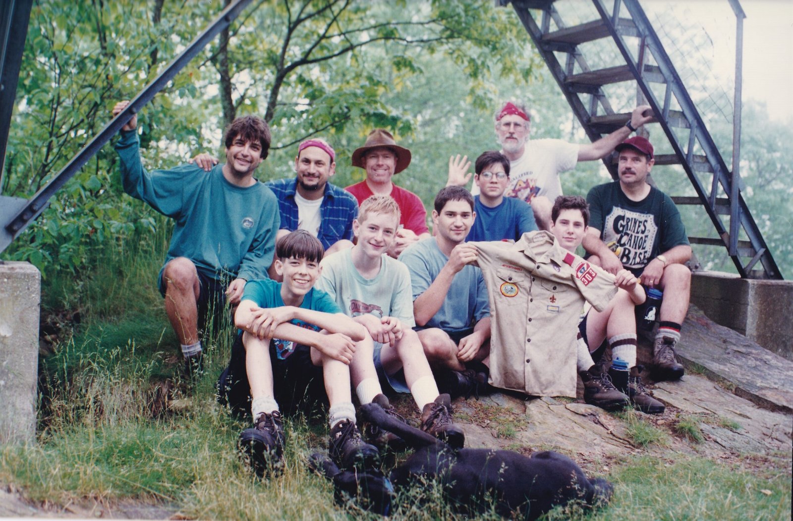
The trip was both difficult and awesome, Albert Mountain never disappoints. Jon and the other boys found a rival scout troop member’s shirt on the trail and had much fun taking pictures of it in various places along the way. Cinder was even honored with a cameo role. During a raging thunderstorm one night, Bob beckoned Cinder out of the vestibule and into his tent where she lay meekly between us, shaking us both throughout the storm. She really hated thunderstorms.
This flashback occurred because we were now in the Escalante – Grand Staircase National Monument. We had extended our stay in Utah a few days so that I could support the BEP with a couple of AstroFest Dark Sky events that both Canyonlands National Park and Natural Bridges National Monument had invited them to attend. While I will discuss this more in my next post, the extension was filling up our personal schedule, but I felt I could really help them with their telescopes, and it looked like so much fun!
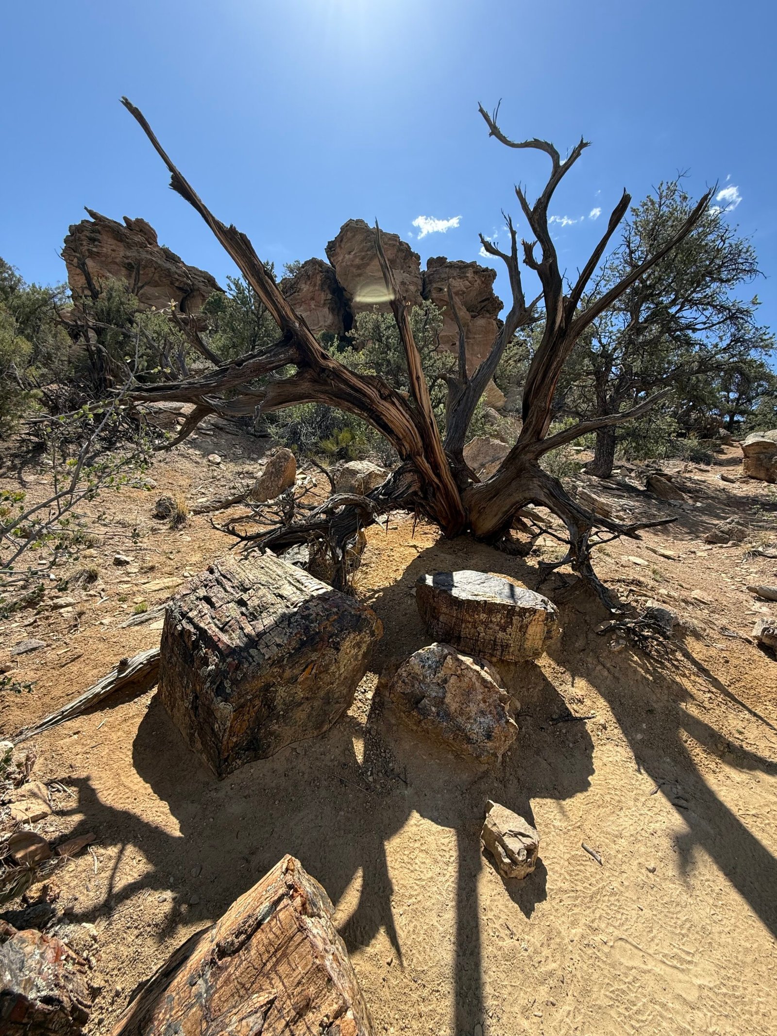
Escalante was named at the suggestion of John Wesley Powell to honor Silvestre Velez de Escalante, a Franciscan missionary. The name means “ladder” in Spanish and is fitting for the area, as the Escalante-Grand Staircase National Monument, comprising nearly 2 million acres, steps its way down to the Grand Canyon. With place names in the area including Death Hollow, The Box, Devil’s Garden, Burning Hills, Death Ridge, Carcass Canyon, Scorpion Canyon, and Spooky Gulch, maybe one should pay attention here.
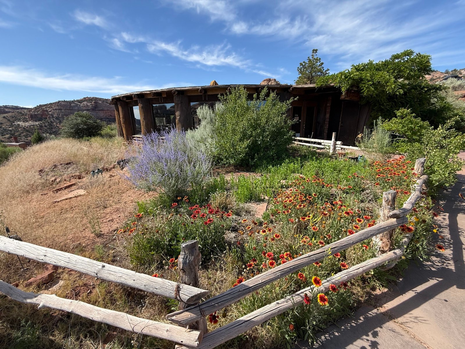
Brandon has spent a couple of decades roaming around Escalante-Grand Staircase and suggested we spend a few days here. About five hours to the west of Bluff, the elevation is higher and there is actually flowing water in many of the canyons, so it’s a popular backpacking destination. So we booked three nights at Escalante Petrified Forest State Park and set out to do some of his recommendations.
“I don’t like this road,” Patricia said quietly.
“I can tell by the way you are wadded up in a ball and hanging onto both grab handles. You know that won’t make much difference if I run off the road, right?”
“Well, it makes me feel better.”
“I could look in the back for a blankey.”
“If I had a blankey, I would get it!”
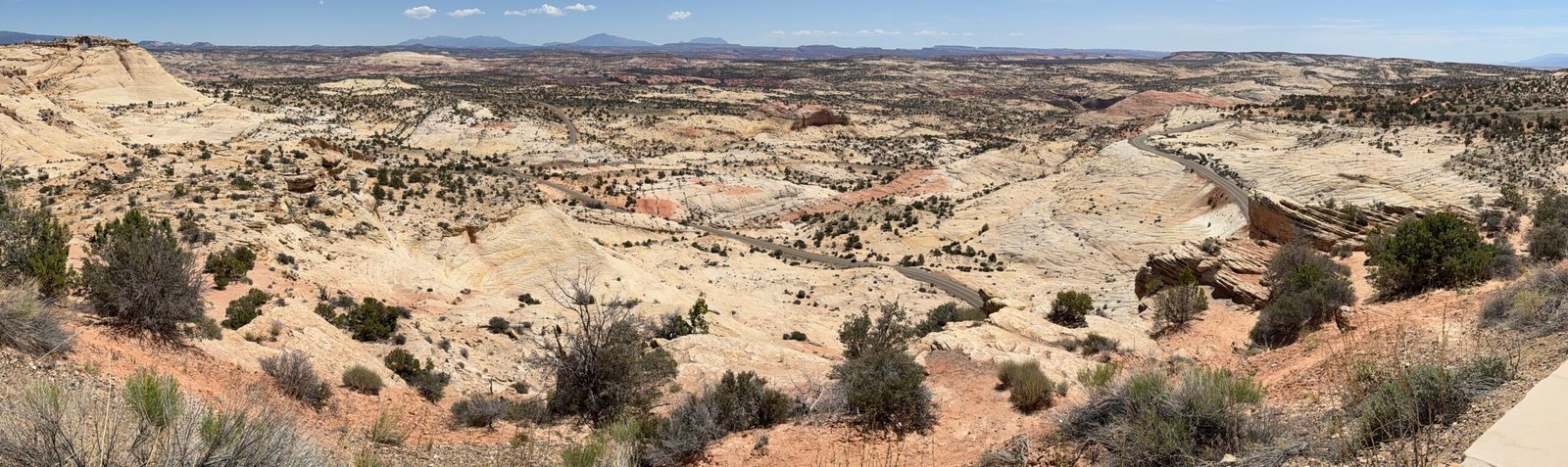
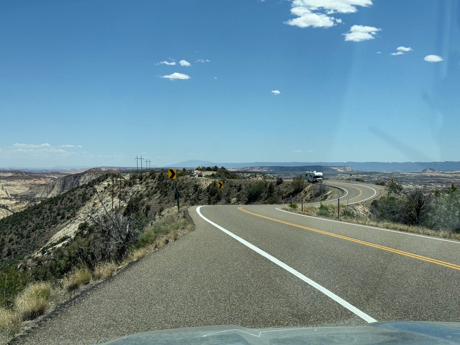
And such was our first trip down Hogback Ridge on Utah’s highway 12, an incredibly scenic road that climbs to over 9,000 feet and skirts the eastern edge of Boulder Mountain. We had traveled down Fry Canyon and traversed Capitol Reef National Park, amazed at the changes in the landscape. But when you hit the Navajo Sandstone of the Southwest (an estimated 230,000 square miles of exposed solid rock) it just gets pretty crazy.

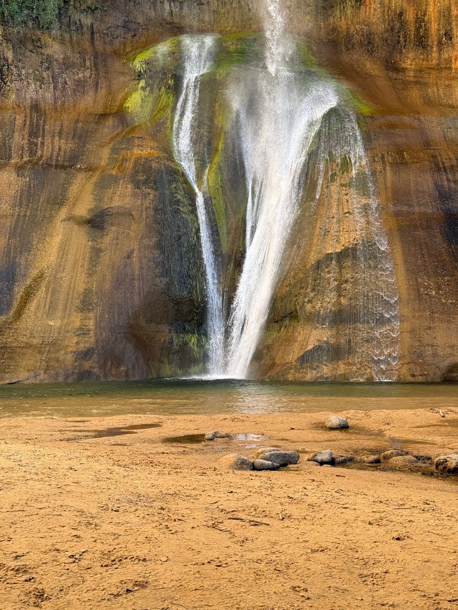
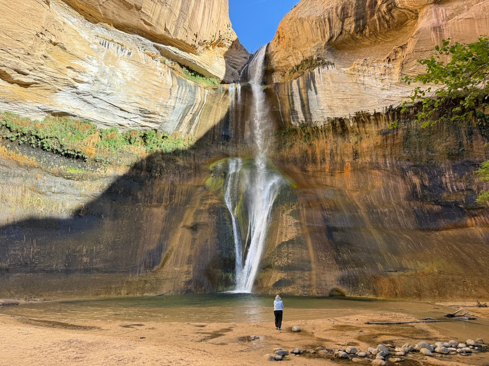
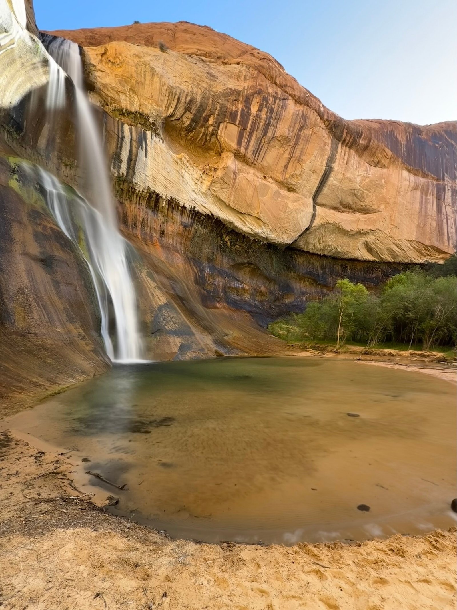
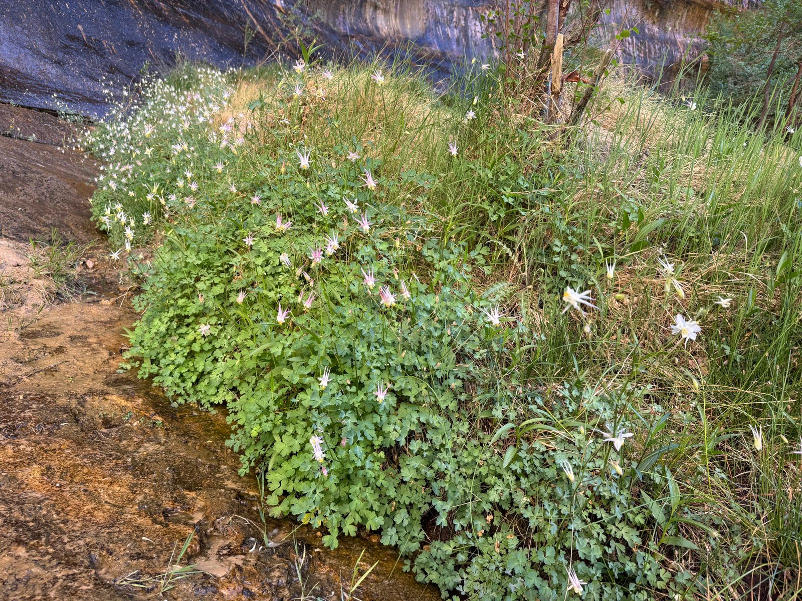
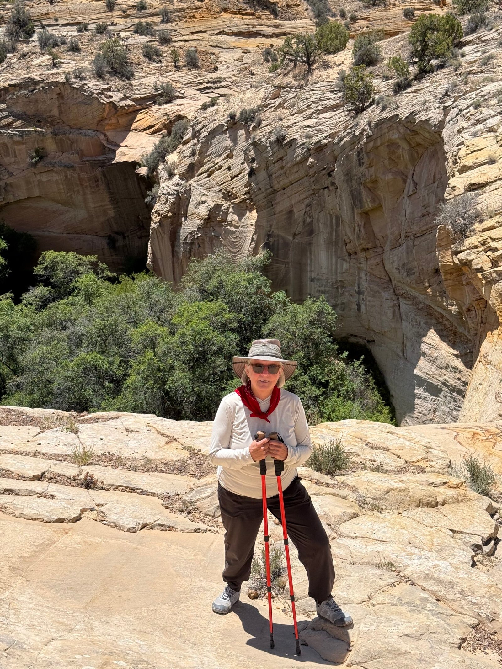
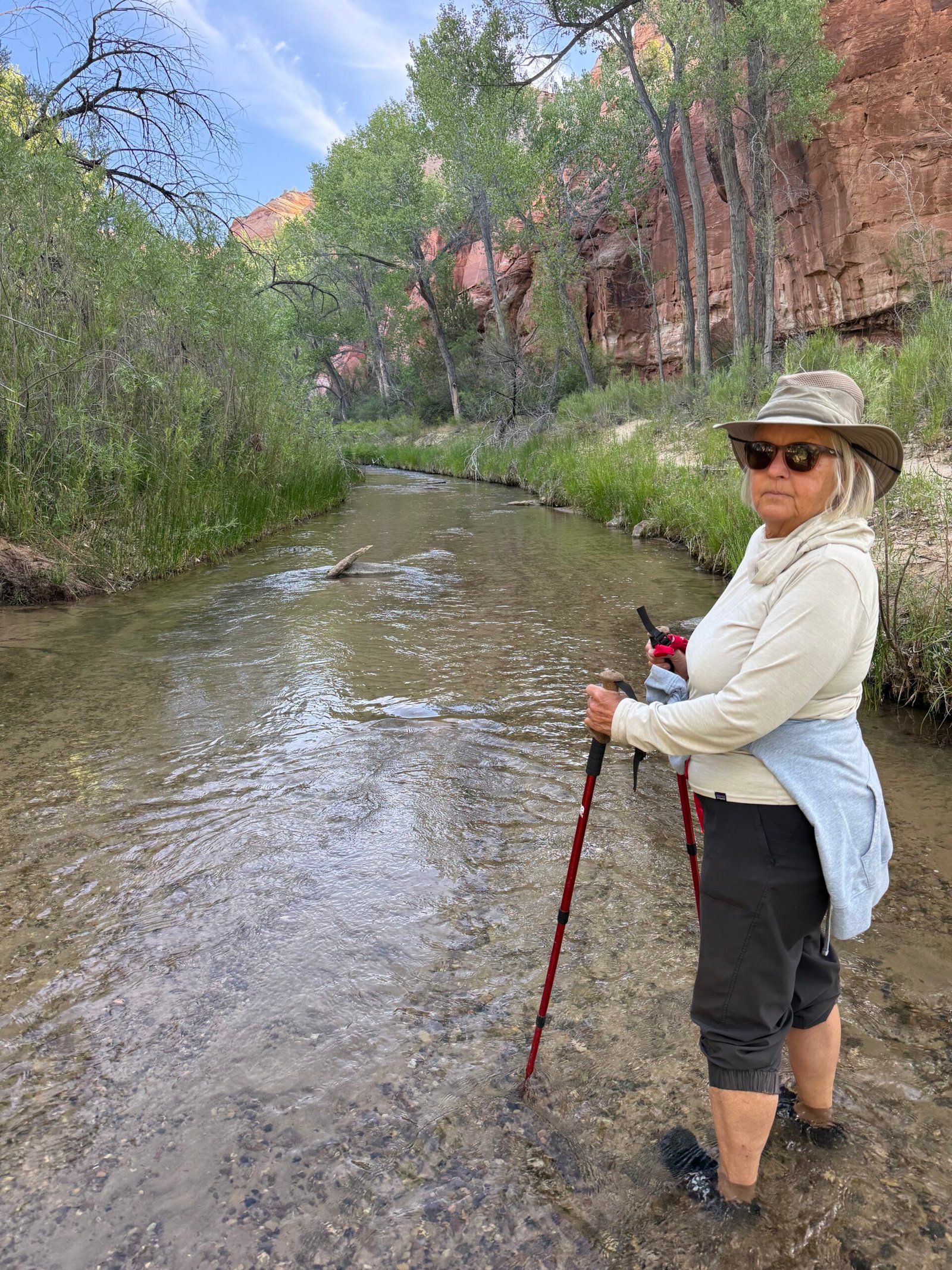
Our first hike was to Lower Calf Creek Falls, a popular 6-miler up the canyon from the Escalante River. Brandon had warned us to get there early because of the crowds, and we had the parking lot to ourselves at 7:30am. It was a beautiful canyon, with the creek carving out the sandstone and creating, with the help of a few industrious beavers, quite an oasis of birds, deer, and fish, including trout.
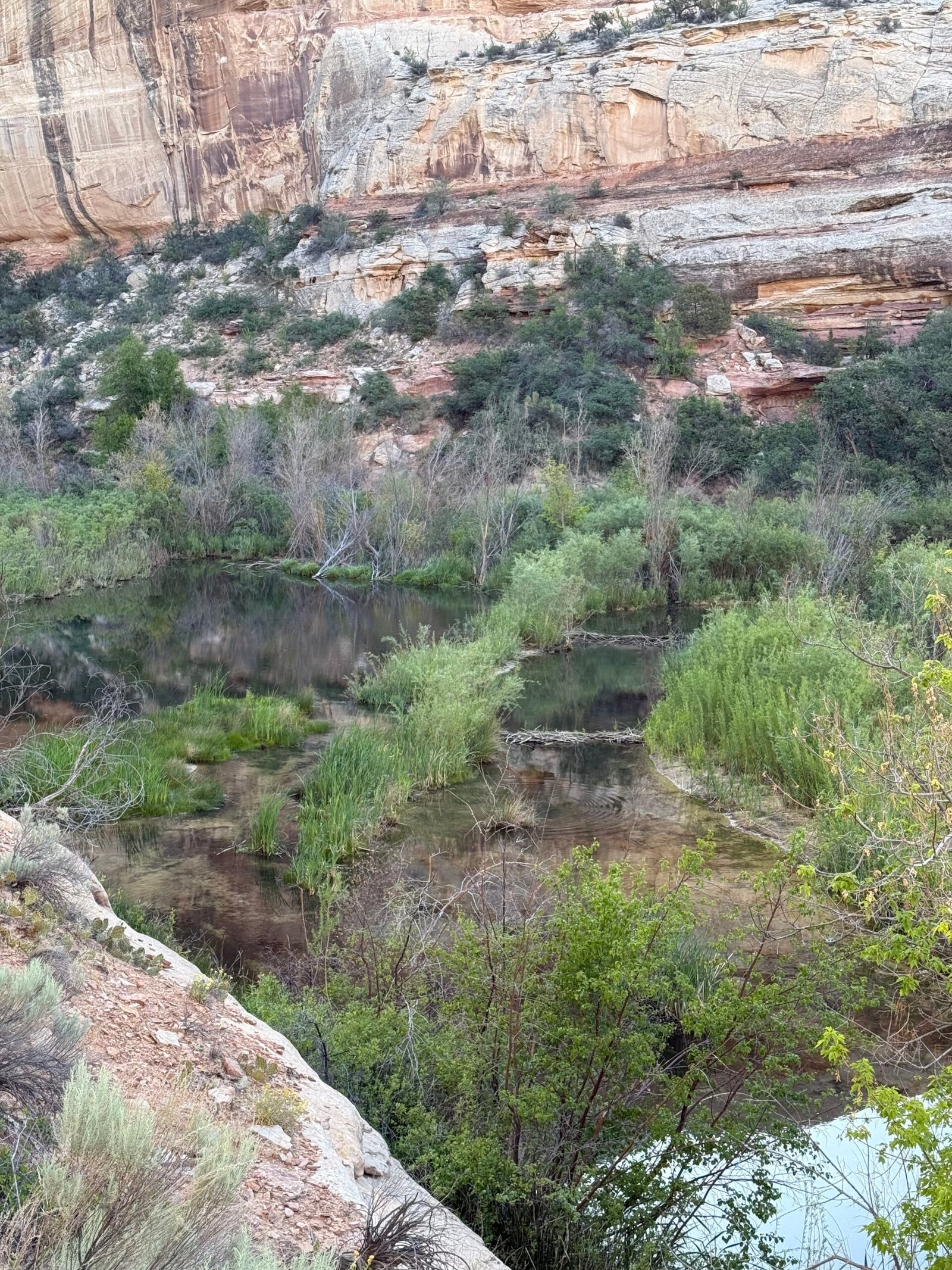
I’ve heard it said that if you have great soil, you can probably thank a beaver. And I believe this to be true. Generations and generations of beavers altering the landscape. Even while millions were hunted and trapped almost to extinction for European hats, we have been blessed with the alluvial soils they’ve left behind while we yet curse the problems they cause us with their comeback.
Along the way we realized that the sheer rock face on the far side was actually Hogback Ridge, and you could catch glimpses of the road markers along the spine (there are no guard rails as they are a distraction to the effect, and Patricia had the full experience on the passenger side the previous day).
The sandstone is playful, forming all sorts of shapes. In The Secret Knowledge of Water, Craig Childs talks about how for decades geologists considered temperature change, wind, and freeze/thaw cycles to be the primary erosion mechanism in these desert places. But they’ve come around to realizing that it’s the flash flooding that really does the carving. When you add silt and grit to the power of rushing water, serious things happen…fast. In fact, he mentions that the indigenous that lived and live here, are not so worried about drought, they’re worried about flash floods that sweep whole communities away!
“Wow, that’s a Holy rock!” Patricia says.
“What makes it Holy?” I ask, intrigued at the concept.
“Well, it has holes in it.”
Ah, a holey rock. I think sometimes (most of the time) I try to read too much into things…
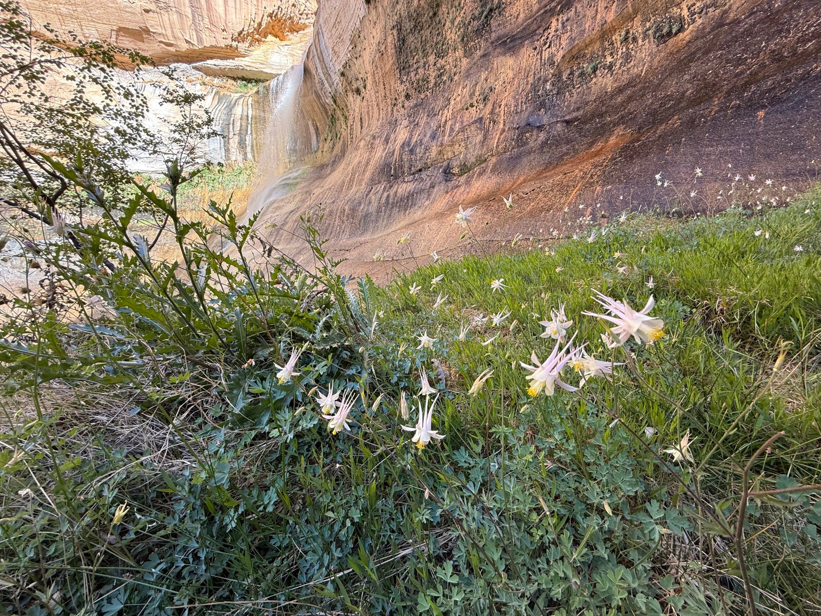
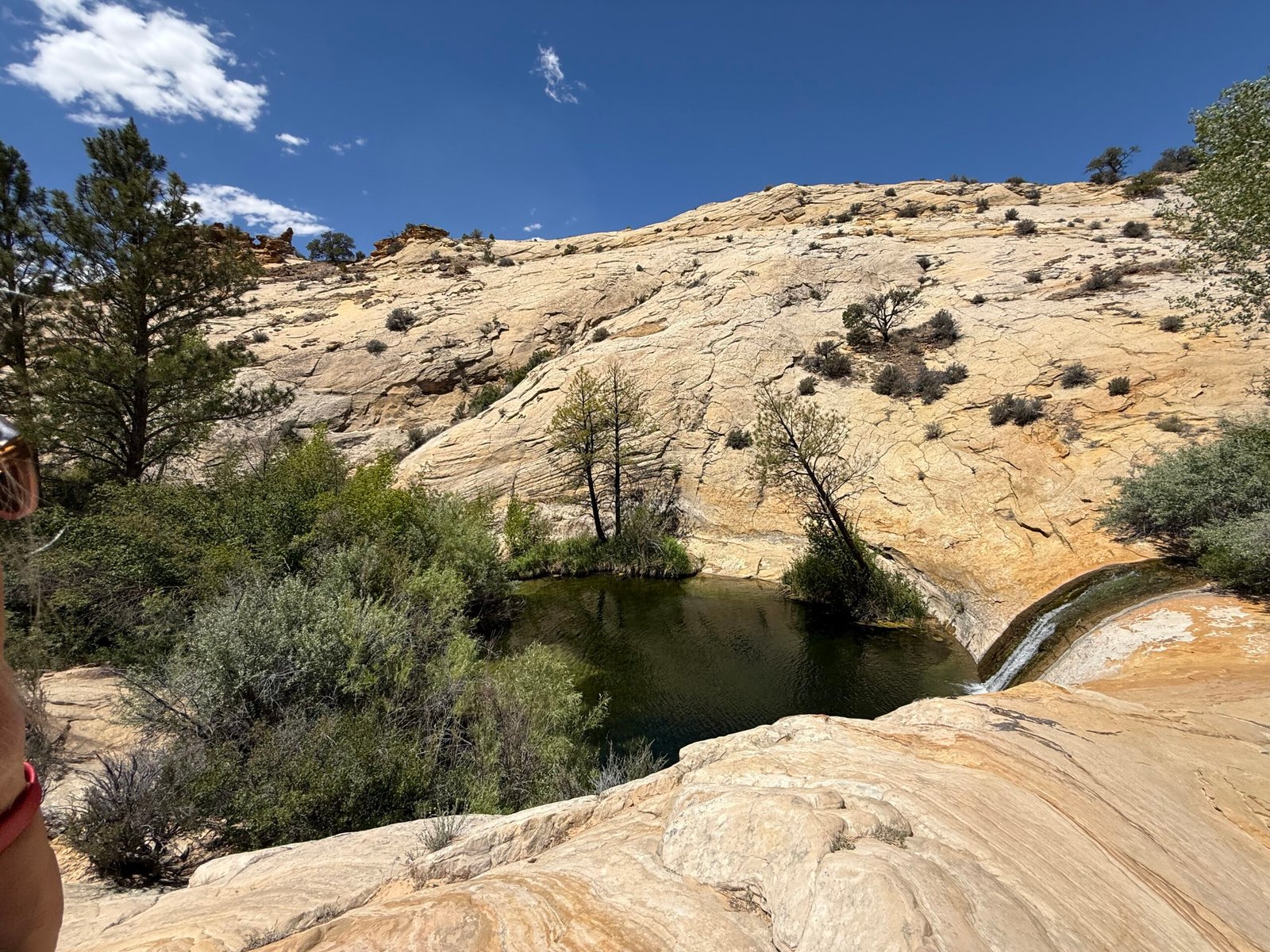
We had the falls to ourselves for a little while, and it was stunning. A blue hole with a sand surround, trout darting about, alcove columbine blooming all along the far side. Nice and cool.
Another couple joined us in a few minutes, and then we started heading back. A few more folks came along, and then a few more. The sun was fully shining on the trail side of the creek and it was warming up fast. About a mile from the truck we met a group of 30 or more, and by the time we had reached the parking lot at 10:30am it was full and the overflow area was beginning to fill in. Patricia had counted 100 people on our way out. Most had short sleeves, or no sleeves, shorts, and not much water.
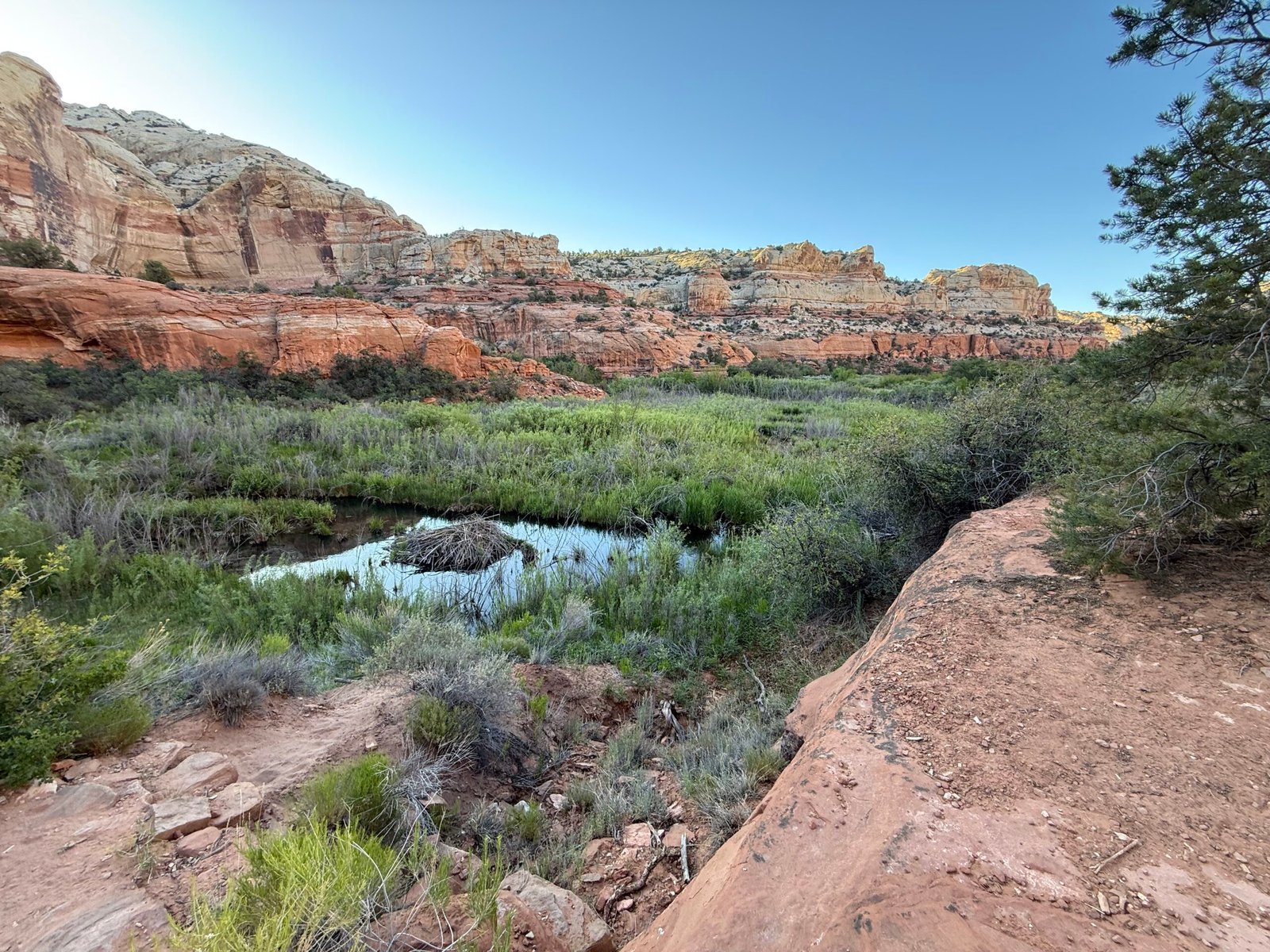
Since it was only 10:30, maybe we should drive the Hogback to the Upper Calf Creek Falls trailhead and visit it as well? Brandon had mentioned it was a short hike, and that the pools above the falls were pretty amazing. So another run up the ridge to a little dirt side road with no sign. The dirt parking area was a couple of hundred yards off the highway and not a single car was in sight! We found the trailhead kiosk and signed the register.
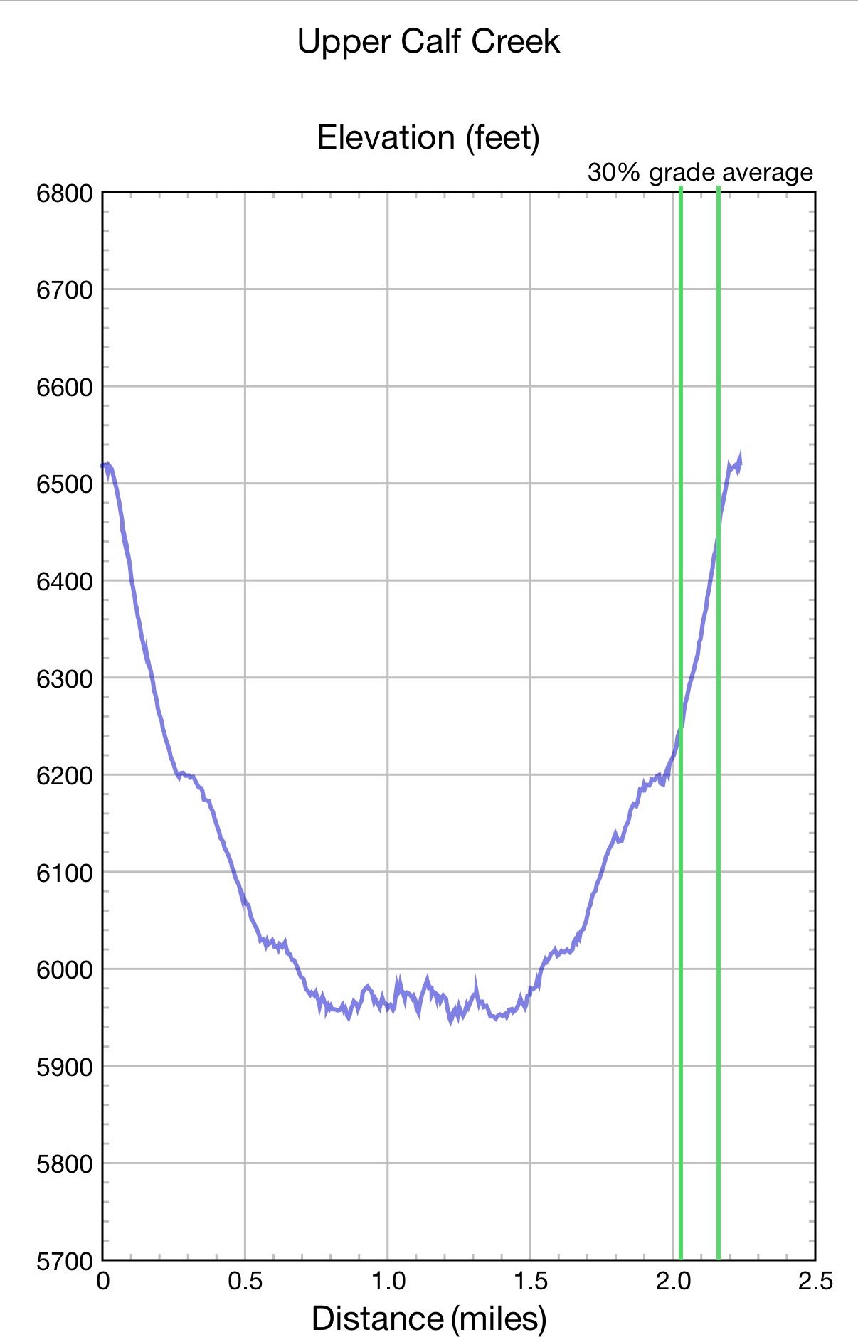
For some reason my mind mixed up the elevation profile for this 2-mile round trip with another hike down on the Escalante river. And even though it was pretty obvious that it was not going to be a level hike, my brain just wouldn’t let it go. And Ffej must have really wanted to check out those pools!
“Are we going down there?” Patricia asked. “Well, I think it’s supposed to be pretty level and it’s only a mile to the top of the falls,” I replied.
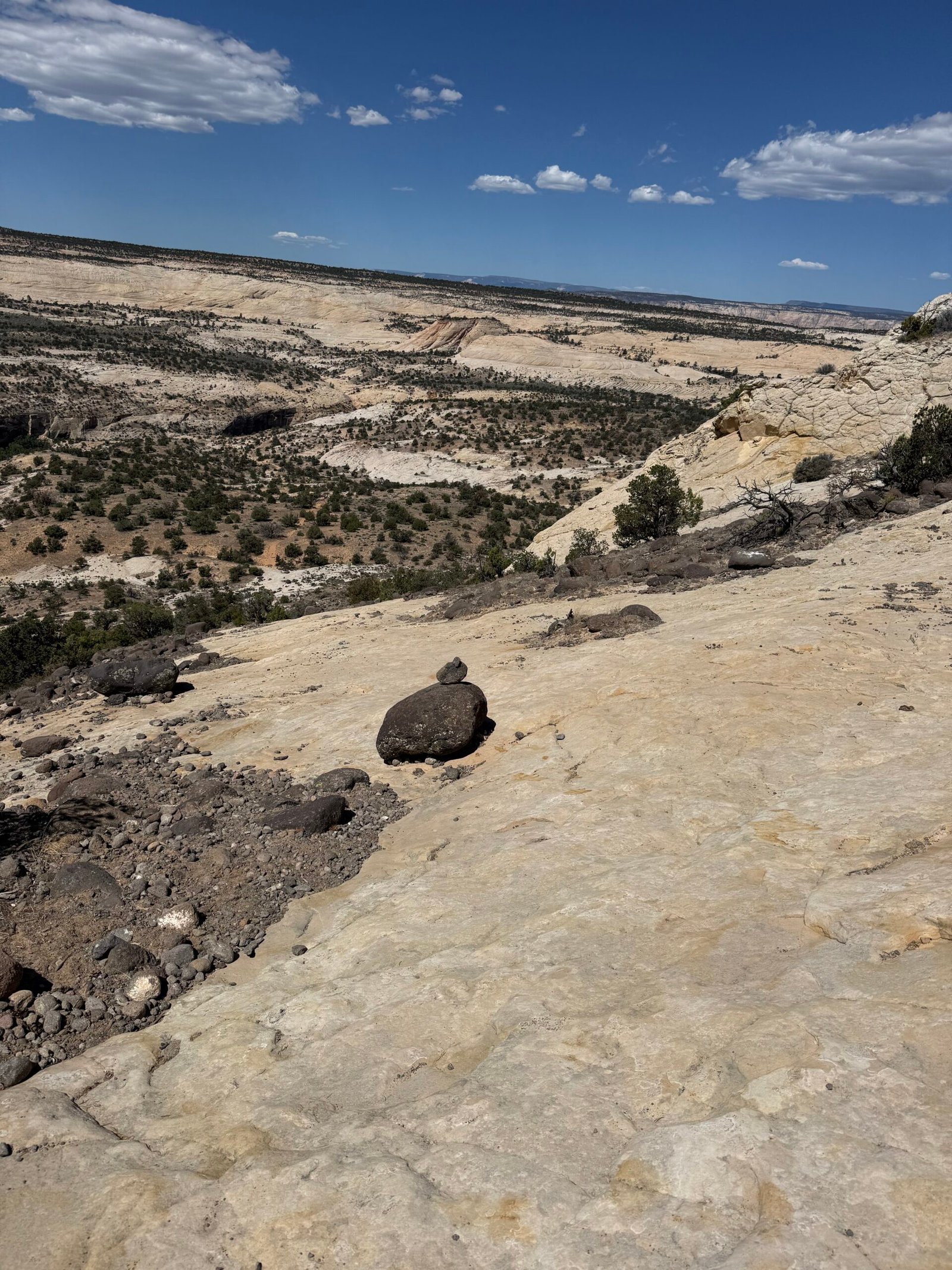
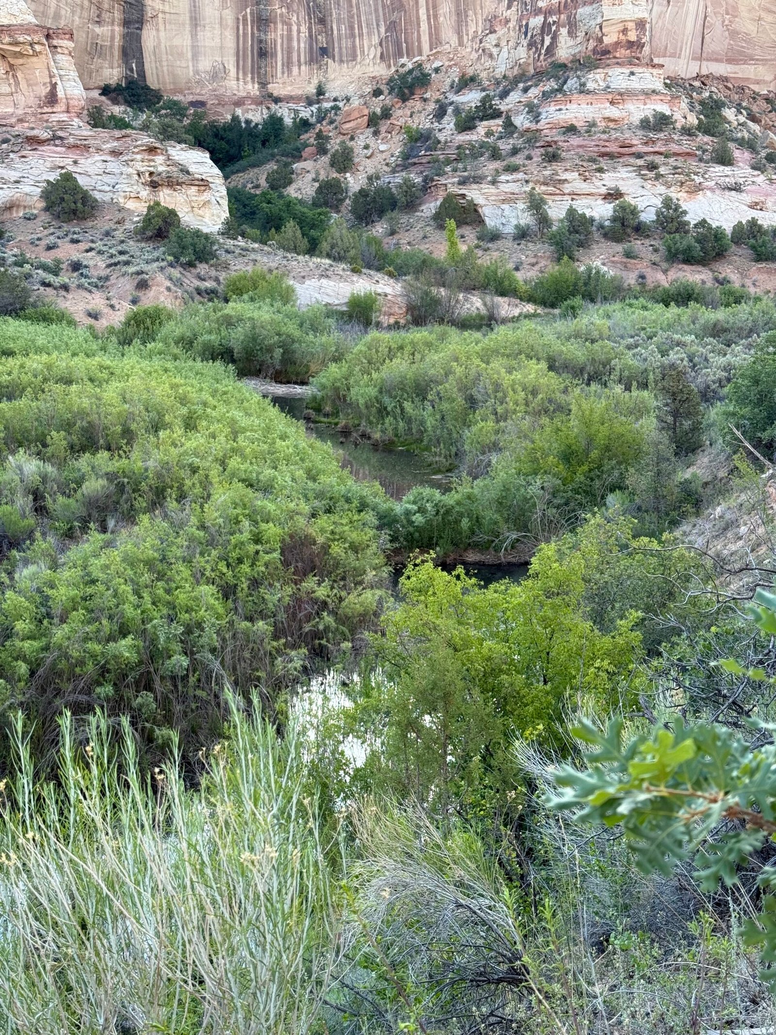
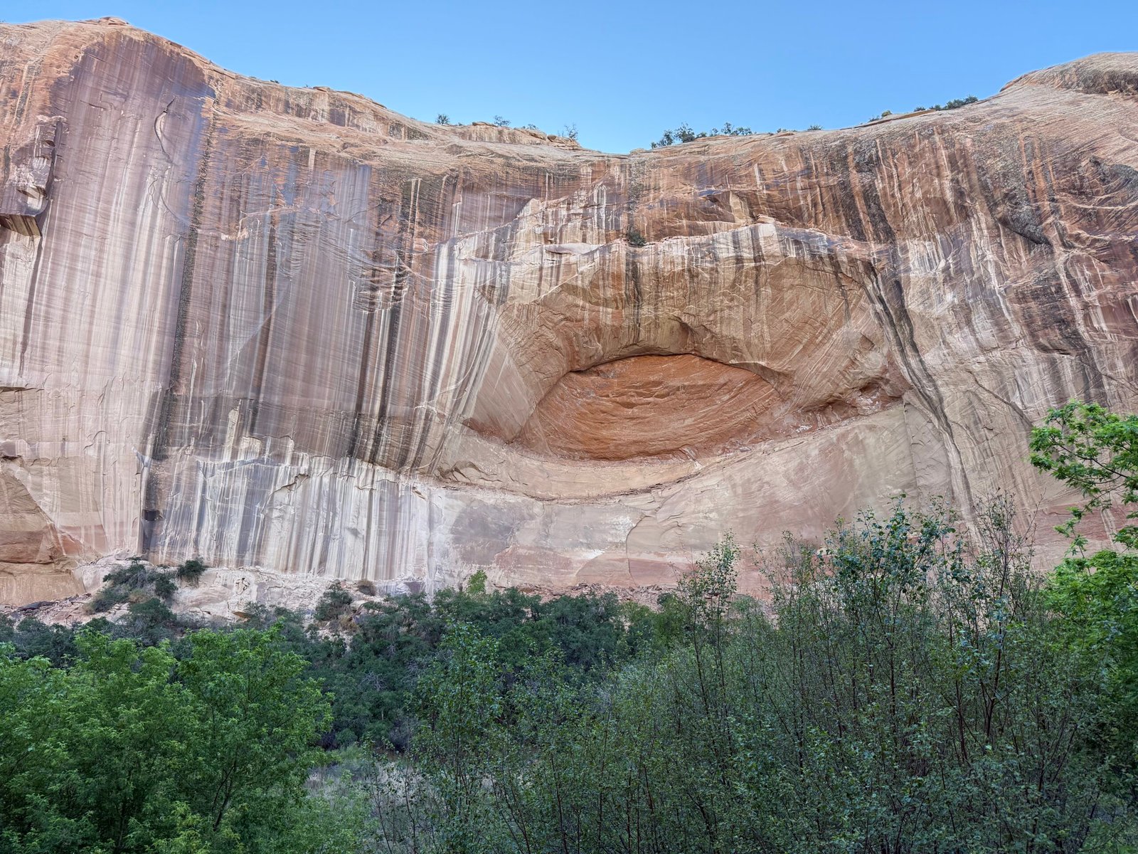
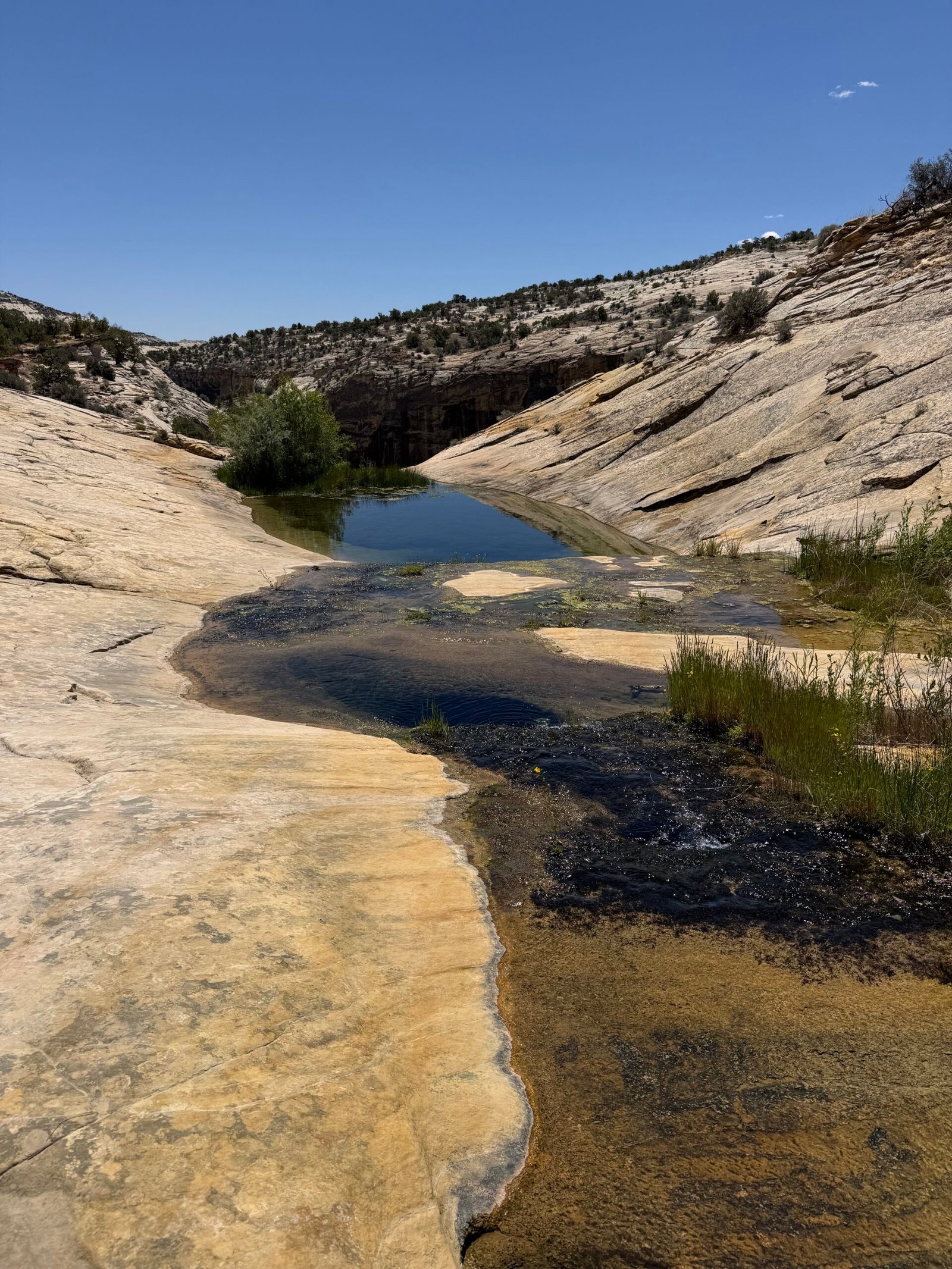
It became obvious that we were, in fact, going down there. About 600 feet, practically all of it in the first half-mile, on slick rock guided by cairns. And it’s getting hot.
There was a sort of “mental whiplash” from expecting an easy hike, realizing the creek was far below, seeing the “trail” run straight down the canyon, and then starting off the rim onto a slippery, sandy and very steep slope. The descent was stressful and really slow going as we navigated cairn to cairn.
The truth is, I’d rather climb than descend. Descending forces you to heel strike first and is uncomfortable for balance, it also adds extra stress on the knees. The whole body tenses for the repeated shocks and unexpected slips and slides. And we need eyes in our toes to find those hidden steps that we know lurk just below the ledges.
In fact, why do we have world-class climbers but no descenders? Yeah, I know Alex Honnold has climbed El Cap, but has anyone ever descended it without a rope? Completely absurd to even think about. And why does my iPhone count flights up, but not down? So here’s to the unsung heroes, the descenders! Always out of their comfort zone, stress hormones maxed out, just trying to catch a break and get down the damn thing. But I digress….
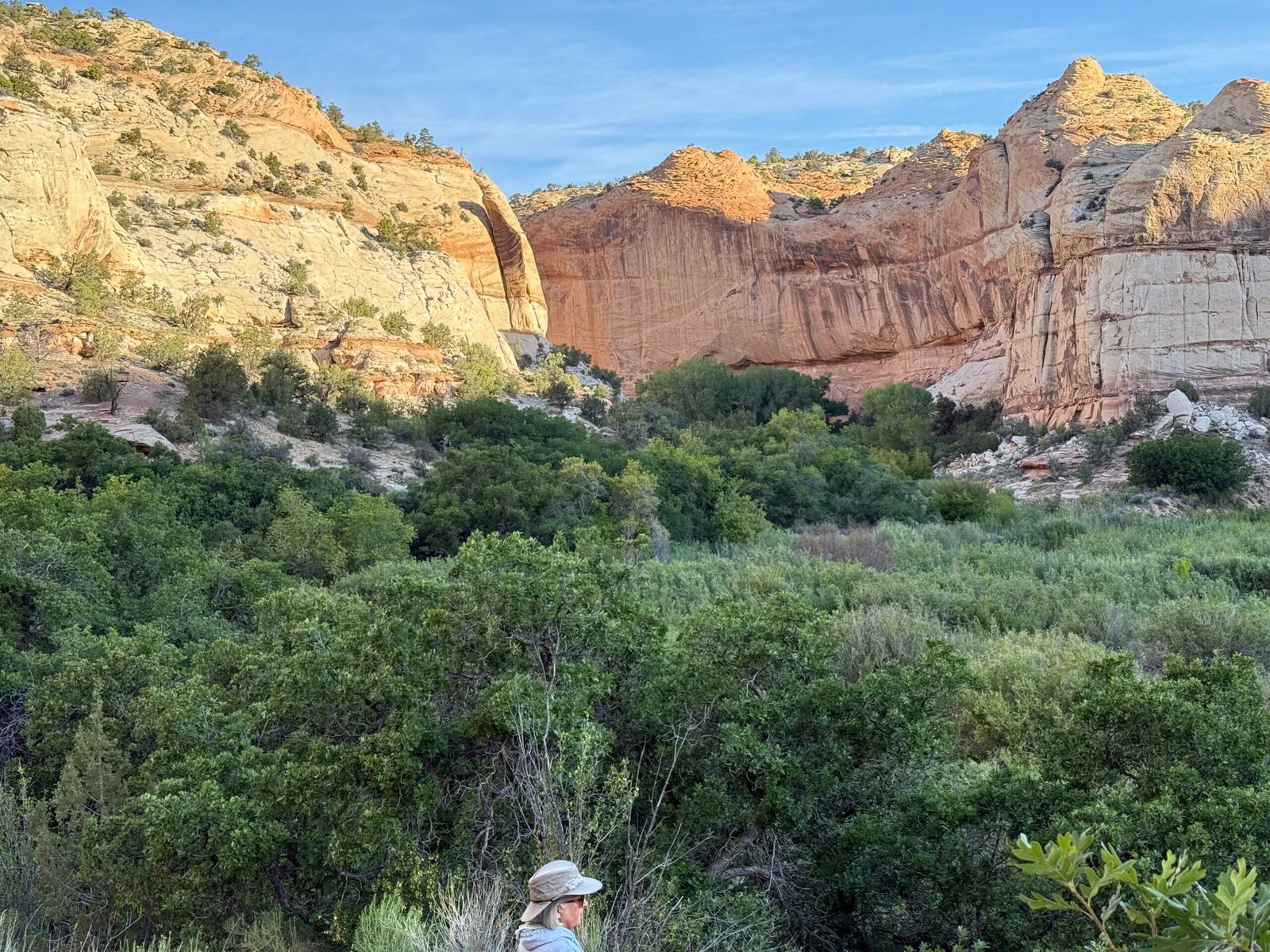
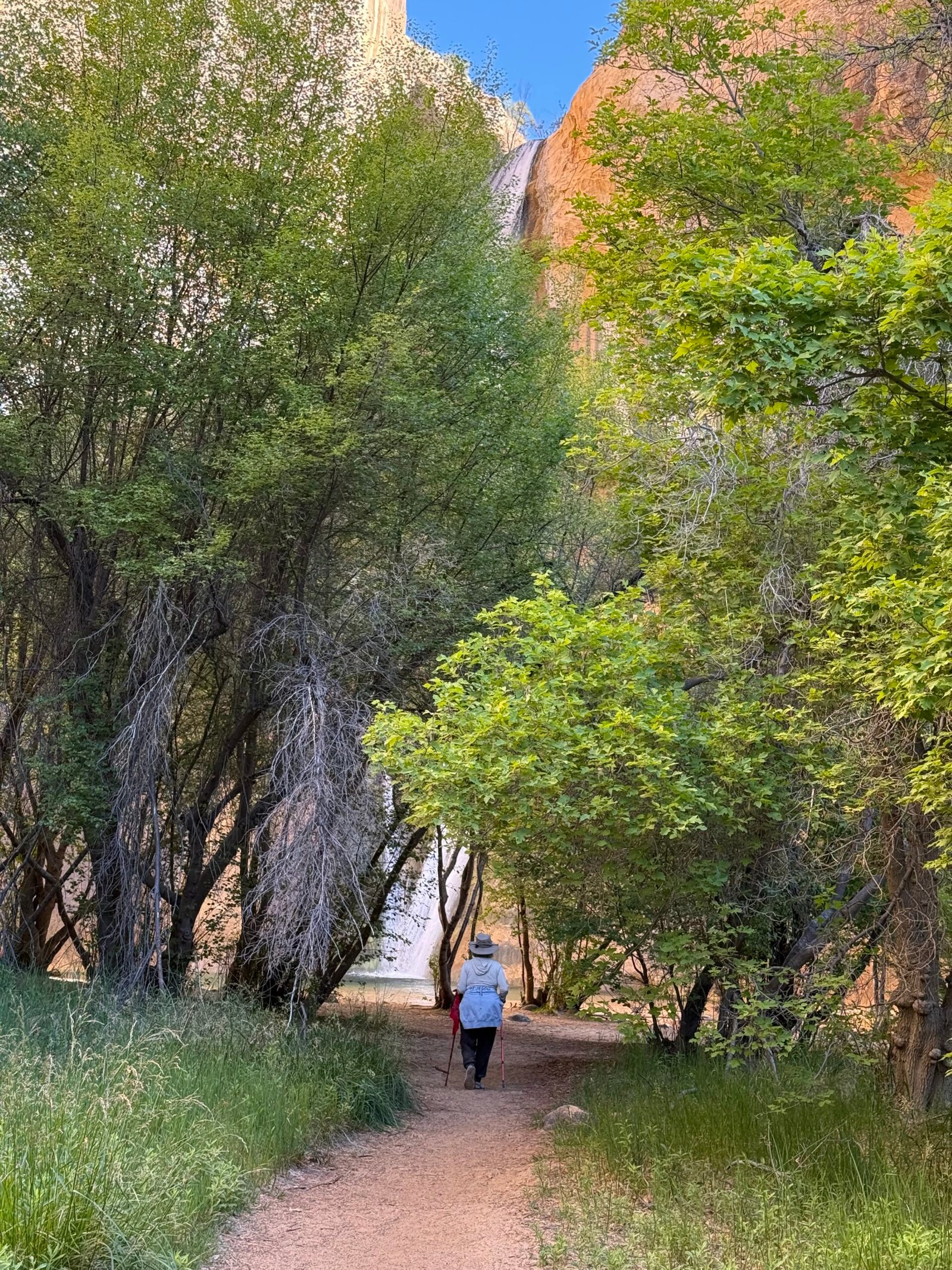
Patricia and I have a discussion. I agree to put Ffej back in his lamp and she agrees to be more forceful in calling me (him) out. We decide we will proceed carefully. I scout out the last bit and although rocky (did I need to mention that?), it levels out near the top of the falls. There is a side trail that scrabbles another couple of hundred feet to the bottom of the falls, we will not be doing that today.
As the trail begins to flatten, it is pushing noon and getting hot. The entire area is completely exposed with a handful of piñon to provide shade. At the 3/4 mile mark with only 1/4 mile of, ostensibly, mild descent remaining, I am seriously considering turning around. We have enough water but I am worried about the heat. If we continue, we will want to hang out a while and then climb out when it is even hotter. We should have done this earlier in the day!
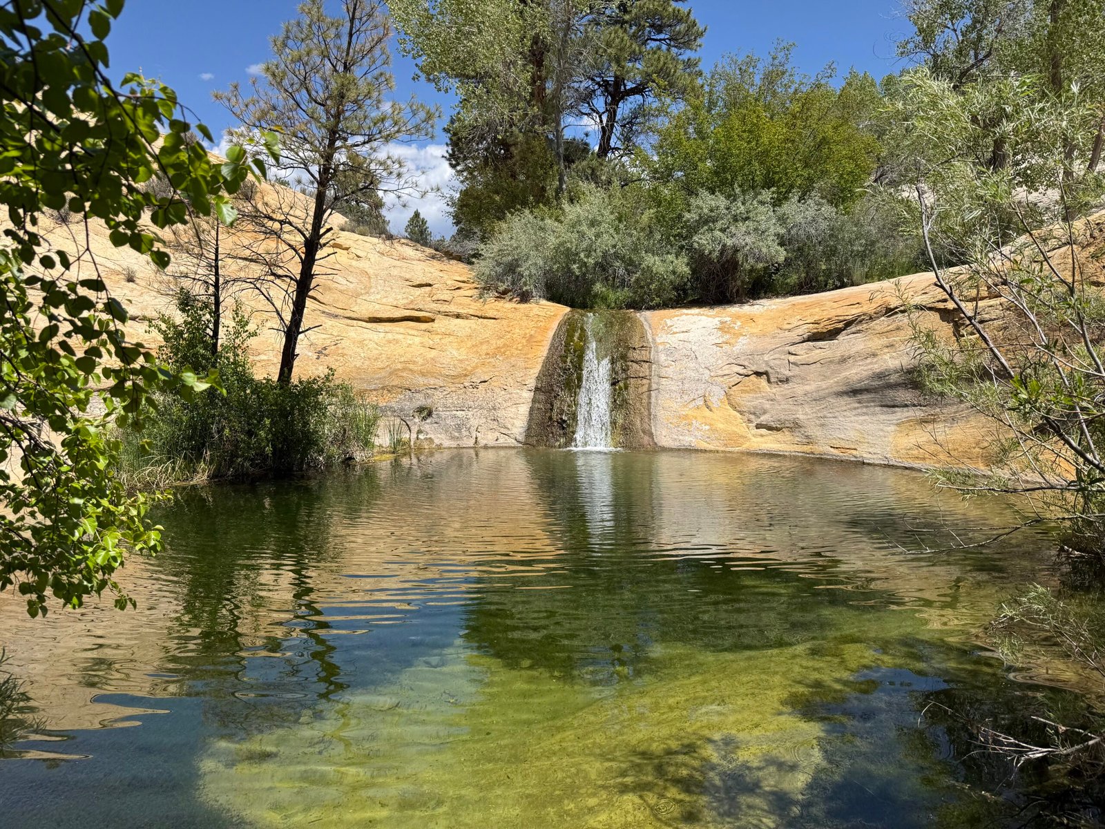
And then, wow. How can you have such a hard rock oven of a canyon and the water be so stinkin’ cold that it takes all of your gumption to jump in it? We have found a little desert paradise. A cluster of shady trees surrounding a little blue hole with its own little waterfall. I eventually managed a breath-taking plunge but Patricia couldn’t make it past her knees, the water had to be in the low 50’s.
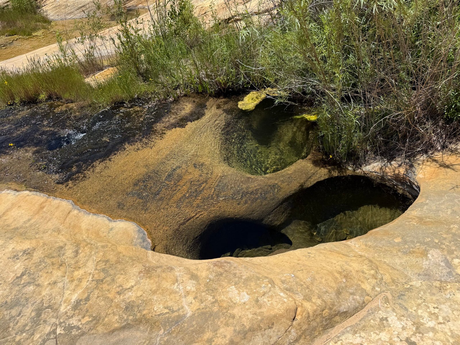
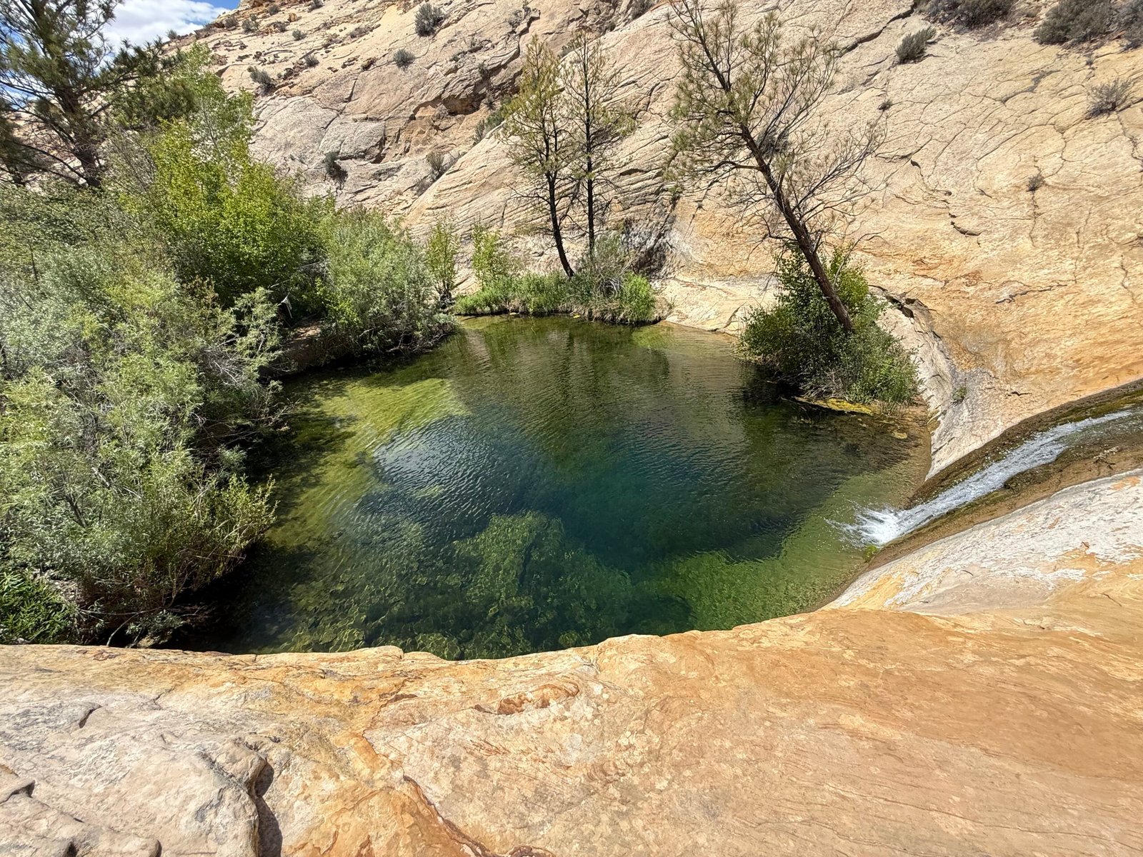
Fully refreshed, we prepped for the one mile hike out. Just in case, I treated a quart of paradise’s water for the climb. I also filled a silicone ziplock with the cold water for dunking our bandanas. With such low humidity, evaporative cooling is a tremendous asset, and a wet bandana on the neck can really help keep the core from overheating.
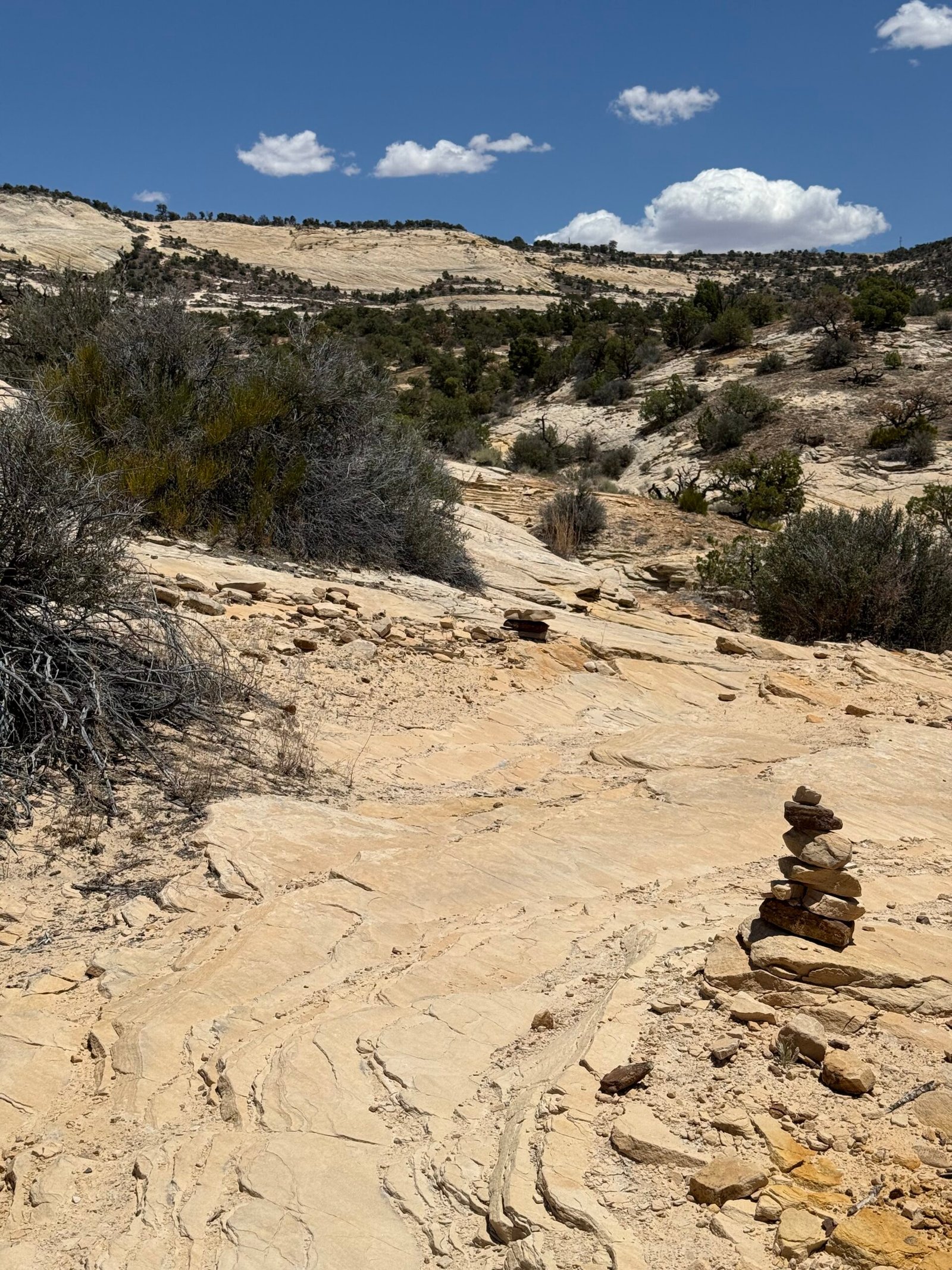
Working our way to the top was a lot quicker than our trip to the bottom. Mentally we were ready for it and we just took our time, resting along the way in the shrinking shade of the little trees until we were up near the final climb. The cairns were well-placed, nudging us to the proper side on the wide slick rock for the best purchase as we moved upward.
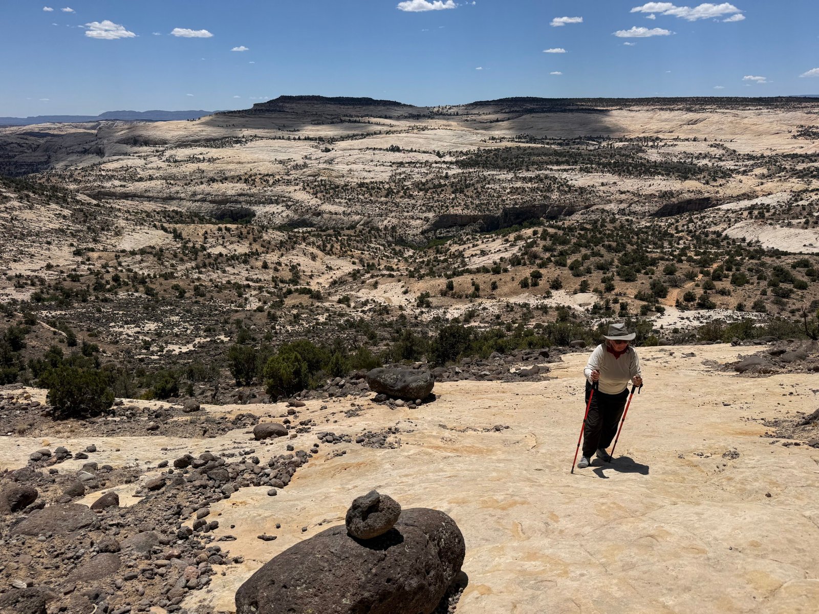
I remember the colonel’s words to this day. And he’s talking about pee. It needs to be clear and not cloudy, and there needs to be a lot of it. Otherwise dehydration with energy loss, creaky joints, and generally bad things are on the doorstep.
We had planned our water well, clear and copious indeed.
The parking lot was still empty when we arrived…
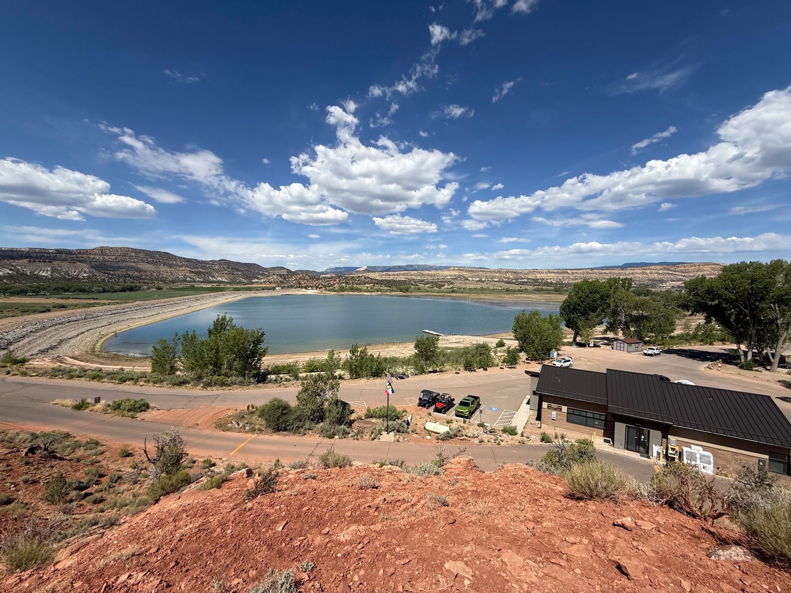
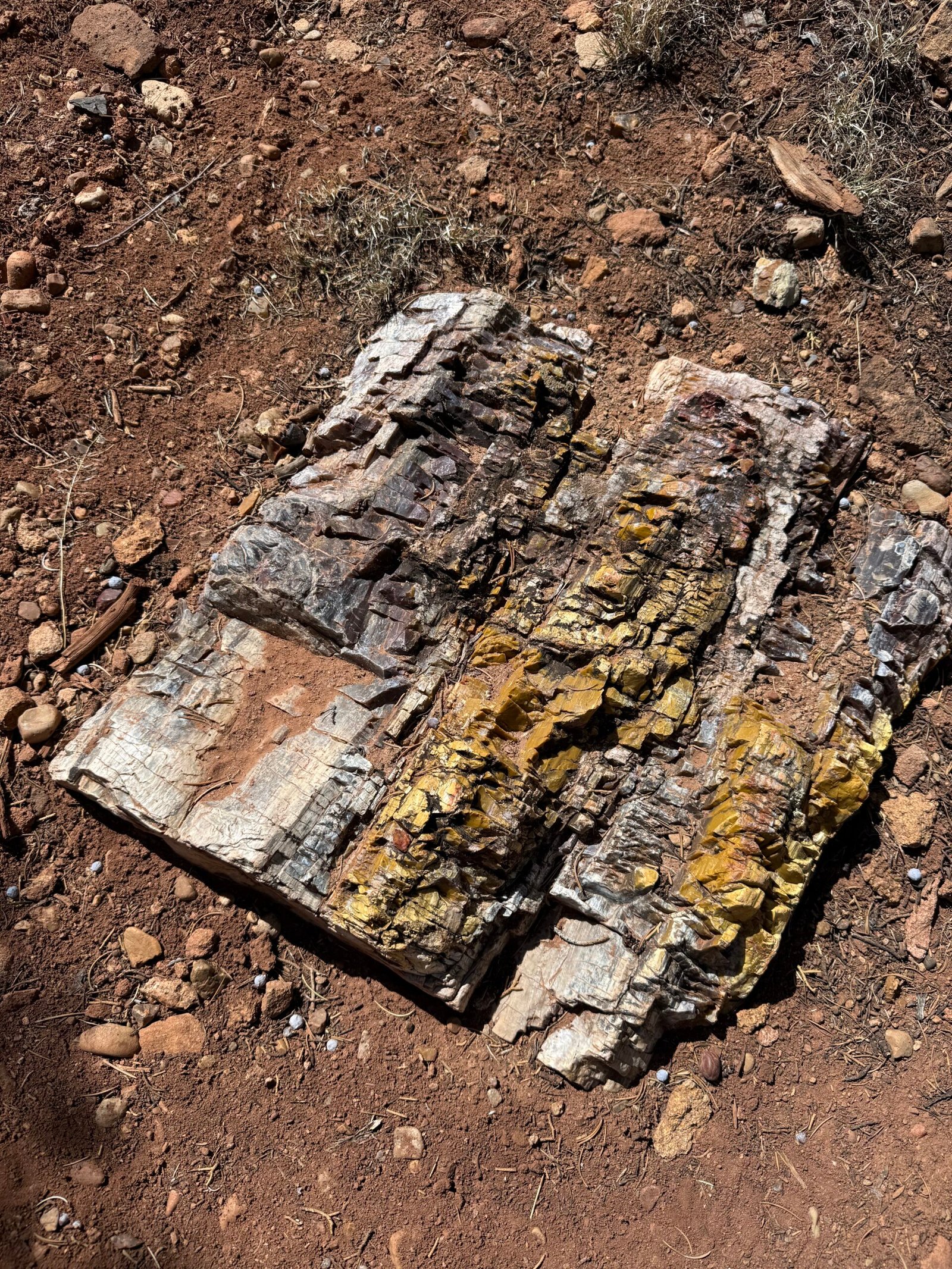
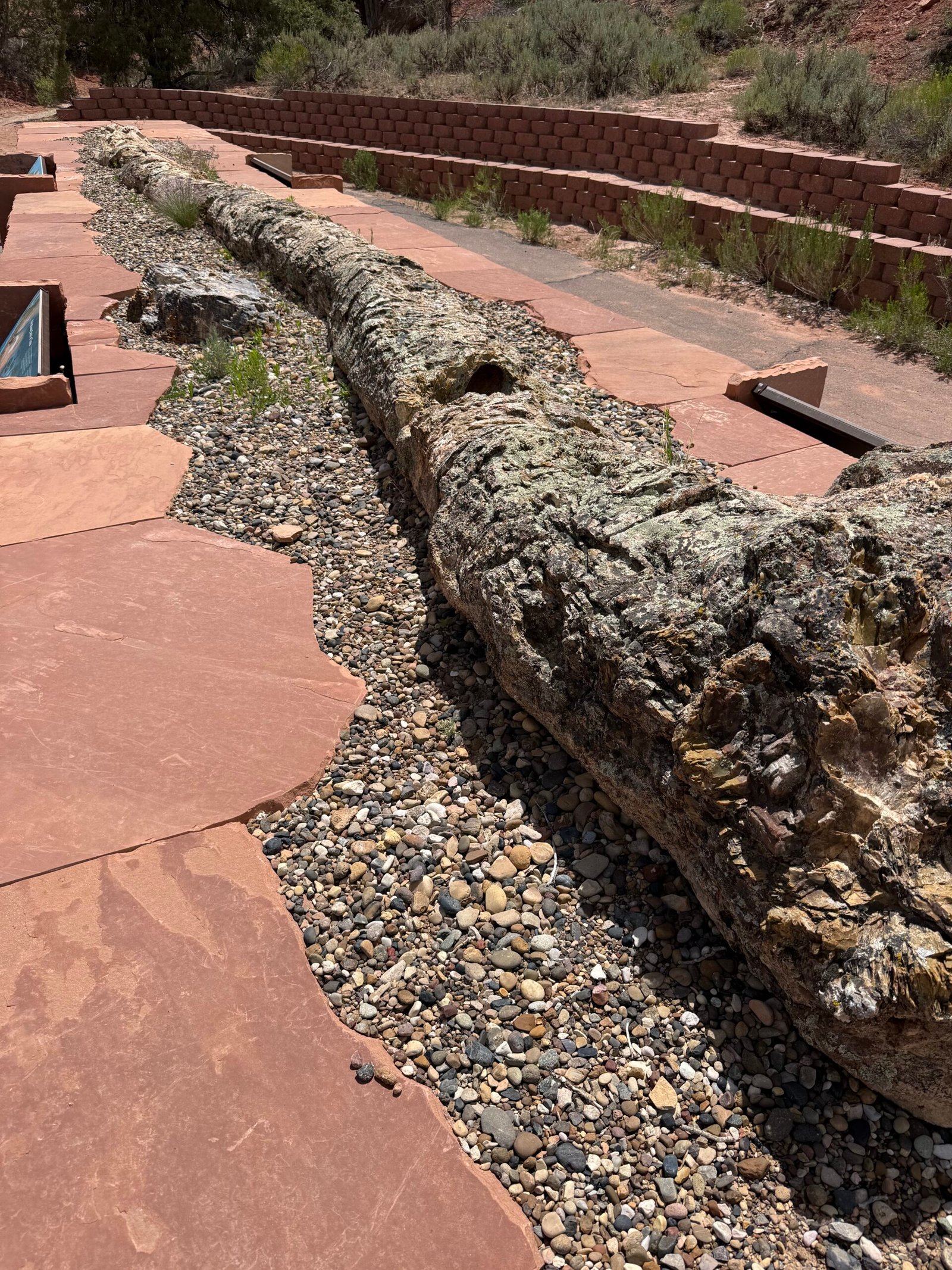
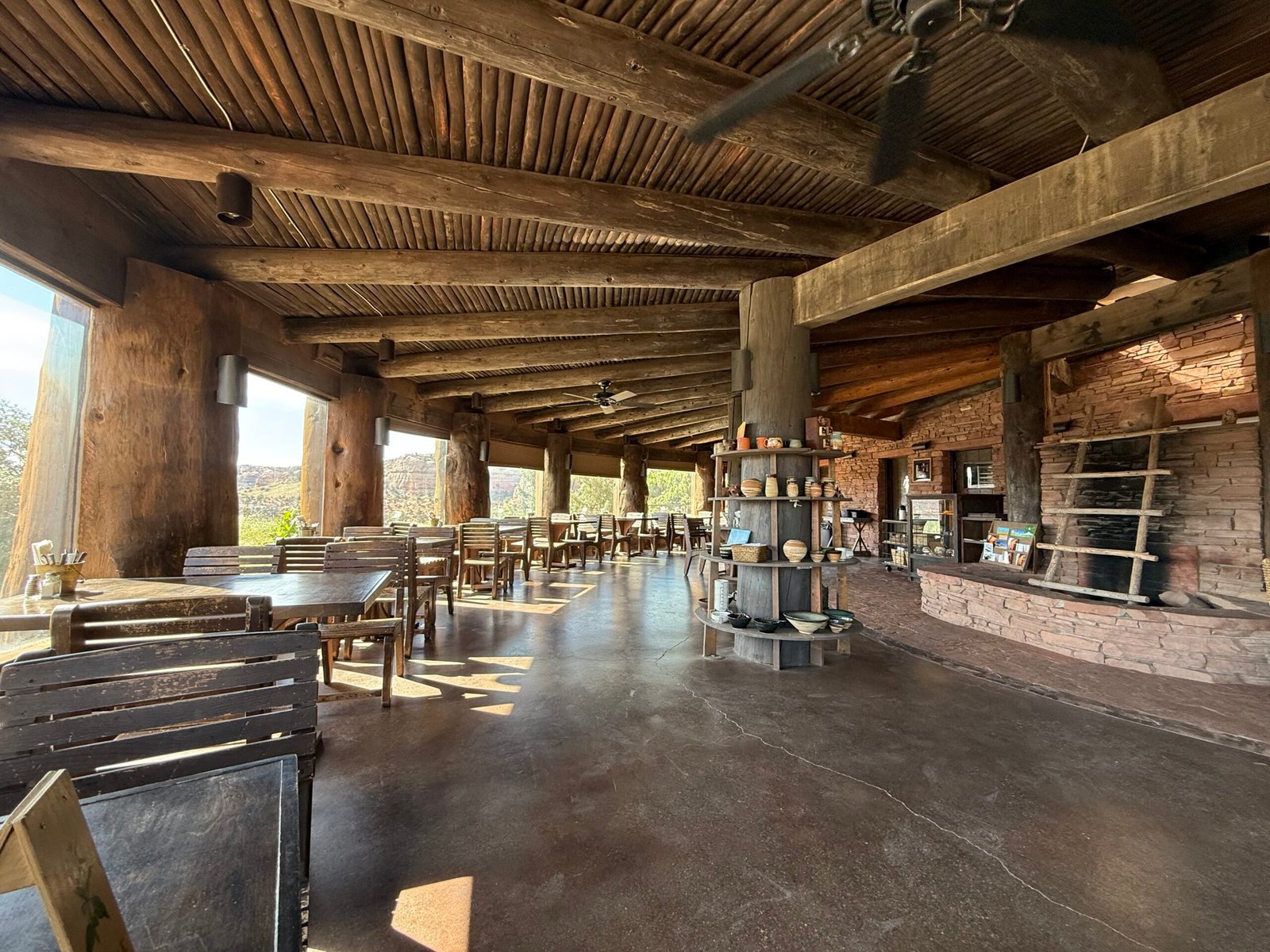
The state park was pretty nice and very well maintained. The blue reservoir looked so inviting that we immediately prepared to break out the paddle board. But the eye can be deceived and the reservoir was low, I’m guessing well below half full. Between the vegetation in the shallow water and the ever-present wind white-capping the surface, we eventually lost interest. But the petrified forest loop was quite nice and the more rugged “sleeping rainbows” trail was a treat. I never knew there could be so much color in the fossilized wood!
Coming out around noon, I was again amazed at the number of people that were just starting the climb into the loop. Families with child backpacks and dogs, but very little sun protection or water during the heat of the day. I guess we can get away with these short excursions, but they can get serious pretty quickly. I have the T-shirt.
The campground is pretty dynamic, with groups using it as a basecamp for various activities. One group of teens was nearby for a night, and one of them had a guitar. It must have been a cheap guitar, as it only knew one song. So they all sang it…over…and…over…and…over…again. With exuberance. I chuckled to myself as it all wound down for a nice…cool…quiet…evening once again.
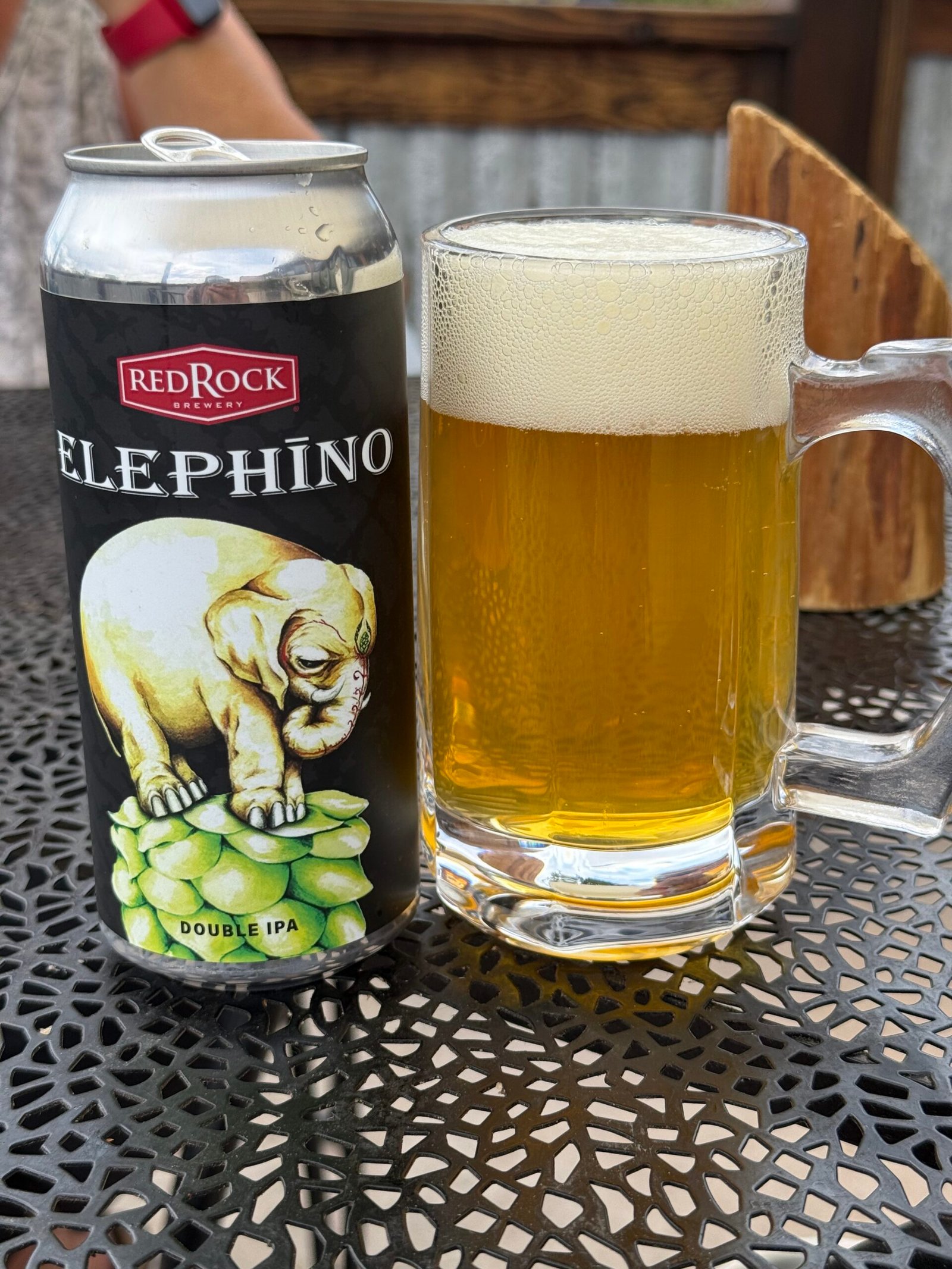
Escalante is a nice little town, and we covered all the bases. Patricia scored a couple of deals at Blue Crow Gear and Gifts, we sampled the goods at Escalante Mercantile, and ate at Escalante Outfitters a couple of times, legendary for their salads and pizzas. And Kiva Koffee was a wonderful space near the river.
In general, this area is considerably more popular and busy than Bears Ears. But so far it seems to be manageable and maintains the small town feel. And it was a bit curious to me that there was so much touring motorbike traffic. Kinda cool, actually. Not really the big Harley’s, these folks were generally self-sufficient and out for the experience of the expanse of it all.
As we rolled out of Escalante, the Hole in the Rock trail branched off toward the Colorado. It’s dozens and dozens of miles of bad washboard road down to the actual spot where the Mormons blasted their way to the river and dragged their wagons across on their way east to, you guessed it, Bluff, Utah. To me it seemed like a bad idea then, and it still seemed like a bad idea today, so we just took highway 12 back up the now-familiar Hogback and over to Hanksville, where Brandon said there were the best milkshakes ever.
Not impressed. Sorry Brandon.
Heading east across highway 95 felt like completely different scenery! We had only driven this road west when we left last year. Once again it reminded us to occasionally “just turn around” on any adventure, what’s behind you can really be surprising! We have experienced this time and time again…when we remember to do it.
Coming back into Bluff from the west was a treat. We met the new volunteer, Carmen, and just settled back in for a couple of days to get ready for the AstroFests. Oh, and the upcoming mountain lion talk!
And, maybe unsurprisingly, Carmen was yet another force of nature and kindred spirit that we wouldn’t have gotten to meet if we had left “on schedule.”
Stay tuned for the next episode….
Leave a Reply