#2 in the series.
Huh? That’s what the road sign said. I mean, where did it begin?! I need to know these things!
But more on that later. We finished up the past post at Birch Lake, OK. Possibly the fastest cell coverage I’ve ever experienced in a campground! The Corps of Engineers (CoE) facility had recently renovated the bath houses and they were first rate. There were only a handful of campers and we had a nice lake view.
The next day we aimed northwest toward Dodge City, KS. When we picked up our camper back in 2022, our first free camping spot was at Ford County Park nearby. So we thought we’d try it a second time.
We rolled through Clearwater, KS and came up to the intersection with highway US400. A brown sign to the east proclaimed “Big Well” with “Meteorite” underneath. We had to check it out.
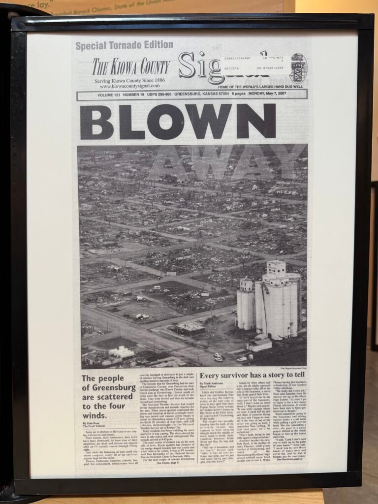
As it turns out, the town of Greensburg was literally leveled by an EF5 tornado in 2007. Only three buildings remained standing. George W. even paid them a visit.
During the rebuilding, the town turned this lemon into lemonade. An impressive downtown rose from the destruction.
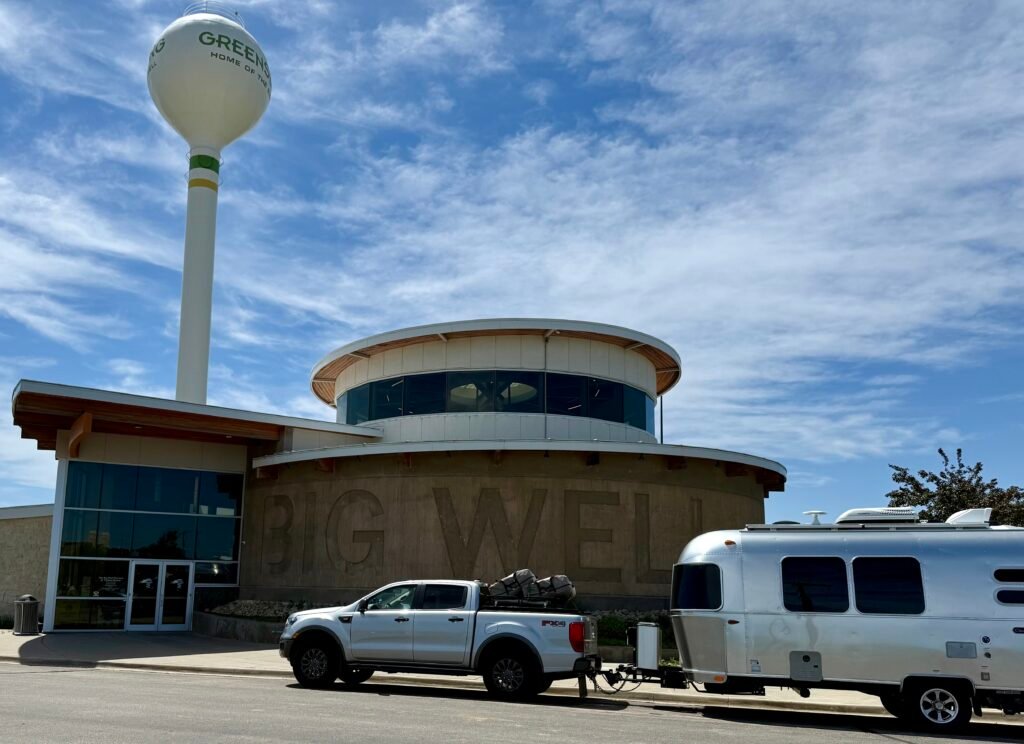

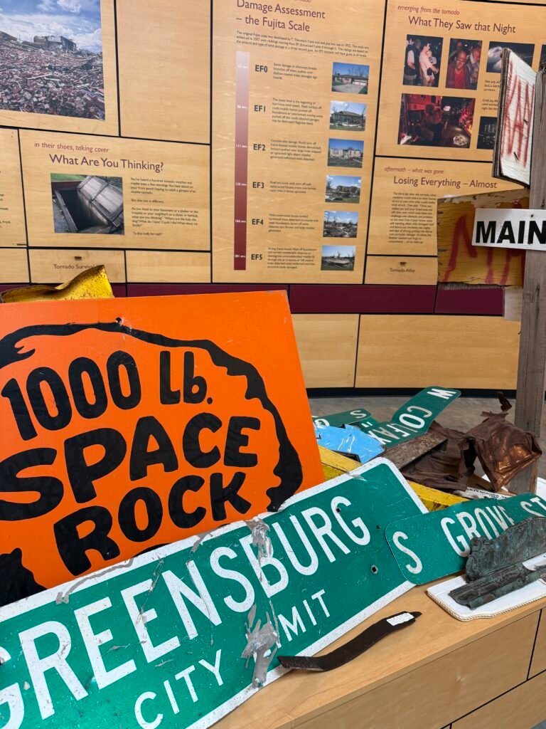
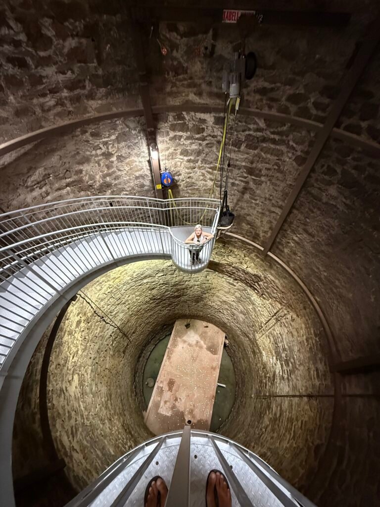
A museum was constructed to tell the story of the tornado, the history of the “largest hand-dug well in the world,” and to house a 1,000 pound meteorite found in 1949.
I will leave you, Dear Reader, to do your research. Particularly about the impressive well and the Ogallala aquifer it finally reached.
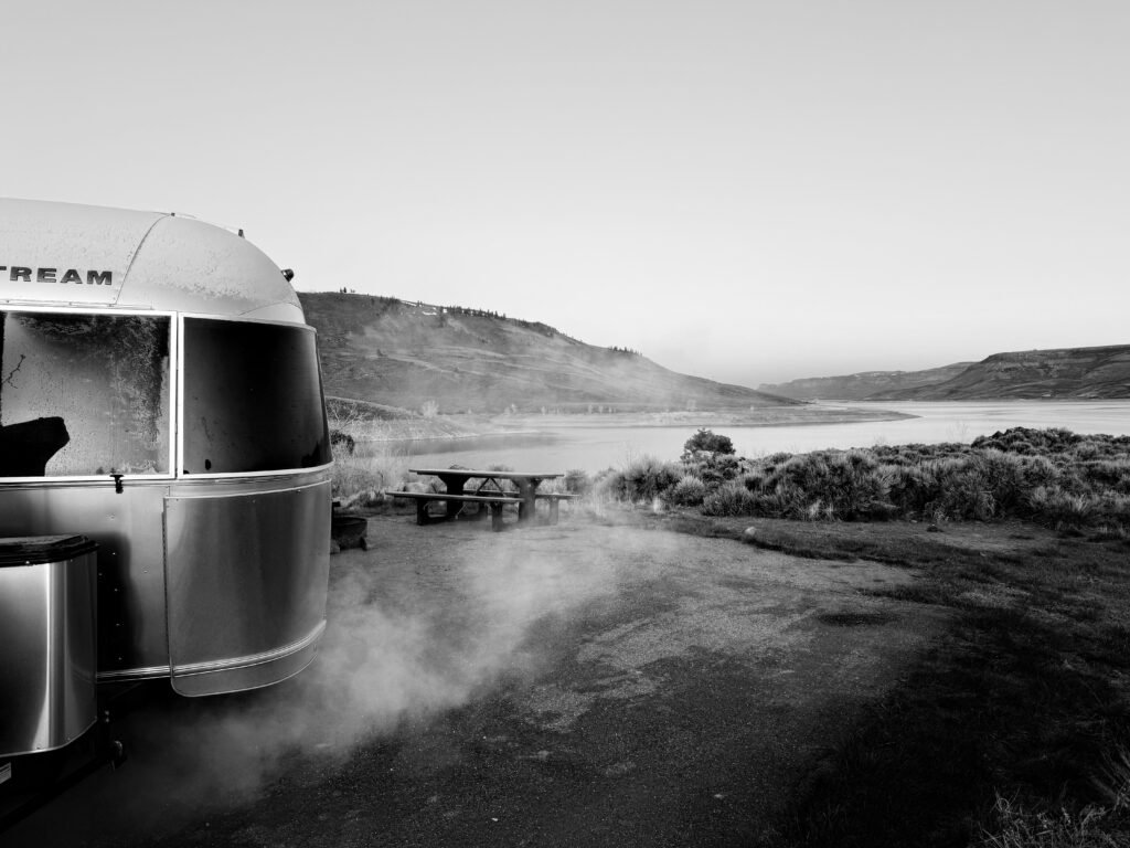
The Ford County park where we stayed the night was quiet. There are a couple of fishing lakes and it is popular with the locals. This was the last place where we knew ahead where we were going to stay. So now the question became, “where to next?” And how much longer to Bears Ears? Mulling it over, we decided for an early start and a long day to get within a day’s drive of Bears Ears, saving a day. So we booked a night at Blue Mesa reservoir near Gunnison, CO and crashed a little early.
Leaving at 4:30am, we made good time on US50 all the way to…wait, what? Pueblo?! I was aiming for Walsenburg! I was a bit apprehensive about getting across Colorado, especially the mountains. I’ve not pulled Ooo Shiny over any of the big stuff and with the potential of snow, I was planning on swinging through Alamosa and Durango. But Apple Maps has this (very) annoying issue of not sticking to your route if it is not the “fastest” route. Any small deviation, like pulling off at a gas station or missing a turn, will cause Maps to reset to the fastest route. And apparently I didn’t catch it. Googling “RV Monarch Pass” found a few posts describing the new route as perfectly doable, but with a comment that the gas engines struggle with the altitude, and watch the brakes!
The entire southwest Kansas and southeast Colorado is heavy industrial farming and feedlots. It’s not the most scenic and one reason we decided to stretch the day. US50 is a good road though, and we breezed on through Pueblo, Canon City, and on toward Salida.
And here is where we add another almost visited to our list. Royal Gorge Bridge! America’s Bridge! Ziplines! Gondola Rides! The Sky Coaster! Indian Food! And only $30 a ticket per person to cross the bridge. Nah.
And then….we dropped into Bighorn Canyon. Wow! This was a nice drive. Plenty of people fly fishing on the…Arkansas River! Here we were in the middle of Colorado near the headwaters of the Arkansas, when just a couple days before we were in Conway, AR and near where it reaches the mighty Mississippi. I had no idea the Arkansas was that long.
The Bighorn Canyon area definitely deserves future investigation.
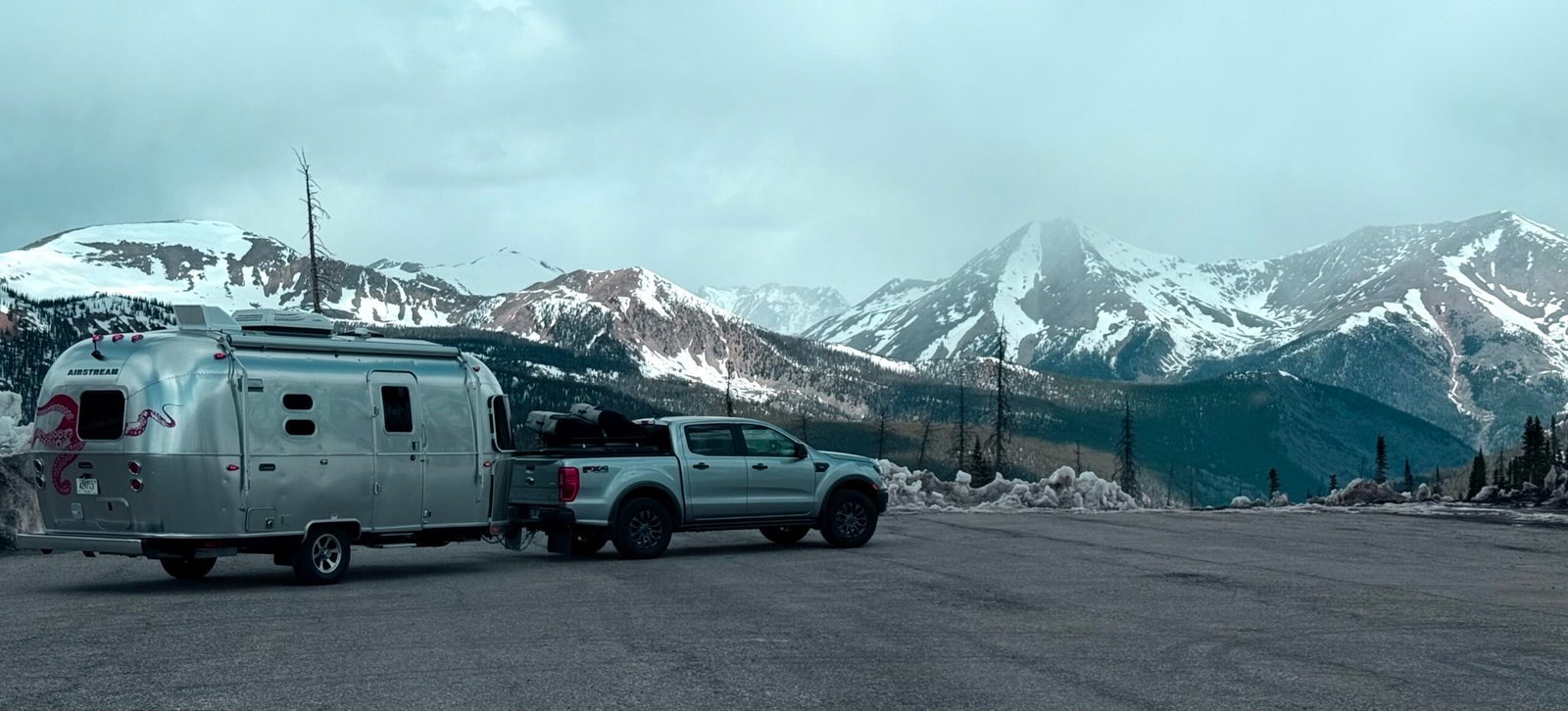
Out of Poncha Springs we began climbing in earnest with a little snow in the air. The little Ranger had no trouble at all. The turbo-4 and 10-spd transmission are a great combination. And “Trailer Mode” does a great job of keeping the truck in lower gears on the descent, only light work on the brakes was needed for most of it.
We passed several of the “avalanche zones” before making Monarch Pass at 11,312 feet. No snow on the road, but plenty piled up by the plows. It was noticeably harder to breathe and it instantly reminded me of another place we’ve been to recently. Cusco, the Navel of the World, sits at 11,000 feet in Peru. A city of nearly 500,000 and nearly a mile higher than Denver. But I digress…
On the way down from the pass, Patricia spied a few bighorn sheep on the mountainside, what a treat! We made camp in the early afternoon and were all set to enjoy the blue sky and lake view.
But the sky grew dark and the wind began to howl. By morning it was 21 degrees and a heavy frost. Mountain weather.
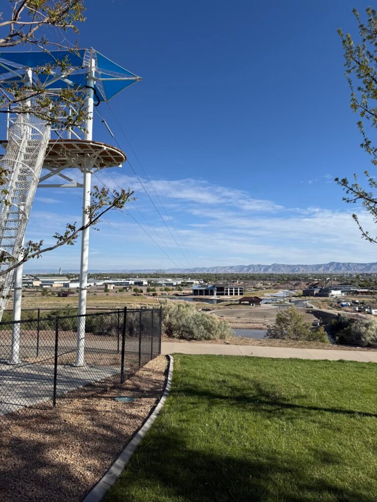
Rolling into Grand Junction, we stopped at Eagle Rim park for a couple of hours for stretch yoga and some brunch. The park was beautiful, with a cool skate park and a zipline all the way across the Colorado River. I think Grand Junction is yet another place to go on our list.
Traffic on I-70 was light and we made good time to our new home for the month of May. It’s been a gorgeous day.
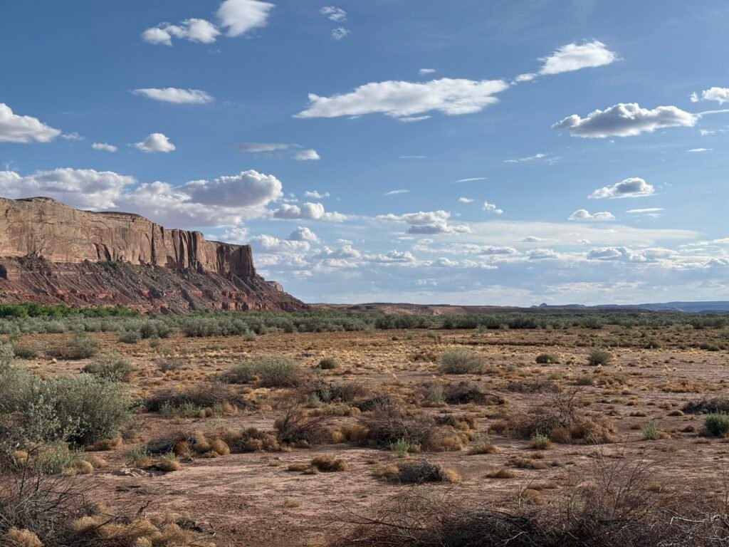
Speaking of almosts. The West is full of ’em. It’s so big you have to put the blinders on sometimes just to get to your destination. We almost stopped at Black Canyon of the Gunnison, almost saw the Ute Council Tree in Delta, whizzed by Arches and Canyonlands, never stopped in Moab, and completely ignored the signs to Capitol Reef.
Whew, and that’s just today.
But we have finally arrived at our destination, the Bears Ears Education Center (BEEC), pulling-in in fine fashion. A little decompression hike down along the San Juan river is just what we needed.
Tomorrow we start our orientation and training here at the education center. I hope we pass…
Leave a Reply